File:NeuillyXVIII.jpg
Jump to navigation
Jump to search

Size of this preview: 800 × 326 pixels. Other resolutions: 320 × 130 pixels | 640 × 260 pixels | 1,838 × 748 pixels.
Original file (1,838 × 748 pixels, file size: 426 KB, MIME type: image/jpeg)
Captions
Captions
Add a one-line explanation of what this file represents
Summary
[edit]
| Description |
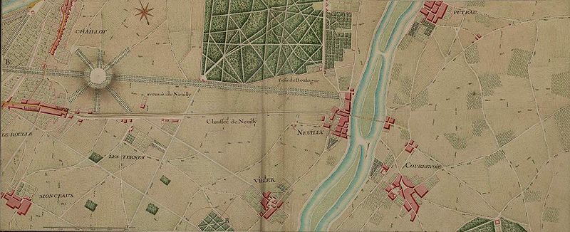
Français : Neuilly et ses environs, seconde moitié du XVIIIème siècle. |
| Date | between 1745 and 1780 |
| Source | Atlas de Trudaine (Archives nationales) |
| Author | Trudaine |
| Object location | | View this and other nearby images on: OpenStreetMap |
|---|
Le nord est au bas de la carte.
Licensing
[edit]
|
This work is in the public domain in its country of origin and other countries and areas where the copyright term is the author's life plus 100 years or fewer. | |
| This file has been identified as being free of known restrictions under copyright law, including all related and neighboring rights. | |
File history
Click on a date/time to view the file as it appeared at that time.
| Date/Time | Thumbnail | Dimensions | User | Comment | |
|---|---|---|---|---|---|
| current | 21:51, 10 April 2009 | 1,838 × 748 (426 KB) | Indefini (talk | contribs) | {{Information |Description={{fr|1=Neuilly et ses environs, seconde moitié du XVIIIème siècle.}} |Source=Atlas de Trudaine |Author=Trudaine |Date=1745-1780 |Permission= |other_versions= }} Le nord est au bas de la carte. <!--{{ImageUpload|full}}--> [[Ca |
You cannot overwrite this file.
File usage on Commons
The following page uses this file:
File usage on other wikis
The following other wikis use this file:
- Usage on el.wikipedia.org
- Usage on fr.wikipedia.org
- Usage on pt.wikipedia.org
- Usage on uk.wikipedia.org