File:Philippines location map.svg
둘러보기로 이동
검색으로 이동

SVG 파일의 PNG 형식의 미리보기 크기: 454 × 599 픽셀. 다른 해상도: 182 × 240 픽셀 | 364 × 480 픽셀 | 582 × 768 픽셀 | 776 × 1,024 픽셀 | 1,552 × 2,048 픽셀 | 1,871 × 2,468 픽셀
원본 파일 (SVG 파일, 실제 크기 1,871 × 2,468 픽셀, 파일 크기: 2.18 MB)
캡션
설명
이 파일이 나타내는 바에 대한 한 줄 설명을 추가합니다
파일 설명
[편집]| 설명 |
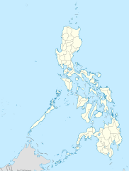
Deutsch: Positionskarte der Philippinen
Quadratische Plattkarte, N-S-Streckung 103 %. Geographische Begrenzung der Karte:
English: Location map of the Philippines
Equirectangular projection, N/S stretching 103 %. Geographic limits of the map:
|
| 날짜 | |
| 출처 |
own work, using
|
| 저자 | NordNordWest |
| 다른 버전 |
|


|
This map has been made or improved in the German Kartenwerkstatt (Map Lab). You can propose maps to improve as well.
|
라이선스
[편집]
나는 아래 작품의 저작권자로서, 이 저작물을 다음과 같은 라이선스로 배포합니다:

|
GNU 자유 문서 사용 허가서 1.2판 또는 자유 소프트웨어 재단에서 발행한 이후 판의 규정에 따라 본 문서를 복제하거나 개작 및 배포할 수 있습니다. 본 문서에는 변경 불가 부분이 없으며, 앞 표지 구절과 뒷 표지 구절도 없습니다. 본 사용 허가서의 전체 내용은 GNU 자유 문서 사용 허가서 부분에 포함되어 있습니다. |
이 파일은 크리에이티브 커먼즈 저작자표시 3.0 Unported 라이선스로 배포됩니다.
- 이용자는 다음의 권리를 갖습니다:
- 공유 및 이용 – 저작물의 복제, 배포, 전시, 공연 및 공중송신
- 재창작 – 저작물의 개작, 수정, 2차적저작물 창작
- 다음과 같은 조건을 따라야 합니다:
- 저작자표시 – 적절한 저작자 표시를 제공하고, 라이센스에 대한 링크를 제공하고, 변경사항이 있는지를 표시해야 합니다. 당신은 합리적인 방식으로 표시할 수 있지만, 어떤 방식으로든 사용권 허가자가 당신 또는 당신의 사용을 지지하는 방식으로 표시할 수 없습니다.
이 라이선스 중에서 목적에 맞는 것을 선택하여 사용할 수 있습니다.
파일 역사
날짜/시간 링크를 클릭하면 해당 시간의 파일을 볼 수 있습니다.
| 날짜/시간 | 섬네일 | 크기 | 사용자 | 설명 | |
|---|---|---|---|---|---|
| 현재 | 2016년 3월 25일 (금) 22:17 | | 1,871 × 2,468 (2.18 MB) | Man77 (토론 | 기여) | upd NIR, Davao |
| 2013년 10월 14일 (월) 11:46 |  | 1,871 × 2,468 (2.2 MB) | Hariboneagle927 (토론 | 기여) | fix | |
| 2013년 10월 14일 (월) 11:07 |  | 1,871 × 2,468 (2.15 MB) | Hariboneagle927 (토론 | 기여) | fix. Cagayan | |
| 2013년 10월 14일 (월) 10:58 |  | 1,871 × 2,468 (2.15 MB) | Hariboneagle927 (토론 | 기여) | Made some update and corrected some minor errors. | |
| 2013년 10월 9일 (수) 07:22 |  | 1,871 × 2,468 (2.14 MB) | Hellerick (토론 | 기여) | Regrouped for easier recoloring. | |
| 2013년 8월 7일 (수) 06:13 |  | 1,871 × 2,468 (1.07 MB) | Hellerick (토론 | 기여) | Regional division replaced with provincial division. | |
| 2009년 7월 5일 (일) 19:09 |  | 1,871 × 2,468 (1,009 KB) | NordNordWest (토론 | 기여) | ||
| 2009년 5월 25일 (월) 21:04 |  | 1,687 × 2,469 (999 KB) | NordNordWest (토론 | 기여) | {{Information |Description= {{de|Positionskarte der Philippinen}} Quadratische Plattkarte, N-S-Streckung 103 %. Geographische Begrenzung der Karte: * N: 21.2° N * S: 4.3° N * W: 115.4° O * O: 127.3° O {{en|Location map of the [[:en |
이 파일을 덮어쓸 수 없습니다.
이 파일을 사용하는 문서
다음 문서 31개가 이 파일을 사용하고 있습니다:
- User:NordNordWest/Gallery/Location maps
- User:SpinnerLaserz/Flags/Flags of the Philippines/Philippines
- Commons:Graphic Lab/Map workshop/Archive/2013
- Commons:Graphic Lab/Map workshop/Archive/2014
- Commons:Graphic Lab/Map workshop/Archive/2016
- File:Autonomous Region in Muslim Mindanao in Philippines.svg
- File:Autonomous Region in Muslim Mindanao in Philippines (special marker).svg
- File:Bicol Region in Philippines.svg
- File:CALABARZON in Philippines.svg
- File:Cagayan Valley in Philippines.svg
- File:Caraga Region in Philippines.svg
- File:Central Luzon in Philippines.svg
- File:Central Visayas in Philippines.svg
- File:Cordillera Administrative Region in Philippines.svg
- File:Davao Region in Philippines.svg
- File:Eastern Visayas in Philippines.svg
- File:Ilocos Region in Philippines.svg
- File:Luzon in Philippines.svg
- File:MIMAROPA in Philippines.svg
- File:MIMAROPA in Philippines (special marker).svg
- File:Mindanao in Philippines.svg
- File:Naja philippinensis distribution.png
- File:Naja samarensis distribution.png
- File:National Capital Region in Philippines.svg
- File:National Capital Region in Philippines (special marker).svg
- File:Northern Mindanao in Philippines.svg
- File:Philippines relief location map.jpg
- File:SOCCSKSARGEN in Philippines.svg
- File:Visayas in Philippines.svg
- File:Western Visayas in Philippines.svg
- File:Zamboanga Peninsula in Philippines.svg
.svg)
.svg)
.svg)
이 파일을 사용하고 있는 모든 위키의 문서 목록
다음 위키에서 이 파일을 사용하고 있습니다:
- af.wikipedia.org에서 이 파일을 사용하고 있는 문서 목록
- als.wikipedia.org에서 이 파일을 사용하고 있는 문서 목록
- an.wikipedia.org에서 이 파일을 사용하고 있는 문서 목록
- az.wikipedia.org에서 이 파일을 사용하고 있는 문서 목록
- be-tarask.wikipedia.org에서 이 파일을 사용하고 있는 문서 목록
- be.wikipedia.org에서 이 파일을 사용하고 있는 문서 목록
- bn.wikipedia.org에서 이 파일을 사용하고 있는 문서 목록
- ce.wikipedia.org에서 이 파일을 사용하고 있는 문서 목록
- ckb.wikipedia.org에서 이 파일을 사용하고 있는 문서 목록
- crh.wikipedia.org에서 이 파일을 사용하고 있는 문서 목록
- cs.wikipedia.org에서 이 파일을 사용하고 있는 문서 목록
이 파일의 더 많은 사용 내역을 봅니다.