File:PrEdwIsl Map.png
Jump to navigation
Jump to search
Size of this preview: 600 × 600 pixels. Other resolutions: 240 × 240 pixels | 480 × 480 pixels | 768 × 768 pixels | 1,024 × 1,024 pixels | 2,207 × 2,207 pixels.
Original file (2,207 × 2,207 pixels, file size: 789 KB, MIME type: image/png)
Captions
Captions
Add a one-line explanation of what this file represents
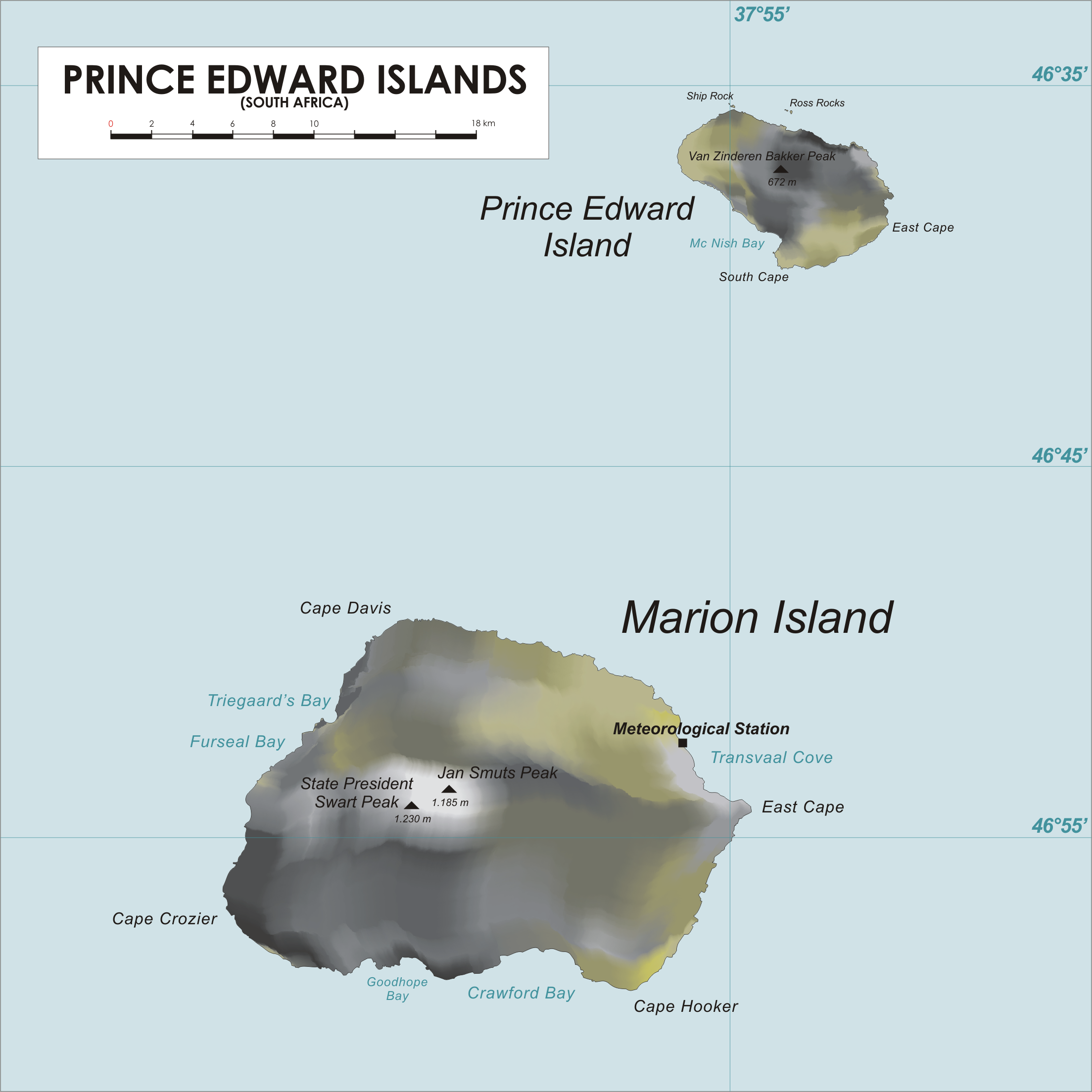
| Description | Map of Prince Edward Islands | ||
| Source | drawn by varp | ||
| Author | drawn by varp | ||
| Permission (Reusing this file) |
|
File history
Click on a date/time to view the file as it appeared at that time.
| Date/Time | Thumbnail | Dimensions | User | Comment | |
|---|---|---|---|---|---|
| current | 13:52, 24 April 2006 | | 2,207 × 2,207 (789 KB) | Varp~commonswiki (talk | contribs) | |
| 12:56, 24 April 2006 |  | 2,207 × 2,207 (740 KB) | Varp~commonswiki (talk | contribs) | *Map of Prince Edward Islands *drawn by varp |
You cannot overwrite this file.
File usage on Commons
The following 2 pages use this file:
File usage on other wikis
The following other wikis use this file:
- Usage on af.wikipedia.org
- Usage on az.wikipedia.org
- Usage on bg.wikipedia.org
- Usage on br.wikipedia.org
- Usage on ca.wikipedia.org
- Usage on ceb.wikipedia.org
- Usage on cs.wikipedia.org
- Usage on da.wikipedia.org
- Forside
- Wikipedia:Skabeloner/Forsiden
- Bruger:Malene/Forsiden
- Bruger:Hockeyindustrien/Test2
- Bruger:Sir48/Sandkasse10
- Skabelon:Forside
- Portal:Forside
- Forside (mobil)
- Bruger:Weblars/sandkasse
- Skabelon:Forside/sandkasse
- Wikipedia:Ugens artikel/2024
- Prince Edward Islands
- Mascarin Peak
- Wikipedia:Ugens artikel/Uge 18, 2024
- Usage on de.wikipedia.org
- Usage on el.wikipedia.org
- Usage on en.wikipedia.org
- Usage on eo.wikipedia.org
- Usage on es.wikipedia.org
- Usage on fa.wikipedia.org
- Usage on fi.wikipedia.org
- Usage on fr.wikipedia.org
- Usage on fy.wikipedia.org
- Usage on hu.wikipedia.org
- Usage on id.wikipedia.org
- Usage on it.wikipedia.org
- Usage on ja.wikipedia.org
- Usage on ka.wikipedia.org
- Usage on ko.wikipedia.org
View more global usage of this file.