Category:Maps of the Prince Edward Islands
Jump to navigation
Jump to search
Media in category "Maps of the Prince Edward Islands"
The following 11 files are in this category, out of 11 total.
-
 IMRAY(1893) p124 PRINCE EDWARD ISLANDS.jpg 2,794 × 3,116; 3.19 MB
-
 Admiralty Chart No 802 Islands in the Southern Ocean, Published 1874, New Edition 1932.jpg 8,149 × 11,042; 8.79 MB
-
 MarionIsland Map.png 1,714 × 1,175; 506 KB
-
-
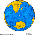
 Pr Edward Isl-pos.png 782 × 385; 21 KB
-
 PrEdwIsl Map be.png 2,207 × 2,207; 467 KB
-
 PrEdwIsl Map.png 2,207 × 2,207; 789 KB
-
 PrEdwIsland Map.png 1,274 × 663; 149 KB
-
 Prince Edward Islands 76.jpg 405 × 628; 45 KB
-
 Prince Edward Islands.jpg 594 × 642; 124 KB
-

_p124_PRINCE_EDWARD_ISLANDS.jpg)


.png)


_(14595481959).jpg)