File:Romania Botosani Location maps.gif
Jump to navigation
Jump to search

Size of this preview: 646 × 599 pixels. Other resolutions: 259 × 240 pixels | 517 × 480 pixels | 831 × 771 pixels.
Original file (831 × 771 pixels, file size: 861 KB, MIME type: image/gif, looped, 2 frames, 10 s)
Captions
Captions
Add a one-line explanation of what this file represents
Summary
[edit]
| Description |
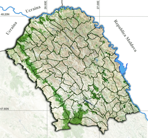
Română: Harta de localizare pentru Judetul Botosani. Harta este calibrată pe urmatoarele coordonate: 48,3 N - 47,425 S si 26,05 W - 27,45 E |
| Date | |
| Source |
|
| Author | Asybaris01 |
Licensing
[edit]
| This image is in the public domain because it is a screenshot from NASA’s globe software World Wind using a public domain layer, such as Blue Marble, MODIS, Landsat, SRTM, USGS or GLOBE.
|
 |
File history
Click on a date/time to view the file as it appeared at that time.
| Date/Time | Thumbnail | Dimensions | User | Comment | |
|---|---|---|---|---|---|
| current | 20:02, 25 January 2015 | | 831 × 771 (861 KB) | Asybaris01 (talk | contribs) | new |
| 18:22, 22 January 2015 |  | 826 × 766 (819 KB) | Asybaris01 (talk | contribs) | corectie frontiera | |
| 08:35, 22 January 2015 |  | 824 × 764 (809 KB) | Asybaris01 (talk | contribs) | new | |
| 08:32, 22 January 2015 |  | 824 × 764 (613 KB) | Asybaris01 (talk | contribs) | new | |
| 08:17, 22 January 2015 |  | 824 × 764 (865 KB) | Asybaris01 (talk | contribs) | User created page with UploadWizard |
You cannot overwrite this file.
File usage on Commons
There are no pages that use this file.
File usage on other wikis
The following other wikis use this file:
- Usage on ro.wikipedia.org
- Dorohoi
- Săveni
- Bucecea
- Adășeni, Botoșani
- Agafton, Botoșani
- Alba, Botoșani
- Albești, Botoșani
- Arborea, Botoșani
- Aurel Vlaicu, Botoșani
- Avram Iancu, Botoșani
- Avrămeni, Botoșani
- Baisa, Botoșani
- Bajura, Botoșani
- Balinți, Botoșani
- Balta Arsă, Botoșani
- Baranca (Cristinești), Botoșani
- Baranca (Hudești), Botoșani
- Băbiceni, Botoșani
- Bădărăi, Botoșani
- Băiceni, Botoșani
- Bălușeni, Botoșani
- Bălușenii Noi, Botoșani
- Bătrânești, Botoșani
- Bârsănești, Botoșani
- Belcea, Botoșani
- Berza, Botoșani
- Bivolari, Botoșani
- Bodeasa, Botoșani
- Bogdănești, Botoșani
- Bohoghina, Botoșani
- Borolea, Botoșani
- Borzești, Botoșani
- Boscoteni, Botoșani
- Bozieni, Botoșani
- Brăteni, Botoșani
- Brehuiești, Botoșani
- Broșteni, Botoșani
- Buda, Botoșani
- Buhăceni, Botoșani
- Buimăceni, Botoșani
- Burla, Botoșani
- Burlești, Botoșani
- Buzeni, Botoșani
- Caraiman, Botoșani
- Carasa, Botoșani
- Călinești (Bucecea), Botoșani
- Călinești (Cândești), Botoșani
- Călugăreni, Botoșani
- Călugărenii Noi, Botoșani
- Cătămărești, Botoșani
View more global usage of this file.