File:South Ossetia location map.svg
Jump to navigation
Jump to search

Size of this PNG preview of this SVG file: 600 × 531 pixels. Other resolutions: 271 × 240 pixels | 542 × 480 pixels | 868 × 768 pixels | 1,157 × 1,024 pixels | 2,314 × 2,048 pixels.
Original file (SVG file, nominally 600 × 531 pixels, file size: 140 KB)
Captions
Captions
Add a one-line explanation of what this file represents
Summary[edit]
| Description |
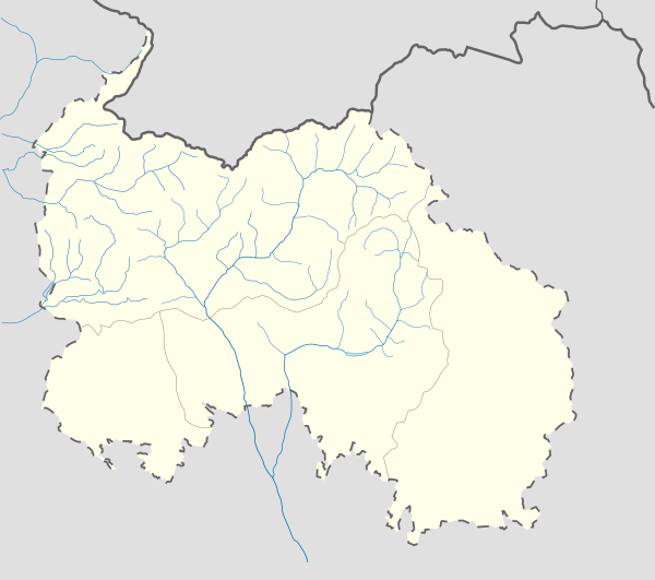
English: Location map of South Ossetia
Geographic limits of the map:
Ирон: Хуссар Ирыстоны позицион картæ
Кæрæтты координæттæ:
|
| Date | |
| Source | Own work |
| Author | Soslanx |
| Other versions | File:RSOLocatorMap.png |
Licensing[edit]
| I, the copyright holder of this work, release this work into the public domain. This applies worldwide. In some countries this may not be legally possible; if so: I grant anyone the right to use this work for any purpose, without any conditions, unless such conditions are required by law. |
File history
Click on a date/time to view the file as it appeared at that time.
| Date/Time | Thumbnail | Dimensions | User | Comment | |
|---|---|---|---|---|---|
| current | 10:05, 7 December 2016 | | 600 × 531 (140 KB) | Giorgi Balakhadze (talk | contribs) | Rv of sockpuppet |
| 00:10, 15 February 2015 |  | 600 × 531 (140 KB) | Leftcry (talk | contribs) | Reverted to version as of 15:04, 4 September 2011 That doesn't really "fix" anything | |
| 18:21, 14 February 2015 |  | 600 × 531 (140 KB) | Giorgi Balakhadze (talk | contribs) | Fixing border | |
| 15:04, 4 September 2011 |  | 600 × 531 (140 KB) | Bouron (talk | contribs) | Black sea basin rivers added | |
| 16:20, 27 March 2011 |  | 600 × 531 (118 KB) | Bouron (talk | contribs) | hydro reloading: + basin of L.Liakhva rivers width fixed | |
| 17:19, 25 March 2011 |  | 600 × 531 (104 KB) | Bouron (talk | contribs) | Hydro reloading: bassin of Bigger Liakhva river added | |
| 10:40, 17 February 2011 |  | 600 × 531 (83 KB) | Iguacu (talk | contribs) | dotted-lined borders of SO | |
| 18:06, 16 February 2011 |  | 600 × 531 (98 KB) | Bouron (talk | contribs) | border fixed | |
| 12:59, 15 February 2011 |  | 1,006 × 910 (73 KB) | Bouron (talk | contribs) | Reverted to version as of 12:51, 13 June 2010 | |
| 12:40, 15 February 2011 |  | 5,785 × 5,203 (77 KB) | Bouron (talk | contribs) | Reverted to version as of 12:09, 13 June 2010 |
You cannot overwrite this file.
File usage on Commons
The following 17 pages use this file:
- User:Bouron/maps
- File:Chanchakhi River.PNG
- File:Churta.PNG
- File:Dzau in South Ossetia.svg
- File:Dzau in South Ossetia (semi-independence).svg
- File:Dzhodzhora.PNG
- File:Ermanydon South Ossetia.PNG
- File:Great Liakhvi (Styr Lewaxi).PNG
- File:Ksani - Chysandon.PNG
- File:Lekhura.PNG
- File:Leningor in South Ossetia.svg
- File:Leningor in South Ossetia (semi-independence).svg
- File:Malaya Liakhva.PNG
- File:Tskhinval in South Ossetia.svg
- File:Tskhinval in South Ossetia (semi-independence).svg
- File:Znaur in South Ossetia.svg
- File:Znaur in South Ossetia (semi-independence).svg
.svg)
.PNG)
.svg)
.svg)
.svg)
File usage on other wikis
The following other wikis use this file:
- Usage on af.wikipedia.org
- Usage on ar.wikipedia.org
- Usage on az.wikipedia.org
- Usage on ba.wikipedia.org
- Usage on be.wikipedia.org
- Usage on bg.wikipedia.org
- Usage on bn.wikipedia.org
- Usage on bs.wikipedia.org
- Usage on ceb.wikipedia.org
- Usage on ce.wikipedia.org
- Usage on ckb.wikipedia.org
- Usage on cs.wikipedia.org
- Usage on da.wikipedia.org
- Usage on de.wikipedia.org
- Usage on en.wikipedia.org
View more global usage of this file.