File:USGS Shakemap - 1960 Agadir, Morocco earthquake.jpg
Jump to navigation
Jump to search
Size of this preview: 510 × 600 pixels. Other resolutions: 204 × 240 pixels | 612 × 720 pixels.
Original file (612 × 720 pixels, file size: 157 KB, MIME type: image/jpeg)
Captions
Captions
Add a one-line explanation of what this file represents
Summary
[edit]
| Description |
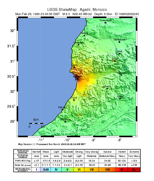
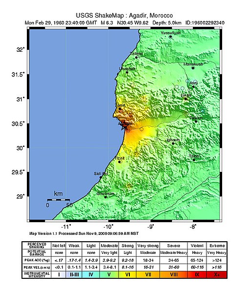
English: Shake map showing intensity of shaking during the 1960 Agadir, Morocco earthquake |
| Date | |
| Source | [1] |
| Author | USGS |
Licensing
[edit]
This image is in the public domain in the United States because it only contains materials that originally came from the United States Geological Survey, an agency of the United States Department of the Interior. For more information, see the official USGS copyright policy.
|
File history
Click on a date/time to view the file as it appeared at that time.
| Date/Time | Thumbnail | Dimensions | User | Comment | |
|---|---|---|---|---|---|
| current | 02:54, 10 December 2012 | | 612 × 720 (157 KB) | Dawnseeker2000 (talk | contribs) | User created page with UploadWizard |
You cannot overwrite this file.
File usage on Commons
There are no pages that use this file.
File usage on other wikis
The following other wikis use this file:
- Usage on en.wikipedia.org
- Usage on es.wikipedia.org
- Usage on fr.wikipedia.org
- Usage on he.wikipedia.org
- Usage on ko.wikipedia.org
- Usage on pl.wikipedia.org
- Usage on uk.wikipedia.org
- Usage on vi.wikipedia.org