Category:Carrer Alemanys (Girona)
Jump to navigation
Jump to search
| Object location | | View all coordinates using: OpenStreetMap |
|---|
street in Girona, Spain .JPG) | |||||
| Upload media | |||||
| Instance of | |||||
|---|---|---|---|---|---|
| Location | Girona, Gironès, Province of Girona, Catalonia | ||||
| Architectural style | |||||
| Heritage designation |
| ||||
 | |||||
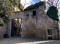
Català: Carrer Alemanys. C. Alemanys (Girona).
This is a category about a building indexed in the Catalan heritage register as Bé Cultural d'Interès Local (BCIL) under the reference IPA-21147. |
Subcategories
This category has the following 3 subcategories, out of 3 total.
C
- Can Porcalla (Girona) (6 F)
- Casa Boada (Girona) (5 F)
Media in category "Carrer Alemanys (Girona)"
The following 6 files are in this category, out of 6 total.
-
 087 Carrer dels Alemanys (Girona).jpg 3,120 × 4,160; 4.28 MB
-
 109 Carrer dels Alemanys (Girona).jpg 2,112 × 2,816; 2.43 MB
-
 113 Carrer dels Alemanys (Girona).jpg 2,112 × 2,816; 2.07 MB
-
 307 Carrer dels Alemanys (Girona).JPG 2,112 × 2,816; 3.66 MB
-
 308 Carrer dels Alemanys (Girona).JPG 2,816 × 2,112; 4.19 MB
-
 Caserna dels Alemanys (Girona).jpg 3,286 × 2,432; 3.49 MB
.jpg)
.jpg)
.jpg)
.JPG)
.jpg)