Category:Dorfkirche Jänickendorf
Jump to navigation
Jump to search
| Object location | | View all coordinates using: OpenStreetMap |
|---|
church building in Oder-Spree district, Brandenburg state, Germany  | |||||
| Upload media | |||||
| Instance of | |||||
|---|---|---|---|---|---|
| Location | Jänickendorf, Steinhöfel, Oder-Spree District, Brandenburg, Germany | ||||
| Heritage designation | |||||
 | |||||
This is the category of the Brandenburger Baudenkmal (cultural heritage monument) with the ID 09115493 (Wikidata)
|
Media in category "Dorfkirche Jänickendorf"
The following 15 files are in this category, out of 15 total.
-
 Dorfkirche Jänickendorf Chor Nordansicht.jpg 4,032 × 3,024; 4.14 MB
-
 Dorfkirche Jänickendorf Chor Südansicht.jpg 4,032 × 3,024; 4.58 MB
-
 Dorfkirche Jänickendorf Denkmal Weltkriege.jpg 4,032 × 3,024; 4.73 MB
-
 Dorfkirche Jänickendorf Kirchenschiff Gemeindepforte.jpg 4,032 × 3,024; 4.78 MB
-
 Dorfkirche Jänickendorf Kirchenschiff Nordansicht.jpg 4,032 × 3,024; 4.71 MB
-
 Dorfkirche Jänickendorf Kirchenschiff Südansicht.jpg 4,032 × 3,024; 4.3 MB
-
 Dorfkirche Jänickendorf Nordansicht.jpg 4,032 × 3,024; 2.93 MB
-
 Dorfkirche Jänickendorf Nordostansicht.jpg 4,032 × 3,024; 3.55 MB
-
 Dorfkirche Jänickendorf Ostansicht.jpg 3,024 × 4,032; 3.62 MB
-
 Dorfkirche Jänickendorf Südostansicht.jpg 4,032 × 3,024; 3.45 MB
-
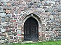 Dorfkirche Jänickendorf Westportal.jpg 4,032 × 3,024; 5.02 MB
-
 Dorfkirche Jänickendorf Westturm Glockengeschoss.jpg 3,024 × 4,032; 2.21 MB
-
 Dorfkirche Jänickendorf Westturm Südansicht.jpg 3,024 × 4,032; 2.68 MB
-
 Jänickendorf - Feldsteinkirche - panoramio.jpg 640 × 480; 64 KB
-
 Jänickendorf, Dorfkirche.jpg 2,048 × 1,536; 915 KB


