Category:Maps of Badlands National Park
Jump to navigation
Jump to search
United States national parks: Acadia · American Samoa · Arches · Badlands · Big Bend · Biscayne · Black Canyon of the Gunnison · Bryce Canyon · Canyonlands · Capitol Reef · Carlsbad Caverns · Channel Islands · Congaree · Crater Lake · Cuyahoga Valley · Death Valley · Denali · Dry Tortugas · Everglades · Gateway Arch · Gates of the Arctic · Glacier · Glacier Bay · Grand Canyon · Grand Teton · Great Basin · Great Smoky Mountains · Guadalupe Mountains · Haleakalā · Hawaii Volcanoes · Hot Springs · Indiana Dunes · Isle Royale · Joshua Tree · Kenai Fjords · Kings Canyon · Kobuk Valley · Lake Clark · Lassen Volcanic · Mammoth Cave · Mesa Verde · Mount Rainier · North Cascades · Olympic · Petrified Forest · Pinnacles · Redwood · Rocky Mountain · Saguaro · Sequoia · Shenandoah · Theodore Roosevelt · Virgin Islands · Voyageurs · White Sands · Wind Cave · Wrangell-St. Elias · Yellowstone · Yosemite · Zion
English: Maps of Badlands National Park
Wikimedia category | |||||
| Upload media | |||||
| Instance of | |||||
|---|---|---|---|---|---|
| Category combines topics | |||||
| Badlands National Park | |||||
national park in South Dakota, United States  | |||||
| Instance of | |||||
| Part of |
| ||||
| Location |
| ||||
| Visitor center | |||||
| Headquarters location |
| ||||
| Operator | |||||
| IUCN protected areas category | |||||
| Inception |
| ||||
| Highest point | |||||
| Area |
| ||||
| Visitors per year |
| ||||
| official website | |||||
 | |||||
Subcategories
This category has the following 2 subcategories, out of 2 total.
Media in category "Maps of Badlands National Park"
The following 25 files are in this category, out of 25 total.
-
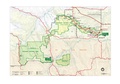
 Map badlands nationalpark.png 4,102 × 2,776; 1.13 MB
-
 Map of Mount Rushmore.png 1,110 × 685; 158 KB
-
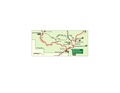
 LocMap Badlands National Park.png 280 × 183; 31 KB
-
 Badlands National Park, Detail.png 3,840 × 2,160; 11.46 MB
-
 Badlands National Park, Overview 01.png 7,680 × 4,320; 55.8 MB
-
 Badlands National Park.svg 1,000 × 1,000; 6 KB
-
 BadlandsNP L7 16oct00.jpg 540 × 540; 141 KB
-
 Big Badlands Overlook- PA090061 The Big Badlands Sign (west entrance road).JPG 3,072 × 2,304; 1.27 MB
-

-
 Map of the country embraced in the campaign against the Sioux Indians Messiah War.png 1,089 × 1,651; 871 KB
-
 NPS badlands-bike-map-northeast-loop.gif 1,020 × 1,320; 142 KB
-
 NPS badlands-bike-map-sage-creek-loop.gif 1,173 × 1,308; 62 KB
-
 NPS badlands-cedar-pass-campground-map.gif 603 × 903; 125 KB
-
 NPS badlands-cedar-pass-detail-map.gif 1,317 × 616; 65 KB
-
 NPS badlands-cedar-pass-detail-map.pdf 789 × 368; 58 KB
-
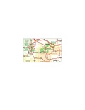
 NPS badlands-map.jpg 2,818 × 1,939; 902 KB
-
 NPS badlands-map.pdf 2,514 × 1,731; 360 KB
-
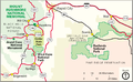
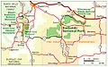 NPS badlands-regional-map.jpg 1,161 × 721; 198 KB
-
 NPS badlands-regional-map.pdf 581 × 360; 71 KB
-
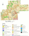 NPS badlands-vegetation-map.gif 4,000 × 4,960; 2.36 MB
-
 Pineridgereservationmap.png 493 × 379; 71 KB
-
 Red Shirt Table.jpg 1,564 × 4,941; 2.14 MB
-
 Reservation map at White River Visitor Center.jpg 4,015 × 2,579; 2.05 MB
-

-
 South Dakota Highway 240 map 1.png 1,030 × 716; 64 KB


.JPG)
.png)


