Category:Maps of Redwood National Park
Jump to navigation
Jump to search
United States national parks: Acadia · American Samoa · Arches · Badlands · Big Bend · Biscayne · Black Canyon of the Gunnison · Bryce Canyon · Canyonlands · Capitol Reef · Carlsbad Caverns · Channel Islands · Congaree · Crater Lake · Cuyahoga Valley · Death Valley · Denali · Dry Tortugas · Everglades · Gateway Arch · Gates of the Arctic · Glacier · Glacier Bay · Grand Canyon · Grand Teton · Great Basin · Great Smoky Mountains · Guadalupe Mountains · Haleakalā · Hawaii Volcanoes · Hot Springs · Indiana Dunes · Isle Royale · Joshua Tree · Kenai Fjords · Kings Canyon · Kobuk Valley · Lake Clark · Lassen Volcanic · Mammoth Cave · Mesa Verde · Mount Rainier · North Cascades · Olympic · Petrified Forest · Pinnacles · Redwood · Rocky Mountain · Saguaro · Sequoia · Shenandoah · Theodore Roosevelt · Virgin Islands · Voyageurs · White Sands · Wind Cave · Wrangell-St. Elias · Yellowstone · Yosemite · Zion
English: Maps of Redwood National Park
Wikimedia category | |||||
| Upload media | |||||
| Instance of | |||||
|---|---|---|---|---|---|
| Category combines topics | |||||
| Redwood National and State Parks | |||||
U.S. national park in California .jpg) | |||||
| Instance of | |||||
| Part of | |||||
| Location |
| ||||
| Located in or next to body of water | |||||
| Operator | |||||
| IUCN protected areas category | |||||
| Inception |
| ||||
| Area |
| ||||
| Visitors per year |
| ||||
| official website | |||||
 | |||||
Subcategories
This category has only the following subcategory.
Media in category "Maps of Redwood National Park"
The following 13 files are in this category, out of 13 total.
-
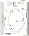
 LocMap Redwood np.png 280 × 183; 40 KB
-
 NPS redwood-elk-prairie-campground-map.gif 1,020 × 1,320; 129 KB
-
 NPS redwood-gold-bluffs-beach-campground.gif 916 × 1,138; 81 KB
-
 NPS redwood-jedediah-smith-redwoods-campground.gif 969 × 1,380; 134 KB
-
 NPS redwood-map cropped.png 6,714 × 17,564; 11.12 MB
-
 NPS redwood-map.jpg 2,950 × 3,842; 829 KB
-
 NPS redwood-map.pdf 2,527 × 3,291; 4.49 MB
-
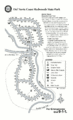 NPS redwood-mill-creek-campground-map.gif 1,020 × 1,680; 178 KB
-
 NPS redwood-range-map.jpg 2,082 × 759; 276 KB
-
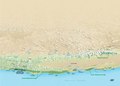 NPS redwood-range-map.pdf 1,785 × 1,277; 152 KB
-
 Redwood National Park.svg 1,000 × 1,000; 42 KB
-
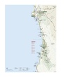
 Redwood-NP Map 2020.jpg 1,647 × 4,200; 2.65 MB
-
 Redwood-NP Map.png 2,000 × 5,460; 1.37 MB


