Category:Shetland Islands
Jump to navigation
Jump to search
Council areas (municipalities) of Scotland: Aberdeen · Aberdeenshire · Angus · Argyll and Bute · Clackmannanshire · Dumfries and Galloway · Dundee · East Ayrshire · East Dunbartonshire · East Lothian · East Renfrewshire · Edinburgh · Falkirk · Fife · Glasgow · Highland · Inverclyde · Midlothian · Moray · North Ayrshire · North Lanarkshire · Outer Hebrides · Orkney Islands · Perth and Kinross · Renfrewshire · Scottish Borders · Shetland Islands · South Ayrshire · South Lanarkshire · Stirling · West Dunbartonshire · West Lothian
Traditional counties (shires) of Scotland: Aberdeenshire · Angus · Argyll · Ayrshire · Banffshire · Berwickshire · Buteshire · Caithness · Clackmannanshire · Cromartyshire · Dumbartonshire · Dumfriesshire · East Lothian · Fife · Inverness-shire · Kincardineshire · Kinross-shire · Kirkcudbrightshire · Lanarkshire · Midlothian · Moray · Nairnshire · Orkney Islands · Peeblesshire · Perthshire · Renfrewshire · Ross-shire · Roxburghshire · Selkirkshire · Shetland Islands · Stirlingshire · Sutherland · West Lothian · Wigtownshire
Former regions and island areas of Scotland: Central Region · Dumfries and Galloway · Fife · Grampian · Highland · Lothian · Orkney Islands · Outer Hebrides · Scottish Borders · Shetland Islands · Strathclyde · Tayside
subarctic archipelago, county and council area of Scotland that lies north-east of mainland Britain    | |||||
| Upload media | |||||
| Instance of |
| ||||
|---|---|---|---|---|---|
| Part of | |||||
| Location | Scotland | ||||
| Located in or next to body of water | |||||
| Capital | |||||
| Legislative body |
| ||||
| Official language | |||||
| Has part(s) | |||||
| Highest point | |||||
| Population |
| ||||
| Area |
| ||||
| Different from | |||||
| official website | |||||
 | |||||


Subcategories
This category has the following 35 subcategories, out of 35 total.
Pages in category "Shetland Islands"
This category contains only the following page.
Media in category "Shetland Islands"
The following 140 files are in this category, out of 140 total.
-
 A reef near Silwick - geograph.org.uk - 5011374.jpg 640 × 480; 174 KB
-

-
 Ayre Dyke - geograph.org.uk - 5130965.jpg 640 × 480; 176 KB
-
 Ayre Dyke near Houss - geograph.org.uk - 5130971.jpg 640 × 480; 161 KB
-
 Ayre of Breiwick, Wadbister Ness - geograph.org.uk - 3981364.jpg 1,024 × 681; 222 KB
-
 Ayre of Breiwick, Wadbister Ness - geograph.org.uk - 3981370.jpg 1,024 × 681; 217 KB
-
 Ayre of Breiwick, Wadbister Ness - geograph.org.uk - 3981382.jpg 1,024 × 681; 227 KB
-
 Beach at the head of the Bay of Deep Dale - geograph.org.uk - 4984493.jpg 1,600 × 1,200; 761 KB
-
 Beach at the South Links, Balta - geograph.org.uk - 6288877.jpg 1,600 × 1,065; 510 KB
-
 Beside Skerries of Easter Paill - geograph.org.uk - 5137383.jpg 1,600 × 1,201; 721 KB
-
 Bight of Vatsland - geograph.org.uk - 1922552.jpg 800 × 534; 128 KB
-
 Black Head - geograph.org.uk - 1974682.jpg 2,816 × 2,112; 916 KB
-
 Boats at The Taing - geograph.org.uk - 2586774.jpg 1,333 × 1,000; 1.02 MB
-
 Boats in the West Voe of Quarff - geograph.org.uk - 2066391.jpg 2,560 × 1,920; 1.9 MB
-
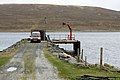
 Bridge between Trondra and Burra - geograph.org.uk - 6207033.jpg 800 × 533; 540 KB
-
 Brother Isle in Yell Sound from Brough, Toft - geograph.org.uk - 6282857.jpg 1,600 × 1,067; 826 KB
-
 Burrier Head - geograph.org.uk - 1973532.jpg 2,816 × 2,112; 826 KB
-
 Callibanks on the Wester Sound - geograph.org.uk - 6182997.jpg 1,600 × 1,132; 390 KB
-
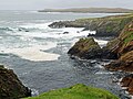
 Clifftops at Coall Head - geograph.org.uk - 2066147.jpg 2,560 × 1,920; 1.8 MB
-
 Clubb of Mulla - geograph.org.uk - 2078151.jpg 2,560 × 1,920; 1.83 MB
-

-
 Coast of Lax Firth south of Otter Point - geograph.org.uk - 3981396.jpg 1,024 × 681; 210 KB
-
 Coast of Muckure - geograph.org.uk - 4011702.jpg 2,048 × 1,536; 1.53 MB
-
 Coast south of Muckle Head, Balta - geograph.org.uk - 6288843.jpg 1,600 × 1,065; 717 KB
-
 Coastal grassland below The Hamar - geograph.org.uk - 5137335.jpg 1,600 × 1,201; 555 KB
-
 Coastal path near Houss - geograph.org.uk - 5130970.jpg 640 × 480; 182 KB
-
 Coastline at Score Head - geograph.org.uk - 3586694.jpg 640 × 480; 270 KB
-
 Coastline west of the Ness of Trebister - geograph.org.uk - 3573882.jpg 640 × 480; 187 KB
-
 Curious structure on the shoreline with its beach - geograph.org.uk - 6188083.jpg 1,600 × 1,200; 353 KB
-
 Deserted crofts at Kurkigarth in the sunshine - geograph.org.uk - 6188370.jpg 1,600 × 1,200; 358 KB
-
 Detached Stack - geograph.org.uk - 2632737.jpg 4,058 × 2,918; 3.63 MB
-
 DM-ST-82-09940 Combat-ready Marines debark from two LVTP-7 during Northern Wedding.jpeg 2,840 × 1,890; 2.46 MB
-

-
 East coast of the Ness of Trebister - geograph.org.uk - 3573902.jpg 640 × 480; 156 KB
-
 East shore of Clift Sound - geograph.org.uk - 5733350.jpg 751 × 1,024; 190 KB
-
 East-the-Voe, Aith - geograph.org.uk - 5045292.jpg 1,024 × 681; 184 KB
-
 Fish farm off Balta - geograph.org.uk - 6288809.jpg 1,600 × 1,065; 452 KB
-
 Fish farm off Balta - geograph.org.uk - 6288837.jpg 1,600 × 1,065; 483 KB
-
 Fish farm off Balta - geograph.org.uk - 6288876.jpg 1,600 × 1,065; 559 KB
-
 Fish meal plant, Heogan - geograph.org.uk - 2709702.jpg 4,416 × 1,735; 470 KB
-
 Fore Holm - geograph.org.uk - 2614587.jpg 4,156 × 3,138; 4.55 MB
-
 Fore Holm north end - geograph.org.uk - 2612620.jpg 3,231 × 2,399; 3.18 MB
-
 From Bruna Ness towards Scalloway - geograph.org.uk - 5132863.jpg 1,600 × 1,201; 682 KB
-
 Galta Stack - geograph.org.uk - 5044143.jpg 3,648 × 2,736; 3.65 MB
-
 Garderhouse pier - geograph.org.uk - 2860608.jpg 800 × 532; 127 KB
-
 Geo of the Muckle Head, Balta - geograph.org.uk - 6288863.jpg 1,600 × 1,065; 657 KB
-
 Graveyard at Sound, Weisdale - geograph.org.uk - 4927711.jpg 1,024 × 682; 221 KB
-
 Greenholm - geograph.org.uk - 5923030.jpg 800 × 601; 411 KB
-
 Gro Stack from Wats Ness - geograph.org.uk - 1976767.jpg 2,816 × 2,112; 600 KB
-
 Gruna Isle - geograph.org.uk - 2277226.jpg 1,024 × 441; 73 KB
-
-
 Head of Garderhouse Voe - geograph.org.uk - 3795529.jpg 640 × 480; 246 KB
-
 Headland at Culswick Broch - geograph.org.uk - 2046807.jpg 2,560 × 1,920; 1.77 MB
-
 Heavy sea at Scaalie Point - geograph.org.uk - 5135591.jpg 1,600 × 1,200; 697 KB
-
 Holm Field from Houss, Burra - geograph.org.uk - 5095917.jpg 1,024 × 681; 129 KB
-
 Holm of Burrafirth, East Burra Firth - geograph.org.uk - 2130683.jpg 800 × 533; 108 KB
-
 Holm of Burrastow, near Walls - geograph.org.uk - 5318057.jpg 1,024 × 681; 154 KB
-
 Ingra Pund - geograph.org.uk - 2700370.jpg 600 × 800; 297 KB
-
 Keolki Field - geograph.org.uk - 2046642.jpg 2,560 × 1,920; 1.69 MB
-
 Kirka Ness and Kirk Holm - geograph.org.uk - 3472983.jpg 640 × 480; 56 KB
-
 Kurkigarth, near Voe - geograph.org.uk - 4946056.jpg 1,024 × 681; 286 KB
-
 Lang Sound - geograph.org.uk - 2706115.jpg 4,928 × 2,307; 1.06 MB
-
 Lang Sound from West Burra - geograph.org.uk - 1924145.jpg 800 × 534; 174 KB
-
 Loch of Vadill, seaward end - geograph.org.uk - 4618467.jpg 4,000 × 2,664; 3.51 MB
-
 Looking NW from Salt Ness - geograph.org.uk - 1971794.jpg 2,816 × 2,112; 2.63 MB
-

-
 Looking up Garderhouse Voe - geograph.org.uk - 3472994.jpg 640 × 480; 63 KB
-
 Looking west across Wick of Watsness - geograph.org.uk - 1976737.jpg 2,816 × 2,112; 618 KB
-
 Lunga Taing - geograph.org.uk - 6181230.jpg 1,600 × 1,144; 269 KB
-
 Moo Stack and the coast at Silwick - geograph.org.uk - 5010532.jpg 640 × 480; 171 KB
-
 Mousa Ness, Whiteness - geograph.org.uk - 2130470.jpg 800 × 534; 209 KB
-
 Mouth of Burri Geo - geograph.org.uk - 3838024.jpg 640 × 360; 212 KB
-
 Mussel rafts beside Burra Bridge - geograph.org.uk - 1924046.jpg 800 × 534; 128 KB
-
 Mussel Ropes at Olna Firth - geograph.org.uk - 6206511.jpg 800 × 600; 626 KB
-
 Natural Arch at Point of Stakka - geograph.org.uk - 5134920.jpg 1,600 × 1,201; 489 KB
-
 Natural arch on the Ness of Trebister - geograph.org.uk - 3573890.jpg 640 × 480; 213 KB
-
 Near Scaalie Point, Houss Ness - geograph.org.uk - 5134942.jpg 1,600 × 1,201; 685 KB
-
 Near the end of the road, in the Shetland Islands 1983 (50239958452).jpg 1,938 × 1,244; 618 KB
-
 Old jetty at the south end of Balta - geograph.org.uk - 6288882.jpg 1,600 × 1,069; 538 KB
-
 Otter Point, Lax Firth - geograph.org.uk - 3981390.jpg 1,024 × 681; 175 KB
-
 Otter Point, Lax Firth - geograph.org.uk - 3981393.jpg 1,024 × 681; 221 KB
-
 Otter Point, Lax Firth - geograph.org.uk - 3981399.jpg 1,024 × 681; 214 KB
-
-
 Pictish Culswick Broch - geograph.org.uk - 2046759.jpg 2,560 × 1,920; 1.76 MB
-
 Pier at Laxfirth - geograph.org.uk - 2360434.jpg 800 × 534; 223 KB
-
 Piers for Mussel Farm - geograph.org.uk - 6207021.jpg 800 × 600; 563 KB
-
 Point of Mulla, Voe - geograph.org.uk - 4946051.jpg 1,024 × 681; 158 KB
-
 Point of Russaness - geograph.org.uk - 2273632.jpg 2,136 × 2,848; 2.97 MB
-
 Point of the Ness of Trebister - geograph.org.uk - 3573893.jpg 640 × 480; 137 KB
-
 Promnontory and stacks at St. Ninian's Isle, Shetland - geograph.org.uk - 6293518.jpg 4,000 × 3,000; 4.37 MB
-
 Reita Ness - geograph.org.uk - 3799807.jpg 640 × 480; 241 KB
-
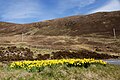 Roadside daffodils at Mulla, Voe - geograph.org.uk - 4946040.jpg 1,024 × 681; 246 KB
-
 Rock stacks at Whale Wick - geograph.org.uk - 5133208.jpg 1,600 × 1,201; 731 KB
-
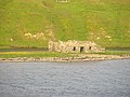 Ruin, Bowayre - geograph.org.uk - 3795525.jpg 640 × 480; 297 KB
-
 Russa Ness, from the air - geograph.org.uk - 5763554.jpg 1,024 × 683; 129 KB
-
 Sand beach - geograph.org.uk - 2136898.jpg 640 × 427; 38 KB
-
 Scaalie Point, Houss Ness - geograph.org.uk - 5135580.jpg 1,600 × 1,201; 677 KB
-
 Shetland Crub - geograph.org.uk - 2622590.jpg 3,221 × 2,374; 2.4 MB
-
 Shetland marine surveying (8271057575).jpg 800 × 533; 221 KB
-
 Skeo Taing - geograph.org.uk - 2609879.jpg 4,320 × 3,240; 5.55 MB
-
 Skerries of Easter Paill - geograph.org.uk - 5137348.jpg 1,600 × 1,201; 564 KB
-
 Skerry-hopping at Loder Head - geograph.org.uk - 5828850.jpg 3,200 × 1,600; 1.79 MB
-
 Skersund Skerry - geograph.org.uk - 3573898.jpg 640 × 480; 167 KB
-
 Small headland, Ayre of Breiwick, Wadbister Ness - geograph.org.uk - 3981385.jpg 1,024 × 681; 199 KB
-
 Small un-named stack off the south coast of Balta - geograph.org.uk - 6288821.jpg 1,600 × 1,065; 624 KB
-
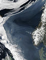 Smoke over the Norwegian Sea-2006-05-07 lrg.jpg 5,800 × 7,600; 4.41 MB
-
 South of Coall Head - geograph.org.uk - 2066235.jpg 2,560 × 1,920; 1.76 MB
-
 South Voe - geograph.org.uk - 2052200.jpg 2,560 × 1,920; 1.91 MB
-
 South Voe and Holm of Papil - geograph.org.uk - 6201628.jpg 800 × 533; 532 KB
-
 South West tip of isle of Flotta - geograph.org.uk - 5987907.jpg 1,024 × 576; 180 KB
-
 Squidel and Clett - geograph.org.uk - 5011378.jpg 640 × 480; 170 KB
-
 Squidel near Silwick - geograph.org.uk - 5011373.jpg 640 × 480; 203 KB
-
 Stack of Sandwick, Burra, Shetland - geograph.org.uk - 5132867.jpg 1,600 × 1,201; 740 KB
-
 Stack on the Ness of Trebister - geograph.org.uk - 3573886.jpg 640 × 480; 196 KB
-
 Steis Point - geograph.org.uk - 1973552.jpg 2,816 × 2,112; 786 KB
-
 Stream Sound from West Burra - geograph.org.uk - 1924137.jpg 800 × 534; 133 KB
-
 Streams Geo, Balta - geograph.org.uk - 6288832.jpg 1,600 × 1,065; 819 KB
-
 The cliffs of Kirka Ness - geograph.org.uk - 3472988.jpg 640 × 480; 55 KB
-
 The Dragon Hus Camping Bod - geograph.org.uk - 6183028.jpg 1,600 × 1,200; 388 KB
-
 The Groni Stack - geograph.org.uk - 2277081.jpg 1,024 × 681; 135 KB
-
 The head of Garderhouse Voe, with scattered dwellings - geograph.org.uk - 3539093.jpg 1,600 × 1,200; 437 KB
-
 The island of Hoy, Weisdale Voe, from the air - geograph.org.uk - 5763226.jpg 1,024 × 1,024; 206 KB
-
 The mouth of the Houb, Grunnavoe, Walls - geograph.org.uk - 5318033.jpg 1,024 × 681; 93 KB
-
 The Nev - geograph.org.uk - 3838013.jpg 640 × 360; 244 KB
-
 The Nev - geograph.org.uk - 3838039.jpg 640 × 360; 223 KB
-
 The Taing - geograph.org.uk - 5130992.jpg 640 × 480; 154 KB
-
 Trailers parked at Scottie Holm - geograph.org.uk - 5831777.jpg 4,400 × 2,200; 1.91 MB
-
 Trolligarts 2.jpg 4,032 × 3,024; 3.93 MB
-
 Trolligarts.jpg 4,032 × 3,024; 3.28 MB
-
 Un-named geo on the east side of Balta - geograph.org.uk - 6288846.jpg 1,600 × 1,065; 764 KB
-
 Un-named geo on the east side of Balta - geograph.org.uk - 6288851.jpg 1,600 × 1,065; 681 KB
-
 Uni Firth and the Vadills - geograph.org.uk - 3488330.jpg 640 × 480; 74 KB
-
 Ved shetlandskysten.png 835 × 606; 506 KB
-
 View from St. Ninian's Isle to the tombolo - geograph.org.uk - 6293530.jpg 4,000 × 3,000; 4.59 MB
-
 Virda and West Voe of Quarff - geograph.org.uk - 2066413.jpg 2,560 × 1,920; 1.96 MB
-
 Watsness from Dog's Head - geograph.org.uk - 1976757.jpg 2,816 × 2,112; 767 KB
-
 Weedy Vementry Lochan - geograph.org.uk - 2277162.jpg 1,024 × 294; 64 KB
-
 West and East Burra - geograph.org.uk - 4505841.jpg 640 × 480; 218 KB
-
 West Voe, Holm of Houss - geograph.org.uk - 5923355.jpg 800 × 533; 622 KB
-
 West Voe, Peerie Holm of Clett - geograph.org.uk - 5923262.jpg 800 × 600; 500 KB


.jpg)


.jpg)


