Commons:Graphic Lab/Map workshop/Archive/2019
 | This is an archive of past discussions. Do not edit the contents of this page. If you wish to start a new discussion or revive an old one, please do so on the current talk page. |
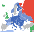
Update UNESCO member states map
-
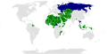
 UNESCO member states

Article(s): en:Member states of UNESCO if you want to link on English Wikipedia -->]]
- Request
- The U.S. and Israel have withdrawn from UNESCO, effective on 1/1 Paris time. Both countries now have observer status (colored yellow, per the EN article), and this map needs to be updated to reflect this: [1][2] --1990'sguy (talk) 17:08, 2 January 2019 (UTC)
- Graphist opinion(s)
 Done BMacZero (talk) 19:00, 5 January 2019 (UTC)
- This section was archived on a request by: BMacZero (talk) 19:00, 5 January 2019 (UTC)
Font Request
- This section was archived on a request by: hueman1 (talk) 23:56, 2 February 2019 (UTC)
-
 Font used here and the svg copy
 -
 Svg file


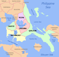
Article(s): Cavite province and its local government units
- Request
- I would just like to request for the svg file and font used for this map. Thank you. --HueMan1 (talk) 08:57, 10 April 2018 (UTC)
- Graphist opinion(s)
@HueMan1: I don't understand, are you requesting for a svg file to be created? Both of the files you have linked to are png files and you can't get font info from those. If it is the last with info then you should mark this as resolved {{section resolved|1=~~~~}} because there is nothing anyone can do. --Goran tek-en (talk) 17:44, 2 February 2019 (UTC)
Kyshtym disaster
- This section was archived on a request by: Kintetsubuffalo (talk) 02:45, 7 February 2019 (UTC)


- Article(s)
- en:Kyshtym disaster
- Request
- English map, please… --Kintetsubuffalo (talk) 01:52, 11 June 2018 (UTC)
- Graphist opinion(s)
@Kintetsubuffalo: I will take it if you provide the translation here, thanks. Ping me. --Goran tek-en (talk) 17:21, 2 February 2019 (UTC)
![]() Request taken by Goran tek-en (talk) 18:57, 4 February 2019 (UTC)
Request taken by Goran tek-en (talk) 18:57, 4 February 2019 (UTC)
- @Goran tek-en: Thank you for taking this, I will work on this in the afternoon!Kintetsubuffalo (talk) 17:53, 2 February 2019 (UTC)
- @Goran tek-en: okay, I've made a dummy of the map with English labels. You can overwrite directly over it. I missed one-the Iset River has only one 's'. Thanks again!Kintetsubuffalo (talk) 05:46, 4 February 2019 (UTC)
- @Kintetsubuffalo: Draft to check. --Goran tek-en (talk) 18:57, 4 February 2019 (UTC)
- @Goran tek-en: almost perfect, should be Sverdlovsk, and thank you!Kintetsubuffalo (talk) 05:07, 5 February 2019 (UTC)
- @Kintetsubuffalo: Draft to check. --Goran tek-en (talk) 18:57, 4 February 2019 (UTC)
- @Goran tek-en: okay, I've made a dummy of the map with English labels. You can overwrite directly over it. I missed one-the Iset River has only one 's'. Thanks again!Kintetsubuffalo (talk) 05:46, 4 February 2019 (UTC)
@Kintetsubuffalo: Now you can find it here file:Map_of_the_East_Urals_Radioactive_Trace.png. If you are happy with this please put the code {{section resolved|1=~~~~}} on this request so it can be archived, thanks. ![]() Done --Goran tek-en (talk) 15:53, 6 February 2019 (UTC)
Done --Goran tek-en (talk) 15:53, 6 February 2019 (UTC)
- @Goran tek-en: Thank you so much!Kintetsubuffalo (talk) 02:45, 7 February 2019 (UTC)
Update map of Duterte's foreign trips
-
 Duterte foreign trips

Article(s): en:List of international presidential trips made by Rodrigo Duterte
- Request
- The map has not been updated since 2017. Missing are his trips to India, South Korea, Israel, Jordan and Papua New Guinea. --Howhontanozaz (talk) 03:35, 11 January 2019 (UTC)
- Graphist opinion(s)
![]() Request taken by Goran tek-en (talk) 16:43, 13 March 2019 (UTC)
@Howhontanozaz: Now there is a new version uploaded. If you are happy with this please put the code
Request taken by Goran tek-en (talk) 16:43, 13 March 2019 (UTC)
@Howhontanozaz: Now there is a new version uploaded. If you are happy with this please put the code {{section resolved|1=~~~~}} on this request so it can be archived, thanks. ![]() Done --Goran tek-en (talk) 16:43, 13 March 2019 (UTC)
Done --Goran tek-en (talk) 16:43, 13 March 2019 (UTC)
- This section was archived on a request by: Howhontanozaz (talk) 04:23, 14 March 2019 (UTC)
Please rotate this map
-
 Map of the communes of Medillin, Columbia
 -
Description of second image (if needed)
-
 Correct depiction of the Medillin Urban zone (in grey))


Article(s): en.wikipedia.org/wiki/Medellín/
- Request
- rotate map 90 degrees
- This map was created with North pointing to the left. Please rotate 90 degrees to the right, so that it matches the correct map, [File:Corregimientos de Medellin.png]'s "urban district of Medillin" portion (in grey). According to the article, The Medillin River runs north, not west. --Quisqualis (talk) 19:11, 25 January 2019 (UTC)
- Graphist opinion(s)
- Done Rotated the image and adjusted the labels accordingly. Let me know if you would like me to change anything on the image. Nancystodd (talk) 23:35, 1 February 2019 (UTC)
This seems to be done. :This section was archived on a request by: Goran tek-en (talk) 14:07, 19 March 2019 (UTC)
Aegean Sea
- This section was archived on a request by: Kintetsubuffalo (talk) 01:29, 21 March 2019 (UTC)
-

-
 would this style be possible?
 -


- Article(s)
- en:Aegean Sea
- Request
- please remove watermark credits top right… --Kintetsubuffalo (talk) 14:59, 27 April 2018 (UTC)
- Graphist opinion(s)
@Kintetsubuffalo: There is no source or anything so can this map be here at all? Is it not better to make a new one? --Goran tek-en (talk) 18:36, 17 March 2019 (UTC)
- @Goran tek-en: I agree and would prefer a more Wiki-like map if you're willing, thanks!--Kintetsubuffalo (talk) 19:07, 17 March 2019 (UTC)
![]() Request taken by Goran tek-en (talk) 13:59, 18 March 2019 (UTC)
Request taken by Goran tek-en (talk) 13:59, 18 March 2019 (UTC)
@Kintetsubuffalo: Which type of map do you want and can go show/tell me the overall area of the map, thanks. --Goran tek-en (talk) 13:59, 18 March 2019 (UTC)
- @Goran tek-en: Would the style of File:Nepal relief location map.jpg above be possible, same dimensions of original map?--Kintetsubuffalo (talk) 14:03, 18 March 2019 (UTC)
- @Kintetsubuffalo: This draft is really heavy but the file I eventually will upload will be heavy but not like this. feed back. --Goran tek-en (talk) 19:01, 18 March 2019 (UTC)
- @Goran tek-en: that is fantastic, thank you!--Kintetsubuffalo (talk) 03:43, 19 March 2019 (UTC)
- @Kintetsubuffalo: I will need the following;
- Name of the file File:Map of the Aegean Sea.svg
- Description Map of the Aegean Sea in English
- Category/ies at commons
Category:Aegean Sea maps
- to be able to upload it at commons. --Goran tek-en (talk) 14:04, 19 March 2019 (UTC)
- @Kintetsubuffalo: I will need the following;
- @Goran tek-en: that is fantastic, thank you!--Kintetsubuffalo (talk) 03:43, 19 March 2019 (UTC)
- @Kintetsubuffalo: This draft is really heavy but the file I eventually will upload will be heavy but not like this. feed back. --Goran tek-en (talk) 19:01, 18 March 2019 (UTC)
- @Goran tek-en: Would the style of File:Nepal relief location map.jpg above be possible, same dimensions of original map?--Kintetsubuffalo (talk) 14:03, 18 March 2019 (UTC)
- @Goran tek-en: How's that?--Kintetsubuffalo (talk) 03:32, 20 March 2019 (UTC)
- @Kintetsubuffalo: I changed the name in the map from AEEGEAN to AEGEAN, if that's not right just tell me. Now you can find it here file:Map of the Aegean Sea.svg. If you are happy with this please put the code
{{section resolved|1=~~~~}}on this request so it can be archived, thanks. Done --Goran tek-en (talk) 17:43, 20 March 2019 (UTC)
- @Kintetsubuffalo: I changed the name in the map from AEEGEAN to AEGEAN, if that's not right just tell me. Now you can find it here file:Map of the Aegean Sea.svg. If you are happy with this please put the code
- @Goran tek-en: that is fantastic, thank you!--Kintetsubuffalo (talk) 01:29, 21 March 2019 (UTC)
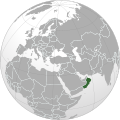
Guardafui Channel
-
 Description of first image
 -
Description of second image (if needed)
-
Description of third image (if needed; don't request too many at once, though)

Article(s): en:Guardafui Channel
- Request
- If would like someone to shade the region from Cape Guardafui and Ras Hafun (the promontory) across the sea up to Socotra Island. I don't mind you using another image for a similar purpose.Hythurrbb (talk) 01:47, 19 January 2019 (UTC)
--Hythurrbb (talk) 01:47, 19 January 2019 (UTC)
- Graphist opinion(s)
![]() Request taken by Goran tek-en (talk) 16:45, 13 March 2019 (UTC)
Request taken by Goran tek-en (talk) 16:45, 13 March 2019 (UTC)
@Hythurrbb: Draft for you to check. Please ping me, thanks. --Goran tek-en (talk) 18:33, 13 March 2019 (UTC)
- @Goran tek-en: This is Hythurrbb - I forgot my password. To the south the shading is fine. To the north, I should have said a dozen miles north of Alula (Caluula), sorry. Could you please shade it a bit further north, just offshore of Alula (about a tenth the distance to the Arabian Peninsula). Once that's done, go ahead and upload. Thanks. Sidhigarraft (talk) 04:24, 19 March 2019 (UTC)
- @Sidhigarraft: Draft-1 to check. --Goran tek-en (talk) 15:55, 19 March 2019 (UTC)
- @Goran tek-en: That looks great! Thanks so much. Sidhigarraft (talk) 16:27, 19 March 2019 (UTC)
- @Sidhigarraft: I will need the following;
- Name of the file
- Description
- Category/ies at commons
- to be able to upload it at commons. --Goran tek-en (talk) 17:58, 19 March 2019 (UTC)
- @Sidhigarraft: I will need the following;
- @Goran tek-en: That looks great! Thanks so much. Sidhigarraft (talk) 16:27, 19 March 2019 (UTC)
- @Sidhigarraft: Draft-1 to check. --Goran tek-en (talk) 15:55, 19 March 2019 (UTC)
@Goran tek-en: Okay. name of file is "Guardafui Channel map". Description = "Area of the Guardafui Channel". Category = this one. Sidhigarraft (talk) 19:48, 19 March 2019 (UTC)
- @Sidhigarraft: Now you can find it here file:Guardafui Channel map.svg. If you are happy with this please put the code
{{section resolved|1=~~~~}}on this request so it can be archived, thanks. Done --Goran tek-en (talk) 14:54, 20 March 2019 (UTC)
- This section was archived on a request by: Sidhigarraft (talk) 18:59, 20 March 2019 (UTC)
Czechia + Slovakia location map (Central Europe closer look)
-
 Location map

Article(s): w:cs:Šablona:LocMap Česko a Slovensko and many articles about sports, music, etc. events
- Request
- Hello, these two countries (Czech Republic, Slovakia) were separated a while ago, but both countries cooperate on many events, for example many sports or music events take place partly in Czech Republic and partly in Slovakia. For articles about these topics, Czechia or Slovakia location map is too close and location points are out of the map. On the other hand the Central Europe location map.svg is too distant and location points are too close to each other. There are many historic maps of Czechoslovakia, but the borderlines are outdated on these maps and also many are missing the borderline between Czechia and Slovakia obviously, so we can not really use them. I miss a closer look of this Central Europe region on the Czech Wikipedia. Could you please create one? --Dvorapa (talk) 10:23, 6 March 2019 (UTC)
- Ping: @NordNordWest, Lencer, Vojtěch Veselý, Mareklug, Matissek, and Topas~commonswiki: --Dvorapa (talk) 10:40, 6 March 2019 (UTC)
- Graphist opinion(s)
- Here it is. NNW 18:10, 6 March 2019 (UTC)
![]() Done
Done
- Thank you! --Dvorapa (talk) 09:43, 7 March 2019 (UTC)
@Dvorapa: If you are happy with this please put the code {{section resolved|1=~~~~}} on this request so it can be archived, thanks. --Goran tek-en (talk) 17:48, 26 April 2019 (UTC)
- Sorry, totally happy with this! :This section was archived on a request by: Dvorapa (talk) 20:43, 26 April 2019 (UTC)
Legality of polygamy
– when finished to trigger automatic archiving

Article(s): en:Legality of polygamy
- Request
- please change to shades with higher contrast for better visibility… --Kintetsubuffalo (talk) 05:59, 12 June 2019 (UTC)
- Graphist opinion(s)
- Done –LaundryPizza03 (dc̄) 05:37, 16 July 2019 (UTC)
- Thank you!Kintetsubuffalo (talk) 08:43, 4 August 2019 (UTC)
Arabic version of File:Titanic voyage map.png
-
 Route of Titanic's first/last maiden voyage, 10-15 April 1912
Article(s): غرق آر إم إس تيتانيك
- Request
- can you please create an Arabic version of this file, translation is as follows:
- Queenstwon = كوينزتاون
- Southampton = ساوثهامپتون
- Cherbourg = شيربورغ
- New York = نيويورك
- 11 April = 11 نيسان (أبريل)
- 10 April = 10 نيسان (أبريل)
- 15 April = 15 نيسان (أبريل)
- in the coordinates use شمالًا for N and غربًا for w
thank you --باسم (talk) 15:22, 16 June 2019 (UTC)
- Graphist opinion(s)
![]() DoneHow’s this? - Tim D. Williamson yak-yak 11:45, 5 July 2019 (UTC)
DoneHow’s this? - Tim D. Williamson yak-yak 11:45, 5 July 2019 (UTC)
- @Timdwilliamson: its great, thank youباسم (talk) 17:25, 6 July 2019 (UTC)
- @باسم: Thank you for providing the Arabic text so I could copy/paste. Made it super easy. - Tim D. Williamson yak-yak
- @باسم: I also did a version that looks antique, to match the photos and illustrations of the time. I may play around with it, and add a border. Pick whichever one you think looks best on the article. - Tim D. Williamson yak-yak
- @باسم: Thank you for providing the Arabic text so I could copy/paste. Made it super easy. - Tim D. Williamson yak-yak
@Timdwilliamson: thank you it looks really great. I would personally keep the 1st one just to add some colour to the paragraph, but i'll ask the main user who developed its article and let him decide. Bestباسم (talk) 09:43, 8 July 2019 (UTC)
- @باسم: Sounds great. I’m happy either way. I just like messing around with maps, and I’m kind of an insomniac. - Tim D. Williamson yak-yak
International trips made by Donald Trump
-
 Countries visited by Donald Trump

Article(s): en:List of international presidential trips made by Donald Trump
- Request
- Trump visited Poland in July 2017. However, this map doesn't show Poland as having been visited at all by Trump. It should be shaded to show that Trump visited once so far. --1990'sguy (talk) 03:20, 3 July 2019 (UTC)
- Graphist opinion(s)
- @1990'sguy: Appears to be Done by Newfraferz87 --AntiCompositeNumber (talk) 21:13, 9 July 2019 (UTC)
- This section was archived on a request by: – BMacZero (🗩) 04:38, 9 August 2019 (UTC)
Locator map of Loveland, Ohio
-
 Locator map in Hamilton County

Article(s): en:Loveland, Ohio
- Request
- This image is misleading, because it only shows Loveland's location within Hamilton County. Loveland lies within three counties: Hamilton, Clermont, and Warren. Loveland does hang off the side of this Hamilton County map, but you can't tell that there are three counties involved. This situation affects many municipalities, but most are primarily in a single county. A majority of Loveland's land may be in Hamilton County, but the downtown and city hall are in Clermont County. Accommodating all three counties may be challenging. For the purpose of the infobox that it's currently embedded in, perhaps the three counties could be laid out vertically. – Minh Nguyễn 💬 06:04, 19 February 2019 (UTC)
- Graphist opinion(s)
Harriet Tubman key locations
-
 Old low-res jpeg map
 -
 Blank SVG map to use as base
 -
 New map


Article(s): Harriet Tubman
- Request
- Recreate as SVG
- The Harriet Tubman article on English Wikipedia will soon be featured on the main page. It's in good shape, except for this old map that was created back in 2007 and looks terrible by current standards. Please recreate the map as an SVG. You can use a crop of the blank SVG map above as a start. Kaldari (talk) 19:31, 20 August 2019 (UTC)
- Graphist opinion(s)
Did it myself. Kaldari (talk) 23:06, 25 August 2019 (UTC)
List of countries by number of Internet users
-
 A world map colored to show the number of Internet users in a country - 2012

Article(s): en:List of countries by number of Internet users, and the Wikimedia Foundation's annual report if this is done somewhat quickly
- Request
- Hello! I'm wondering if someone here could update the above map to the most recent data from the International Telecommunications Union, which you can find here (spreadsheet link via this webpage). I also wonder if using two different colors is the right approach... Thank you!
- --Ed Erhart (WMF) (talk) 21:57, 4 March 2019 (UTC)
- Graphist opinion(s)
svg
-
 Description of first image
 -


Article(s): en:Genpei War
- Request
- please convert this .png to .svg. I want to translate map's information.
- Details of your request go here… --MOSIOR (talk) 13:28, 13 March 2019 (UTC)
- Graphist opinion(s)
 Request taken by AntiCompositeNumber (talk) 13:51, 25 March 2019 (UTC)
I guess this is completed.
Gallia Cisalpina


Article(s): en:Gallia Cisalpina
- Request
- English version please… Celtes Celts
Salasses Salassi Taurins Taurini Ligures Ligures Lépontiens Lepontii Insubres Insubres Camunes Camunni Rhètes Raeti Vénètes Veneti Cénomans Cenomani Lingons Lingones Boïens Boii Étrusques Etruscans Carnes Carni Sénons Senones Picéniens Picentes--Kintetsubuffalo (talk) 03:07, 1 June 2019 (UTC)
- Graphist opinion(s)
![]() Done - Nancystodd (talk) 23:24, 17 July 2019 (UTC)
Done - Nancystodd (talk) 23:24, 17 July 2019 (UTC)
I guess this is completed.
Proportional voting systems
-
 A geographic representation of the types of proportional voting systems used around the world at national level.
Article(s): ar:نظام انتخابي
- Request
- Please translate the legend into Arabic as follow:
- التمثيل النسبي لقائمة الأحزاب
- تصويت موازي
- التمثيل النسبي المختلط
- الصوت الواحد القابل للتحويل
Thank you in advance ![]() .
--Aladdin (talk) 12:24, 18 July 2019 (UTC)
.
--Aladdin (talk) 12:24, 18 July 2019 (UTC)
- Graphist opinion(s)
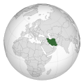
Members of Organisation of Islamic Cooperation
-
 Map of OIC Member States

Article(s): Organisation of Islamic Cooperation
- Request
- Change the colour coding for Northern Cyprus.
- The map of the OIC countries has Northern Cyprus colour coded as as a member state rather than an observer state. Can Northern Cyprus' colour be changed from green to blue on the map, to reflect their actual status within the OIC? The sources for this change are already self contained within wikipedia; in the article and in the observer state section of the member states page for the OIC, however, the OIC website's members listing is here as an external reference. Maranello10 (talk) 18:11, 25 August 2019 (UTC)
- Graphist opinion(s)
![]() Request taken by Amitchell125 (talk) 01:33, 3 October 2019 (UTC)
Request taken by Amitchell125 (talk) 01:33, 3 October 2019 (UTC)
![]() Done
Done
Iran historical map
-
 historical map (1952) in jpg
 -
 historical map (1921) in jpg
 -
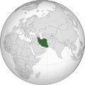 current map that reflect Iran current border


.svg)
Article(s): en:Pahlavi dynasty
- Request
- Someone at en:Talk:Pahlavi dynasty to request to change the SVG map in the infobox of the article to jpg, and they may be right, as the current map that shown Russia instead of USSR, it not historically accurate for the article which was for Iran in the period of 1925 to 1979. For example, we have SVG historical map of en:Weimar Republic, which show the historical border of Germany as well as the historial border of nearby countries. --Matthew hk (talk) 13:34, 24 March 2019 (UTC)
- Graphist opinion(s)
@Matthew hk: Why it should be changed to a jpg I don't understand. Svg is so much easier to edit and better in many more ways and there is always png versions created on a svg file. So if you want the globe image to be accurate of that time you would have to provide sources on which/how to change borders, thanks. --Goran tek-en (talk) 18:08, 8 April 2019 (UTC)
- @Goran tek-en: , it was due to an ip user keep on changing map on a lots of article. Some of the reasoning seem right, for example for "Pahlavi dynasty". But yes, i did not have source, just have the two jpg files. The ip did not even provide any other source to allow other people to follow up. Just common sense at that time was Soviet Union instead of Russia, is not enough. Matthew hk (talk) 18:17, 8 April 2019 (UTC)
- @Matthew hk: I still don't understand, I'm a graphic worker and I know nothing of your subject. Please just tell me what you want changed, only the information I need for that. Which borders to change and a source for that border, preferably a map. I do graphic work not research or things like that, thanks for your understanding. --Goran tek-en (talk) 08:51, 9 April 2019 (UTC)
- Can convert either one jpg to svg? Again, it is not my request actually, An ip got a rampage on changing so many svg map to jpg despite sometimes his jpg proposal are more correct. Matthew hk (talk) 15:29, 9 April 2019 (UTC)
- @Matthew hk: Please always ping me. I need sources on what to change, in any format. You are the requester here but if you don't want this just let me know. --Goran tek-en (talk) 17:46, 9 April 2019 (UTC)
Greater Beirut svg map
-
 SVG map of Beirut (I would like something similar)

Article(s): en:2019–20 Lebanese Football League
- Request
- Hi, would anyone be kind enough to create a map of en:Greater Beirut in the same style of this map on Beirut? I'm asking here because I'm not able to do so myself. The coordinates on OSM should be N: 33.9838, S: 33.7860, E: 35.6802, W: 35.4220. Thanks for your help, Nehme1499 (talk) 11:17, 21 April 2019 (UTC)
- Graphist opinion(s)
Municipalities of Mexico.svg
-
 Municipalities of Mexico

Article(s): Municipios de México
- Request
- Hello, this is a map of Mexico's municipalities (updated to 2015), but I would like to have it fixed. That the municipal boundaries are black lines. In a way, it looks like this map. Also this map is too heavy to edit in Inkscape, is there a way to decrease the weight? or should it be re-done again? I ask because this does not happen with the other map I linked in the example.
- As a clarification, this map would also be used to "color" it by adding the municipalities won by political parties, etc. --Hispano76 (talk) 19:51, 23 April 2019 (UTC)
- Graphist opinion(s)
Federal electoral districts of Mexico
Article(s): es:Distritos electorales federales de México
- Request
- Hello, I would like to create a map of Mexico's federal electoral districts. There are two websites that may be useful or based on the state maps listed in the article es:Distritos electorales federales de México To clarify, I want to be able to "color" the districts just like this map. --Hispano76 (talk) 23:35, 23 April 2019 (UTC)
- Graphist opinion(s)
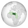
Africa in 1930

Article(s): en:Africa
- Request
- Botswana should be pink for British, not independent… --Kintetsubuffalo (talk) 07:00, 24 April 2019 (UTC)
- Graphist opinion(s)
File:1832 Electoral Map.png
-
 1832 Electoral map

Article(s):
- Request
- There are multiple errors with this image. First it shows William Wirt, who got 7.78%, of the vote with 20% of the vote and with 255,000 when he only got 100,715. Next it shows Henry Clay with only 329,000 votes when he got 484,205. Andrew Jackson is shown with 707,000 votes when he only got 701,780. It also shows the total popular vote at 1,291,000 when it was 1,293,973. --Jon698 (talk) 04:34, 6 October 2019 (UTC)
- Graphist opinion(s)
This user "Jon698" and its account has been blocked indefinitely so I will not work on it although the information might be correct any way, I always want someone with subject knowledge to be able to check the edit. As a result of this I will mark this as resolved but if someone else wants to work on it, just remove that.
English-language version of Vindobona map
-
 German-language version

Article(s): en:Vindobona
- Request
- Please create an English-language version of this map to to be used in the English Wikipedia in place of the German-language version.
- Details of your request go here…: The English labels have been provided by the Reference Desk; here they are:--70.67.193.176 20:29, 4 October 2019 (UTC)
Header: Vindabona ~ 250 n. Chr. --> Vindabona ca. 250 A.D.
River names: Donau --> Danube. Wienfluss --> can remain the same. Ottakringer Bach --> can remain the same.
Street names: can remain the same
Important locations (purple dots): can remain the same
Current buildings (red squares): Universität --> University. Rathaus --> City Hall. Parlament --> Parliament. Stephansdom --> St. Stephen's Cathedral.
Cemeteries (gray blobs): can remain the same
Legend: Kaserne --> Barracks. Stabsgebäude --> Staff building. Kommandeursgebäude --> Commandant's building. Tribunenhäuser --> Tribunes' quarters . Lagerbad --> Baths. Vorratsspeicher --> Storehouse. Lazarett --> Hospital. Gräberfelder --> Cemeteries. wichtige Fundpunkte --> Major discovery locations. aktuelle Straßenführung --> Current street routing . aktuelle Bauwerke --> Current buildings . Höhe ab Donauspiegel (10. jh) --> Elevation above Danube in 10th century.
![]() Done New version uploaded.
Done New version uploaded.
- Graphist opinion(s)
![]() Request taken by Goran tek-en (talk) 18:53, 29 October 2019 (UTC)
Request taken by Goran tek-en (talk) 18:53, 29 October 2019 (UTC)
Battle of Cape Econmus
-
Description of first image
-
Description of second image (if needed)
-
Description of third image (if needed; don't request too many at once, though)
Article(s): En:Battle of Cape Econmus
- Request
- A replacement set of maps showing the three stages of the Battle of Ecnomus
- The English Wikipedia article Battle of Cape Econmus (https://en.wikipedia.org/wiki/Battle_of_Cape_Ecnomus) has a map - (https://commons.wikimedia.org/wiki/File:CapeEcnomus.png). Unfortunately it is inaccurate in a couple of small but important details. A have recently successfully nominated the article for GA, it is currently undergoing an ACR, and I hope to shortly submit it for FAC; for this the map need to be correct. There are a number of similar maps, e.g. here (an Internet Archive resource, free registration needed). But perhaps the best maps to base any new ones on are here - apart from the lack of a key and the barely distinguishable colours. This is my first map request, so apologies for anything missed. Gog the Mild (talk) 17:23, 25 February 2019 (UTC)
- Graphist opinion(s)
@Gog the Mild: I could help you but there are some things I don't understand. I have no knowledge of this subject, the link for the article is wrong in some way, you use some abbreviations and I don't understand them, I'm a graphic worker not an editor. You have two links to sources but the one to google books I don't know how to get to page 89, in the livius link there are several images so I don't know which. Please just get me a link to the images directly and what ever text information I need. Please ping me, thanks. --Goran tek-en (talk) 18:13, 1 March 2019 (UTC)
--Goran tek-en (talk) 17:49, 26 April 2019 (UTC)
![]() Request taken by Amitchell125 (talk) 08:19, 3 October 2019 (UTC)
Request taken by Amitchell125 (talk) 08:19, 3 October 2019 (UTC)
![]() Done
Done
Age of consent Vatican City
-
 This map shows legal age of consent for heterosexual sex in various countries.
 -
 Map showing the age of consent in European countries. Legend is below.


Article(s):File:Age_of_Consent_-_Global.svg#globalusageen:Age of consent in Europe
- Request
- The age of consent of Vatican City is misleading. The age of consent to marry not heterosexual sex is 14 and 16 for females and males, respectively otherwise fornication is punishable by law.
- Details: Change from green to pink. Vatican City is pink for “must be married”Manabimasu (talk) 02:31, 14 June 2019 (UTC)
- Graphist opinion(s)
Myanmar

Article(s): en:Myanmar
- Request
- choose a shade other than white for the Chinese strip which is not part of Myanmar… --Kintetsubuffalo (talk) 04:55, 11 September 2019 (UTC)
- Graphist opinion(s)
@Kintetsubuffalo: I can't see any "white" in this and I don't know what "Chinese strip which is not part of Myanmar" is, please ping and explain, thanks. --Goran tek-en (talk) 10:57, 8 December 2019 (UTC)
- Sorry for being unclear, there's a horizontal stretch of (disputed) area in the upper left, which could be India or China, on this monitor it shows up pale grey, other monitors it shows up white-it needs a better color to show up properly. Thanks! Kintetsubuffalo (talk) 19:58, 8 December 2019 (UTC)
- @Kintetsubuffalo: Like this? --Goran tek-en ([[User talk:Goran tek-en|
- Yes, that's much better, thank you! Kintetsubuffalo (talk) 04:26, 10 December 2019 (UTC)
talk]]) 14:02, 9 December 2019 (UTC)
![]() Request taken by Goran tek-en (talk) 17:39, 10 December 2019 (UTC)
Request taken by Goran tek-en (talk) 17:39, 10 December 2019 (UTC)
- @Kintetsubuffalo: New version uploaded. If you are happy with this please put the code
{{section resolved|1=~~~~}}on this request so it can be archived, thanks. Done --Goran tek-en (talk) 17:39, 10 December 2019 (UTC)
- @Kintetsubuffalo: New version uploaded. If you are happy with this please put the code
- Thanks again! Kintetsubuffalo (talk) 03:42, 12 December 2019 (UTC)
Change location of Eastern Diocese of the Serbian Orthodox Church
-
 English
 -
 Serbian


Article(s): en:Serbian Orthodox Eparchy of Eastern America
- Request
- The headquarters of the Eastern Eparchy changed to New Rochelle, New York (it had previously moved to New Jersey, but it moved again), so the image needs to be altered accordingly.
Also I am aware User:Vanjagenije no longer has the editing software (this is why I'm using the graphics lab), but the Serbian name of New Rochelle may be needed for the edit of the Serbian version. @Vanjagenije: @Ivan25: (also see Germany request below) --WhisperToMe (talk) 15:58, 4 June 2019 (UTC)
- Graphist opinion(s)
![]() Done - Nancystodd (talk) 06:53, 18 July 2019 (UTC)
Done - Nancystodd (talk) 06:53, 18 July 2019 (UTC)
Change the location of the German diocese of the Serbian Orthodox church
-
 English
 -
 Serbian
 -
 French


Article(s): en:Serbian Orthodox Eparchy of Eastern America
- Request
- The headquarters of the Central Europe eparchy changed to Dusseldorf, Germany and the name of the diocese changed to Dusseldorf and all of Germany.
Also I am aware User:Vanjagenije no longer has the editing software (this is why I'm using the graphics lab), but the Serbian name of New Rochelle may be needed for the edit of the Serbian version.
At a later point I may try to see if French and German versions could be made of the new one.
French:
- Britain and Scandinavia: Bretagne et Scandinavie
- Western Europe: Europe occidentale
- Seat of Eparchy: Siège de l'éparchie
- Austria and Switzerland: Autriche et Suisse
- Legend: Légende
--WhisperToMe (talk) 16:08, 4 June 2019 (UTC)
- Graphist opinion(s)
![]() Done - Also updated the French version. Nancystodd (
talk) 22:01, 22 July 2019 (UTC)
Done - Also updated the French version. Nancystodd (
talk) 22:01, 22 July 2019 (UTC)

Article(s): Articles related to en:Ming treasure voyages
- Request
- There's a background positioning error. Thank you. --Cold Season (talk) 14:36, 6 September 2019 (UTC)
- Graphist opinion(s)
@Cold Season: That is not enough information. We, the graphic workers have no knowledge of your favorite subject. Tell us exactly what is wrong and how it should be to be correct, thanks. --Goran tek-en (talk) 18:18, 20 September 2019 (UTC)
![]() Done The file just had one of the layers slightly out of place. I centered the background on the image. It should look better now.
Done The file just had one of the layers slightly out of place. I centered the background on the image. It should look better now.
--Nancystodd (talk) 02:00, 1 October 2019 (UTC)
Map cleanup
![]() Done
Done
-
 Map of "Chera" kingdom in early historic south India

Article(s):en:Chera_dynasty
- Request
- Blur boundaries - of darkish grey area (we are not sure about them)
- Remove the darkish grey from the area marked as "Ezhil Malai" (we are not sure about that)
--Rajesh of Raigad (talk) 04:55, 30 March 2019 (UTC)
- Graphist opinion(s)
![]() Request taken by - Tim D. Williamson yak-yak 11:23, 8 July 2019 (UTC)
I should have something for you by tonight.
Request taken by - Tim D. Williamson yak-yak 11:23, 8 July 2019 (UTC)
I should have something for you by tonight.
- @Rajesh of Raigad: How about this? - Tim D. Williamson yak-yak
-
 Approximate representation of the extent of Chera Kingdom
.jpg)
Phoenix Grand Prix two routes
-
 Bad render at 180px and 200px. Good render at 120px. This can be observed on different zoom levels in browsers which support HTML attribute srcset.
 -
 Good render at all sizes.


Article(s): wikipedia:en:United States Grand Prix#Previous circuits used
- Request
The two SVG files differ in two ways:
- PNG renders of first image at some scales do not include the main subject of the image—the route of the race circuit.
- If you look closely, second image has finish line marking and "Ave S 7th" (jumbled) street name above the race circuit. First image covers both these elements with the route SVG path.
Could someone please fix the rendering of the route on the first image? I don't know what's the correct way (i.e. wording and positioting) to fix the jumbled "Ave S 7th" mark or marks. —andrybak (talk) 23:08, 28 July 2019 (UTC)
- Graphist opinion(s)
British Hong Kong Map
-
 Map of British Hong Kong
.svg)
Article(s): British Hong Kong
- Request
- Please can the map have some additional place names that were used during the time it was a British Colony adding to it as currently it has very few place names. It does not even show the actual Metropolitan areas (although this must be kept to the areas it was as a British Colony). Also can the map be renamed as Hong Kong Map 1898-1997. (2A02:C7F:5622:2000:3CC2:FA50:39B2:1ACE 11:38, 1 August 2019 (UTC))
- Details of your request go here… --2A02:C7F:5622:2000:3CC2:FA50:39B2:1ACE 11:38, 1 August 2019 (UTC)
- Graphist opinion(s)
World homeschooling map
-
 Description of first image

Article(s): en:Homeschooling in the United States
- Request
- The U.S. should be colored green on this map, as homeschooling is legal in all 50 states. What is disputed is not the legality of homeschooling, but the "amount of state regulation and help that can or should be expected", according to the article en:Homeschooling in the United States. --1990'sguy (talk) 03:45, 2 July 2019 (UTC)
- Also, the two parts of India should be conjoined. Kintetsubuffalo (talk) 18:34, 7 July 2019 (UTC)
- The border of South Sudan needs to be drawn as well. Maphobbyist (talk) 19:19, 6 August 2019 (UTC)
- Also, the two parts of India should be conjoined. Kintetsubuffalo (talk) 18:34, 7 July 2019 (UTC)
- Graphist opinion(s)
Maps of Fujian
Article(s): Zhangzhou; Quanzhou; Putian; Fuzhou
- Request
- In the File:Shannan mcp.png map and File:Nyingchi mcp.png map, we can clearly see what areas are claimed by the People's Republic of China. Those files are used on English Wikipedia's en:Shannan, Tibet and en:Nyingchi pages. That's an ethical and a fair way to represent a dispute/claim. There are four maps of the territories of the People's Republic of China that don't show this kind of 'claimed' or 'disputed' status, namely File:Administrative Division Zhangzhou prfc map.png, File:Administrative Division Putian prfc map.png, File:Administrative Division Fuzhou prfc map.png, and File:Administrative Division Quanzhou 3.png. I would like to request that some new but similar maps be created that would indicate more clearly what areas are in the Republic of China (Taiwan). The original maps should be used in the Wikiworld for the purpose of understanding the claims made by the PRC, but the new maps I propose would be used for displaying the situation as it is. I am not skilled enough to make these maps well. I think using something like the methodology used on the maps for Shannan and Nyingchi would work great. I recently encountered a similar type of problem on the File:Taiwan relief location map.jpg page. Thanks for any help or suggestions. (Original request was here:[3])
- --Geographyinitiative (talk) 01:33, 21 August 2019 (UTC)
- Graphist opinion(s)
FBS Independent Schools Map

Article(s): en:NCAA Division I FBS independent schools
- Request
- Need to modify the map to include Connecticut, the University of Connecticut has joined.:
- Graphist opinion(s)
![]() Done Nancystodd (talk) 16:45, 16 December 2019 (UTC)
Done Nancystodd (talk) 16:45, 16 December 2019 (UTC)
- This section was archived on a request by: Minoraxtalk (formerly 大诺史) 06:50, 14 March 2020 (UTC)
Location Map of United States Including Alaska and Hawaii
-
 Location map of United States
 -
 Location map of Alaska
 -
 Location map of Hawaii


Article(s): Multiple
- Request
- A location map of the United States that includes both Alaska and Hawaii as inset boxes in the lower left corner. I searched the location map templates and, as far as I can tell, it doesn't exist. I don't know if this is possible given that there would be a large jump in coordinates to allow for the inset boxes. –Noha307 (talk) 02:07, 16 September 2019 (UTC)
- Graphist opinion(s)
- Both File:Usa edcp (+HI +AK) location map.svg and File:Usa edcp (+HI +AK +PR) location map.svg should work with the Location map template, note for the insets you can't use real coordinates though, you have to fake it to get points to show up in the right place, an example of use is in en:List of presidents of the United States by home state. Kmusser (talk) 17:43, 23 September 2019 (UTC)
Adding contemporary coastlines to map of Kingdom of Northumbria
-
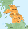 Map of the Kingdom of Northumbria, around 700 AD
 -
 Map of England (and Scotland to the Lowland belt)


Article(s): en:Kingdom of Northumbria
- Update SVG to show contemporary coastline
- Some of the maps of Anglo-Saxon (and Norse) England show coastlines based on David Hill's An Atlas of Anglo-Saxon England, as in File:England green top.svg, with Yorkshire and Lincolnshire in particular shown as being mainly "sea, swap or alluvium". Given there was so much territory to the south of Northumbria, it would be good to see that reflected in the map File:Map of the Kingdom of Northumbria around 700 AD.svg — OwenBlacker (talk; please ping me in replies) 20:52, 20 October 2019 (UTC)
- Graphist opinion(s)
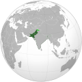
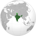
Standardized SVG blank map of Indian states
-
 PNG version (outdated)

Article(s): None, but will likely be used to make many derivative maps
- Request
- Create a standardized blank map of Indian states and territories, like this one for the United States. Above is the closest PNG analog, but it is out of date. –LaundryPizza03 (dc̄) 05:02, 16 July 2019 (UTC)
- Graphist opinion(s)
@LaundryPizza03: If you want help with this please give us valid sources that we can use. We are graphic workers, not researchers etc, thanks. --Goran tek-en (talk) 17:52, 4 August 2019 (UTC)
- [4]? –LaundryPizza03 (dc̄) 18:36, 31 August 2019 (UTC)
- @LaundryPizza03: That link is no good as I can't run Internet explorer 6 or above, I'm on a Linux computer, so please provide something else, thanks. --Goran tek-en (talk) 18:32, 20 September 2019 (UTC)
@LaundryPizza03: I found this map. It it usable as it is? But if needed, I can make a lighter version of it to match the colours of the .png map above. --Garabond (talk) 12:20, 17 November 2019 (UTC)
Plastic bag legislation
-
 Plastic bag legislation around the world

Article(s): en:Phase-out of lightweight plastic bags
- Request
- Please could someone remove the subnational boundaries on Pakistan? The whole country now has bans in place so the subnational boundaries are no longer required. Thanks--DelUsion23 (talk) 07:42, 8 August 2019 (UTC)
- Graphist opinion(s)
![]() Request taken by Garabond (talk) 18:38, 18 November 2019 (UTC)
Request taken by Garabond (talk) 18:38, 18 November 2019 (UTC)
Plastic bag legislation
-
Plastic bag legislation around the world
Article(s): en:Phase-out of lightweight plastic bags
- Request
- Please could someone remove the subnational boundaries on Pakistan? The whole country now has bans in place so the subnational boundaries are no longer required. Thanks--DelUsion23 (talk) 07:42, 8 August 2019 (UTC)
- Graphist opinion(s)
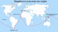
-
 Magellan's voyage AZ.svg
 -
 Magellan's voyage EN it.svg
 -
 Magellan's voyage EN.svg
 -
 Magellan's voyage ET.svg
 -
 Magellan's voyage HE.png
 -
 Magellan's Voyage HR.PNG
 -
 Magellan's voyage HU.svg
 -
 Magellan's voyage HY.svg
 -
 Magellan's voyage MK.svg
 -
 Magellan's voyage PL.svg
 -
 Magellan's voyage PT.svg
 -
 Magellan's voyage SR.svg
 -
 Magellan's voyage zh-classical.svg
 -
 Magellan's voyage-fr.svg
 -
 Itinerario de Magallanes y Elcano.jpg
 -
 Magellan-Harita-Tr.jpg
 -
 Magellan-Map-En.png
 -
 Magellan-Map-No.png


- Article(s)
- Many articles across Wikipedia.
- Request
- The modern borders need to be removed from the circumnavigation maps of Magellan and Elcano. They are anachronistic. --Maphobbyist (talk) 17:58, 6 August 2019 (UTC)
- Graphist opinion(s)
@Maphobbyist: Would simply removing the borders altogether suffice, or should the borders be redrawn in some fashion? (in which case I would need sources) --Garabond (talk) 18:33, 18 November 2019 (UTC)
- The borders should be totally removed. Maphobbyist (talk) 16:33, 26 November 2019 (UTC)
2019 Maharashtra Legislative Assembly election
-
 Base map with constituency numbers

Article(s): en:2019 Maharashtra Legislative Assembly election
- Request
- Request to edit the base map as per the results and create the file File:2019 Maharashtra Legislative Assembly election results by constituency.svg. Winner parties are listed at en:2019 Maharashtra Legislative Assembly election in section "#Results by constituency". Not all shades are needed to be filled as there are 16 parties. I think only 4 major parties as below can be filled and all others can be clubbed in grey colour as "Others". --§§Dharmadhyaksha§§ {Talk / Edits} 13:18, 5 November 2019 (UTC)
| Colour | Party |
|---|---|
| Bharatiya Janata Party | |
| Indian National Congress | |
| Nationalist Congress Party | |
| Shiv Sena | |
| Others |
- Graphist opinion(s)
-
Description of first image
-
Description of second image (if needed)
-
Description of third image (if needed; don't request too many at once, though)
Article(s): [[]]
- Request
- Details of your request go here… --JoshuaLatusia (talk) 19:32, 29 November 2019 (UTC)
- Graphist opinion(s)
Ottawa rapid-transit map needs multiple edits - File:Oc-transpo-rapid-transit-567O.svg
-
 Ottawa rapid-transit system map
 -
 new map


Article(s): Wikivoyage: Ottawa
- Request
- With Ottawa finally getting a subway/LRT system in September 2019, the Ottawa rapid-transit system map File:Oc-transpo-rapid-transit-567O.svg is both out-of-date and misleading. I don't have SVG editing software. The list of changes that need to be made is on the file's Discussion page. Could somebody with an SVG editor please make them? --Robkelk (talk) 17:02, 2 September 2019 (UTC)
- Graphist opinion(s)
- I thought it is better to create a comlete new map. --Chumwa (talk) 16:03, 6 September 2019 (UTC)
- @Robkelk: The tool is out there, Inkscape and it's free and open source, but it takes some practice. You didn't link to any information, you have to. We do graphic work, not research or gathering information, that is up to you as it's your subject, we have zero knowledge. So link to all of the nedded information and then we will see, thanks for your understanding. --Goran tek-en (talk) 18:23, 20 September 2019 (UTC)
--Goran tek-en (talk) 10:59, 8 December 2019 (UTC)
Nazi Germany 1942
-
 Germany in 1937, but 1942 seems not available yet.
 -

-
-


Article(s): nl:Auschwitz (concentratiekamp) among others
- Request
- Hello, I would like to make a module like en:Module:Location map/data/Germany 1937 for the Germany of 1942 (including border coordinates), but I couldn't find a file suitable for that. Someone able to help me out?
- Borders can be found in this source. --Encycloon (talk) 15:29, 12 December 2019 (UTC)
- Graphist opinion(s)
@Encycloon: There are a variety of maps available already. It depends on what kind of map you are looking for. I have added some to the gallery for you to look at, but others are in Category:Maps_of_Nazi_Germany, particularly Category:Locator_maps_of_Nazi_Germany and Category:Maps_of_Europe_under_Nazi_occupation. NikNaks talk - gallery - wikipedia 16:56, 18 December 2019 (UTC)
- Thanks, NikNaks, but I still can't find a map with Nazi Germany in one (neutral) colour and with coordinates available, as is the case with File:German Empire 1937 adm location map.svg. Encycloon (talk) 17:23, 18 December 2019 (UTC)
South Sudan borders need to be added in these orthographic maps
-
 Administered Western Sahara (orthographic projection).svg Done
 -
 Asia (orthographic projection).svg Done
 -
 Azerbaijan (orthographic projection).svg Done
 -
 Azerbaijan with Nagorno Karabakh region.svg Done
 -
 CPV orthographic NaturalEarth.svg Done
 -
 Customs Union of Belarus, Kazakhstan, and Russia (orthographic projection).svg Done
 -
 Eurasian Economic Union (orthographic projection).svg Done
 -
 Dominion of Pakistan & Indian Controlled Kashmir (orthographic projection).svg Done
 -
 Egypt (orthographic projection) highlighted.svg Done
 -
 EU27 on a globe.svg Done
 -
 European Union Morocco Locator (orthographic projection).svg Done
 -
 India (orthographic projection).svg Done
 -
 Iran Ecuador (orthographic projection).svg Done
 -
 Iran Lebanon (orthographic projection).svg Done
 -
 Latin Africa (orthographic projection).svg Done
 -
 Lebanon (orthographic projection).svg Done
 -
 Libya North Africa (orthographic projection).svg Done
 -
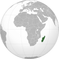 Madagascar (orthographic projection).svg Done
 -
 Mughal Empire (orthographic projection).svg Done
 -
 Nanyue.svg Done
 -
 North Asia (orthographic projection).svg Done
 -
 Oman (orthographic projection).svg Done
 -
 Pakistan & Indian Controlled Kashmir (orthographic projection).svg Done
 -
 Pakistan (orthographic projection) wd.svg Done
 -
 Pakistan (orthographic projection) with J. and Kashmir.svg Done
 -
 Pakistan (orthographic projection).svg Done
 -
 Pakistan orthographic projection.svg Done
 -
 People's Republic of China (orthographic projection).svg Done
 -
 Republic of China (orthographic projection, without Mongolia).svg Done
 -
 Republic of China (orthographic projection).svg Done
 -
 Russian Federation (orthographic projection) highlighted.svg Done
 -
 Russian Federation (orthographic projection) marked.svg Done
 -
 Serbia (orthographic projection).svg Done
 -
 Songhai Empire (orthographic projection).svg Done
 -
 Spain WS-included (orthographic projection).svg Done
 -
 Union State.svg Done
 -
 Western Sahara (orthographic projection).svg Done
 -
 Kashmir conflict disputed territory animation.png
 -
 Azerbaijan (orthographic projection).png
 -
 Russian Federation (orthographic projection).svg
I'm not allowed to update this file.
.svg)
.svg)
.svg)


.svg)
.svg)
.svg)
_highlighted.svg)

.svg)
.svg)
.svg)
.svg)
.svg)
.svg)
.svg)
.svg)
.svg)

.svg)
.svg)
.svg)
_wd.svg)
_with_J._and_Kashmir.svg)
.svg)

.svg)
.svg)
.svg)
_highlighted.svg)
_marked.svg)
.svg)
.svg)
.svg)

.svg)

.png)
.svg)
- Article(s)
- Many articles across Wikipedia.
- Request
- The borders of South Sudan need to be added in these orthographic maps. --Maphobbyist (talk) 17:28, 6 August 2019 (UTC)
@Maphobbyist: I have added the border to all the maps with ![]() Done. At the bottom there are two bitmap maps that I hope you can take. Also there is one which I was not allowed to upload a new version of. --Goran tek-en (talk) 16:14, 29 December 2019 (UTC)
Done. At the bottom there are two bitmap maps that I hope you can take. Also there is one which I was not allowed to upload a new version of. --Goran tek-en (talk) 16:14, 29 December 2019 (UTC)
- Graphist opinion(s)
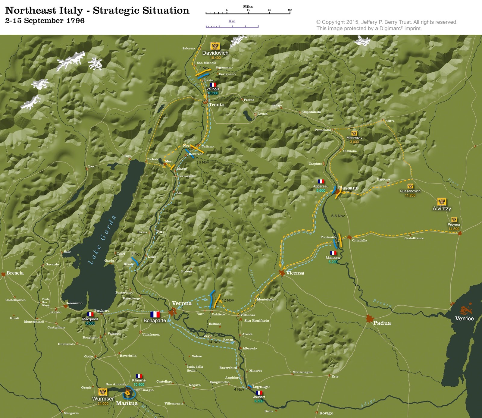
1796 Italian campaign maps
-
 Nap07.pdf
 -
 Siege of Mantua Campaign Map 1796 1797.JPG
 -
 Arcole 1796 Campaign Map.jpg


Article(s): en:Battle of Arcole, ru:Бой при Арколе
- Request
- I tried converting the PDF to SVG automatically, but the result was messy. There are also some things to be fixed here: Vaubois is spelled incorrectly; Davidovich corps (18k troops) present in Ala by the 12th is not shown; Massena's strength actually was around 9,500 while Augereau had 8,300 (his movement towards Brenta and back is also not shown); Joubert is incorrectly shown to leave Legnago completely (while a single demi-brigade was dispatched); presence of 28k troops in Mantua under Wurmser's command may also be depicted. --Qbli2mHd (talk) 17:52, 28 April 2019 (UTC)
- If an SVG is made, it can be changed slightly to substitute the other two images. --Qbli2mHd (talk) 18:03, 28 April 2019 (UTC)
- Graphist opinion(s)
@Qbli2mHd: I can help you with this but first I want to make sure that you will be available for information and feedback, so please ping me and answer here, thanks. --Goran tek-en (talk) 17:05, 27 October 2019 (UTC)
- @Goran tek-en: sure --Qbli2mHd (talk) 22:16, 29 October 2019 (UTC)
![]() Request taken by Goran tek-en (talk) 12:24, 30 October 2019 (UTC)
Request taken by Goran tek-en (talk) 12:24, 30 October 2019 (UTC)
| Extended content |
|---|
@Qbli2mHd: I'm sorry but this is really complicated for me without any knowledge of this so I have to take a step back so I can get the basics right, I hope that is OK with you. The draft here is for the northern part you explained and is so I can get things right.
|
- @Goran tek-en: I've only just noticed we got colours messed up. Let's have the French in blue and the Austrians in red.
- I also wonder if increasing the font size up 1 pt would increase readability.
- We can also show en:Battle of Caldiero (1796) (another victory for the Austrians on November 12).
- We should also show that there're Wurmser's 28k in Mantua besieged by Kilmaine's 8,300. --Qbli2mHd (talk) 04:41, 16 November 2019 (UTC)
- @Qbli2mHd: Draft 7.
- You wrote: We can also show en:Battle of Caldiero (1796) (another victory for the Austrians on November 12). You have to explain what you want in detail otherwise I don't know..
- What else do you want by Mantua?
- Of course I can increase the font size but do you mean all text?
- When I make a map I never know at which size it will be viewed and it probably varies. So I make it readable at 100% but do you know at which size you will use it because then I can make it for that size? --Goran tek-en (talk) 16:38, 17 November 2019 (UTC)
- @Qbli2mHd: I mark this as I need your feedback but don't hear from you. --Goran tek-en (talk) 14:56, 29 November 2019 (UTC)
 Stale
Stale
- You wrote: We can also show en:Battle of Caldiero (1796) (another victory for the Austrians on November 12). You have to explain what you want in detail otherwise I don't know..
- @Qbli2mHd: Draft 7.
@Qbli2mHd: Is it possible for you to help me finish this request? --Goran tek-en (talk) 15:36, 16 January 2020 (UTC)
1935
.png)
_location_map.svg)
_location_map.svg)
.svg)
Article(s): en:1935
- Request
- please correct Alaska flag to US as anachronism… --Kintetsubuffalo (talk) 05:08, 8 July 2019 (UTC)
- Graphist opinion(s)
- The current flag of Alaska was adopted in 1927, before the time period represented by this map. Whether it should instead use another copy of the United States flag is uncertain. (Alaska was a territory at this time and would be admitted as a state only in 1959.) –LaundryPizza03 (dc̄) 05:52, 16 July 2019 (UTC)
- It's not a country-other flags used are not subnational.Kintetsubuffalo (talk) 05:40, 5 August 2019 (UTC)
- I agree that Alaska should have the American flag -- Korea was a Japanese territory at the time, and this map correctly has the Japanese flag over Korea. --1990'sguy (talk) 15:14, 13 January 2020 (UTC)
- If Alaska's flag is to be changed, should those of pre-Commonwealth Puerto Rico, and the Commonwealth of the Philippines (established in 1935) be changed?—AlphaMikeOmega (talk) 15:17, 30 March 2020 (UTC)
- Similarly, Jamaica's flag is anachronistic.—AlphaMikeOmega (talk) 15:17, 30 March 2020 (UTC)
St. Wenceslas Prison (Prague)
Hi, I would like to ask you for a favor: could someone of you please make a map with the ground plan of Svatováclavská trestnice (St. Wenceslas Prison, the only prison in Prague till 1890s, when Pankrác prison was opened) - or - could you teach me how to do it? The scheme is to see in this video: https://www.ceskatelevize.cz/porady/10116288835-z-metropole/219411058230033/video/713917?fbclid=IwAR2bcl8fYG1I8LkmUk7EHlwh5p2lH0aUHKGjlvGzQ-xuPh5r09coLO4Tolk at 6:23. I promise to make a stub about the prison then in both cases. Thank you! --Jiří Janíček (talk) 17:15, 11 September 2019 (UTC)
- @Jiří Janíček: First it would be great and so much easier for every one if you would use the "Make a new request" link at the top, this gives us all the code we need.
- I might be able to help you but you will have to provide me with information/links/layouts/maps or whatever for the prison and tell me what kind of ground plan you want, how much details, what to include and so on, thanks. Please ping me. --Goran tek-en (talk) 18:15, 20 September 2019 (UTC)
- @Goran tek-en and Goran: , thank you very much and sorry for my delayed answer. Actually I don't know much what to say to you - more info is anyway here in Czech: https://cs.wikipedia.org/wiki/Wikipedie:Pod_l%C3%ADpou/Archiv_2019/02#Svatov%C3%A1clavsk%C3%A1_trestnice. I don't care and have no idea how it should look like, I personally think the scheme that is here:
https://www.ceskatelevize.cz/porady/10116288835-z-metropole/219411058230033/video/713917?fbclid=IwAR2bcl8fYG1I8LkmUk7EHlwh5p2lH0aUHKGjlvGzQ-xuPh5r09coLO4Tolk(at time 6:23) is ok, but some colleagu at the cs page recommended something else - a better map is here (but is so big that it's not working for me well): https://upload.wikimedia.org/wikipedia/commons/e/e3/Juttneruv_plan_Prahy.jpg. I hope you can implement the scheme from the video on the map we can use in Wikipedie, what is, I think, the OpenStreetMap? The region on the OpenStreetMap is in this area: https://www.openstreetmap.org/export#map=18/50.07498/14.41582 (Prague, Dittrichova Street). Is there anything else that you need? Can you do it somehow? Thank you! --Jiří Janíček (talk) 13:46, 8 November 2019 (UTC)
- @Goran tek-en and Goran: , thank you very much and sorry for my delayed answer. Actually I don't know much what to say to you - more info is anyway here in Czech: https://cs.wikipedia.org/wiki/Wikipedie:Pod_l%C3%ADpou/Archiv_2019/02#Svatov%C3%A1clavsk%C3%A1_trestnice. I don't care and have no idea how it should look like, I personally think the scheme that is here:
:::@Jiří Janíček: The videolink that is stroked thru is only 5.38 long so there is no 6.23. Maybe it's the wrong video? And why is the link stroked thru, I thought that meant it was broken...
For the big map, I don't know which area you mean. I have made a small version of it, can you encircle which area you mean and show it/send it to me. You have to provide me with something to see, thanks. Please ping me. --Goran tek-en (talk) 14:39, 8 November 2019 (UTC)
![]() Request taken by Goran tek-en (talk) 14:50, 8 November 2019 (UTC) I found the correct video on the cs page, forget what I wrote above.
Request taken by Goran tek-en (talk) 14:50, 8 November 2019 (UTC) I found the correct video on the cs page, forget what I wrote above.
- How big area do you want the overall map to cover?
- Should today's roads, buildings also be there or should that come from the big map? --Goran tek-en (talk) 14:50, 8 November 2019 (UTC)
- Oh, sorry, the right video is this one: https://www.ceskatelevize.cz/porady/10886931259-tajemstvi-prazskych-dvorku/215411033190003/?fbclid=IwAR2gIFuUpyvKY-C3eBwWCOr8YoMIlgOzIRf--H9E4NCe0xio_ymhoVBeVtw, time 6:23 is ok. More trough e-mail. Thank you! --Jiří Janíček (talk) 18:43, 13 November 2019 (UTC)
- @Jiří Janíček: It's really difficult to move information from a today map to the old one, and I'm still not really sure what you want.
- This is a draft for you so you can tell me if this is the right shape and if it's in the right position?
- This is a draft but is it something like this you want, with the whole of that image also?
- In the email you talk about a link to the picture of the former prison, which image?
- What can be done on wikipedia concerning overlays and stuff I have no knowledge, but I have seen overlays there. Talk to some other editors. --Goran tek-en (talk) 15:22, 14 November 2019 (UTC)
- @Jiří Janíček: I mark this as I need your feedback but don't hear from you. --Goran tek-en (talk) 15:00, 29 November 2019 (UTC) Stale
- This is a draft for you so you can tell me if this is the right shape and if it's in the right position?
- @Jiří Janíček: It's really difficult to move information from a today map to the old one, and I'm still not really sure what you want.
- Oh, sorry, the right video is this one: https://www.ceskatelevize.cz/porady/10886931259-tajemstvi-prazskych-dvorku/215411033190003/?fbclid=IwAR2gIFuUpyvKY-C3eBwWCOr8YoMIlgOzIRf--H9E4NCe0xio_ymhoVBeVtw, time 6:23 is ok. More trough e-mail. Thank you! --Jiří Janíček (talk) 18:43, 13 November 2019 (UTC)
Hi Goran, thank you very much, actually I see that I am not able to answer your questions and actually don't know what is possible to do. I asked a colleague from cs wiki Matej Orlicky, if he would be se nice and would answer your questions (https://cs.wikipedia.org/wiki/Diskuse_s_wikipedistou:Mat%C4%9Bj_Orlick%C3%BD#Svatov%C3%A1clavsk%C3%A1_trestnice). All I can say is that I in between founded two another maps that I am sending you through e-mail - and it seems the prison is not the building you marked in the draft - but probably the building no. 329 lower - I hope Matej will tell us more realiably). Thank you! --Jiří Janíček (talk) 16:17, 5 December 2019 (UTC)
- @Jiří Janíček: Please always ping me, thanks. I don't understand what you meant by this file Juttneruv plan - snad Svatovaclavska trestnice.jpg that you sent me?
- The other two you sent show the same area but the encircled shapes are different so now we have three different shapes with the one I show in the draft.
- I know where it was situated now but I don't know which of the three different shapes I should use, you have to tell me. --Goran tek-en (talk) 17:58, 5 December 2019 (UTC)
@Jiří Janíček: I haven't heard from you, should we finish this request or what? --Goran tek-en (talk) 15:41, 16 January 2020 (UTC)
- @Jiří Janíček: Can we finish this? --Goran tek-en (talk) 15:56, 16 April 2020 (UTC)
Nazi Germany 1942
-
Germany in 1937, but 1942 seems not available yet.
-
-
-
Article(s): nl:Auschwitz (concentratiekamp) among others
- Request
- Hello, I would like to make a module like en:Module:Location map/data/Germany 1937 for the Germany of 1942 (including border coordinates), but I couldn't find a file suitable for that. Someone able to help me out?
- Borders can be found in this source. --Encycloon (talk) 15:29, 12 December 2019 (UTC)
- Graphist opinion(s)
@Encycloon: There are a variety of maps available already. It depends on what kind of map you are looking for. I have added some to the gallery for you to look at, but others are in Category:Maps_of_Nazi_Germany, particularly Category:Locator_maps_of_Nazi_Germany and Category:Maps_of_Europe_under_Nazi_occupation. NikNaks talk - gallery - wikipedia 16:56, 18 December 2019 (UTC)
- Thanks, NikNaks, but I still can't find a map with Nazi Germany in one (neutral) colour and with coordinates available, as is the case with File:German Empire 1937 adm location map.svg. Encycloon (talk) 17:23, 18 December 2019 (UTC)
- Request still active. Encycloon (talk) 12:56, 25 June 2020 (UTC)
Encycloon If this map file:World War II in Europe, 1942.svg is correct in the content I can help you to create a version you need. Please always ping me, thanks. --Goran tek-en (talk) 18:31, 13 November 2020 (UTC)
- Goran tek-en: I compared the map with [5] and it seems accurate to me. Would be great if you can help. Encycloon (talk) 15:38, 14 November 2020 (UTC)
![]() Request taken by Goran tek-en (talk) 15:51, 14 November 2020 (UTC)
Request taken by Goran tek-en (talk) 15:51, 14 November 2020 (UTC)
- Encycloon Is this the area you want? --Goran tek-en (talk) 16:13, 14 November 2020 (UTC)
- Hi Goran tek-en. Not completely, I think the areas occupied by Germany should be included too (maybe in a slightly different colour, if possible?). Encycloon (talk) 17:43, 14 November 2020 (UTC)
- Encycloon Why I picked this area is because that's the same (more or less) as in the image for 1937 that you showed. Can you download a png from File:World_War_II_in_Europe,_1942.svg, draw a rectangle for the area you want and send it to me. At this point you don't have to think about how it looks, it's just the overall area now. --Goran tek-en (talk) 17:58, 14 November 2020 (UTC)
- Encycloon Here is a png draft for you to check. The original file is svg but it's not rendered so well here. Check everything and tell me what to change, thanks. --Goran tek-en (talk) 18:29, 18 November 2020 (UTC)
- Goran tek-en: looks great, I think. Encycloon (talk) 18:42, 18 November 2020 (UTC)
- Encycloon You cant't think, you are the expert and you know what you want so you really have to check it. Do you need higher resolution so you can zoom in just tell me. But seriously you have to check it, take your time and then get back to me, thanks. --Goran tek-en (talk) 19:31, 18 November 2020 (UTC)
- Goran tek-en: I am sure this is what I want. Encycloon (talk) 15:26, 21 November 2020 (UTC)
- Encycloon I will need the following;
- Name of the file
- Description (/language)
- Captions/s (/language)
- Category/ies at commons
- to be able to upload it at commons. If you don'y know about Captions read here.--Goran tek-en (talk) 17:53, 21 November 2020 (UTC)
- Encycloon I will need the following;
- Goran tek-en: I am sure this is what I want. Encycloon (talk) 15:26, 21 November 2020 (UTC)
- Encycloon You cant't think, you are the expert and you know what you want so you really have to check it. Do you need higher resolution so you can zoom in just tell me. But seriously you have to check it, take your time and then get back to me, thanks. --Goran tek-en (talk) 19:31, 18 November 2020 (UTC)
- Goran tek-en: looks great, I think. Encycloon (talk) 18:42, 18 November 2020 (UTC)
- Encycloon Here is a png draft for you to check. The original file is svg but it's not rendered so well here. Check everything and tell me what to change, thanks. --Goran tek-en (talk) 18:29, 18 November 2020 (UTC)
- Encycloon Why I picked this area is because that's the same (more or less) as in the image for 1937 that you showed. Can you download a png from File:World_War_II_in_Europe,_1942.svg, draw a rectangle for the area you want and send it to me. At this point you don't have to think about how it looks, it's just the overall area now. --Goran tek-en (talk) 17:58, 14 November 2020 (UTC)
- Hi Goran tek-en. Not completely, I think the areas occupied by Germany should be included too (maybe in a slightly different colour, if possible?). Encycloon (talk) 17:43, 14 November 2020 (UTC)
- Hi Goran tek-en.
- Name: Nazi Germany 1942 location map
- Description: "Location map of Nazi Germany (including occupied areas) in 1942" and coordinates, just as is the case with File:German Empire 1937 adm location map.svg.
- Caption: "Location map of Nazi Germany (including occupied areas) in 1942"
- Categories: Category:Locator maps of Nazi Germany and Category:Maps of World War II in Europe
- Encycloon (talk) 19:17, 21 November 2020 (UTC)
- Encycloon Now you can find it here file:Nazi Germany 1942 location map.svg. This map has not the same projection type as where I got the coordinates from so if something is wrong just get back to me and I will adjust them. If you are happy with this please put the code
{{section resolved|1=~~~~}}on this request so it can be archived, thanks. Done --Goran tek-en (talk) 19:47, 21 November 2020 (UTC)
- @Goran tek-en: thanks. However, the coordinates should indeed be adjusted. Encycloon (talk) 20:20, 21 November 2020 (UTC)
- Encycloon I'm sorry, I haven't put out coordinates very much, I mixed them. Try now again they are updated, thanks. --Goran tek-en (talk) 21:06, 21 November 2020 (UTC)
- @Goran tek-en: thanks. However, the coordinates should indeed be adjusted. Encycloon (talk) 20:20, 21 November 2020 (UTC)
- Encycloon Now you can find it here file:Nazi Germany 1942 location map.svg. This map has not the same projection type as where I got the coordinates from so if something is wrong just get back to me and I will adjust them. If you are happy with this please put the code
Encycloon If you are happy with this please put the code {{section resolved|1=~~~~}} on this request so it can be archived, thanks. --Goran tek-en (talk) 18:35, 22 November 2020 (UTC)
- Sure. Thanks for your help. Encycloon (talk) 18:37, 22 November 2020 (UTC)