File:Blank map of Afghanistan districts.svg
Jump to navigation
Jump to search

Size of this PNG preview of this SVG file: 800 × 589 pixels. Other resolutions: 320 × 236 pixels | 640 × 471 pixels | 1,024 × 754 pixels | 1,280 × 942 pixels | 2,560 × 1,885 pixels | 910 × 670 pixels.
Original file (SVG file, nominally 910 × 670 pixels, file size: 700 KB)
Captions
Captions
Badakhshan
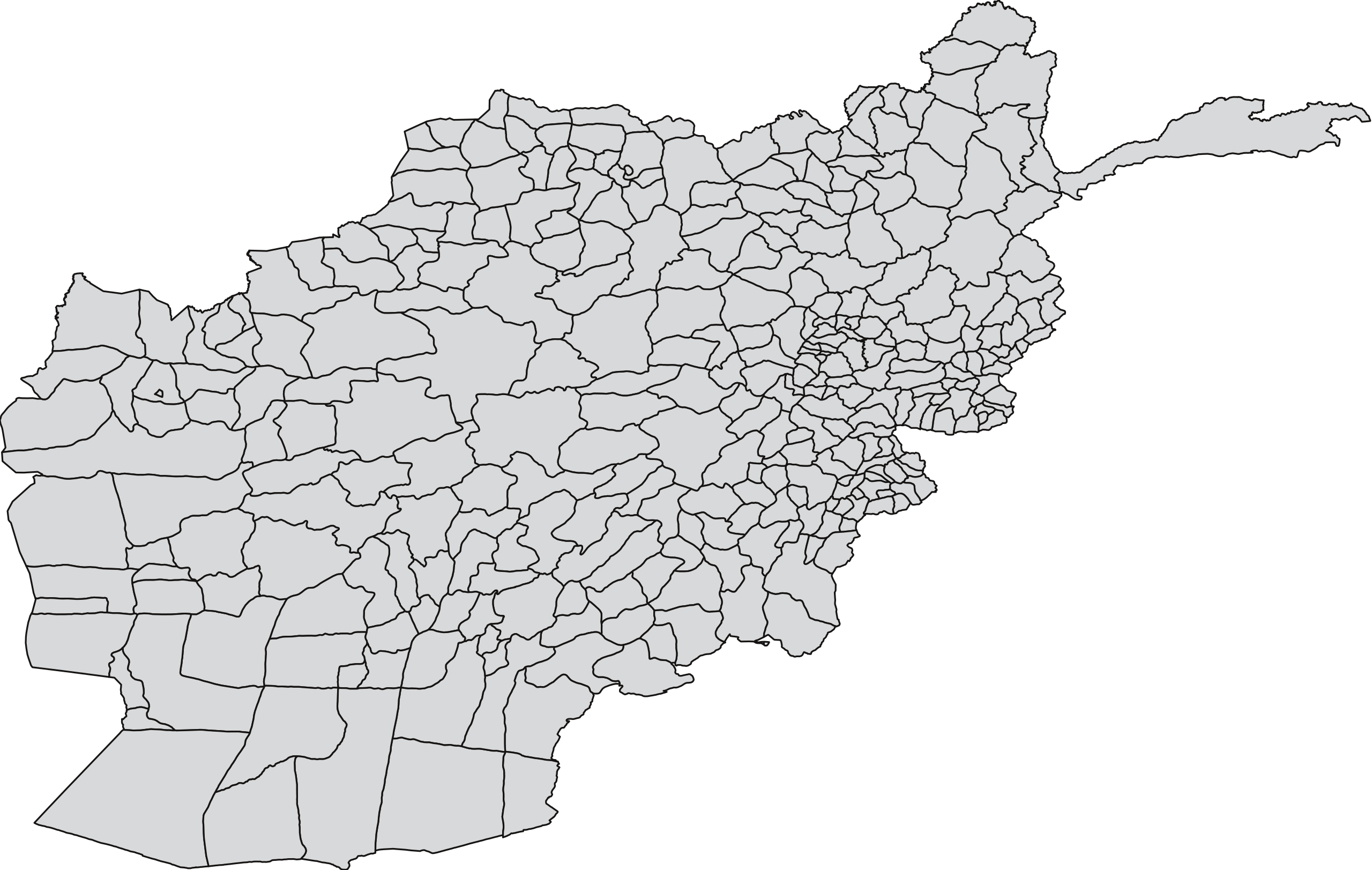
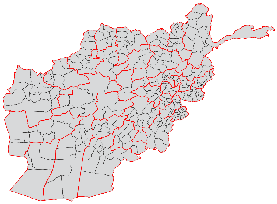
| Description | A blank map of the districts of Afghanistan. The districts are grouped by province and province borders are shown in red. | |||||
| Date | ||||||
| Source |
Map originally from Maplibrary.org who in turn have extracted it from GADM version 0.9 which source the data for Afghanistan as comming from the USGS.
|
|||||
| Author | USGS and Lokal_Profil | |||||
| Permission (Reusing this file) |
|
|||||
| Other versions |
|


File history
Click on a date/time to view the file as it appeared at that time.
| Date/Time | Thumbnail | Dimensions | User | Comment | |
|---|---|---|---|---|---|
| current | 08:55, 21 October 2018 | | 910 × 670 (700 KB) | Furfur (talk | contribs) | Map looked a liitle bit distorted – adjusted it to match Afghanistan_location_map.svg |
| 19:54, 1 March 2009 |  | 750 × 475 (2.57 MB) | Lokal Profil (talk | contribs) | Added province info | |
| 19:45, 25 February 2009 |  | 750 × 475 (1.68 MB) | Lokal Profil (talk | contribs) | {{Information |Description=A blank map of the districts of Afghanistan. |Source=Map originally from [http://www.maplibrary.org/stacks/gadm/AFG/index.php Maplibrary.org] who in turn have extracted it from [http://biogeo.berkeley.edu/gadm/ GADM version 0.9] |
You cannot overwrite this file.
File usage on Commons
The following 4 pages use this file:
File usage on other wikis
The following other wikis use this file:
- Usage on ar.wikipedia.org
- Usage on bn.wikipedia.org
- Usage on ca.wikipedia.org
- Usage on de.wikipedia.org
- Usage on es.wikipedia.org
- Usage on fa.wikipedia.org
- Usage on fr.wikipedia.org
- Usage on id.wikipedia.org
- Usage on it.wikipedia.org
- Usage on ja.wikipedia.org
- Usage on ms.wikipedia.org
- Usage on new.wikipedia.org
- Usage on no.wikipedia.org
- Usage on oc.wikipedia.org
- Usage on pnb.wikipedia.org
- ضلع بامیان
- ضلع بلخ
- ضلع انار درہ
- ضلع باکواہ
- ضلع اوبہ
- ضلع ادرسکن
- ضلع بالا بلوک
- ضلع انجیل
- ضلع المار
- ضلع اندخوی
- ضلع آقچہ
- ضلع اشکمش
- ضلع بنگی
- ضلع آرگو
- ضلع آرغنج خواہ
- ضلع اشکاشیم
- ضلع باک
- ضلع برک متال
- ضلع ارچی
- ضلع اسد آباد
- ضلع برکنر
- ضلع اجرستان
- ضلع اسمار
- ضلع اندر
- ضلع آب بند
- ضلع برکہ
- ضلع اندراب
- ضلع الہ ساری
- ضلع بغلان جدید
- ضلع باغران
- ضلع برگ متال
- ضلع بزارک
- ضلع ایبک
- ضلع ارغنداب
- ضلع ارغستان
View more global usage of this file.