File:Francophone Africa.png
Jump to navigation
Jump to search
Size of this preview: 600 × 599 pixels. Other resolutions: 240 × 240 pixels | 480 × 480 pixels | 997 × 996 pixels.
Original file (997 × 996 pixels, file size: 158 KB, MIME type: image/png)
Captions
Captions
Add a one-line explanation of what this file represents

|
File:Francophone Africa.svg is a vector version of this file. It should be used in place of this PNG file when not inferior.
File:Francophone Africa.png → File:Francophone Africa.svg
For more information, see Help:SVG. |
 |
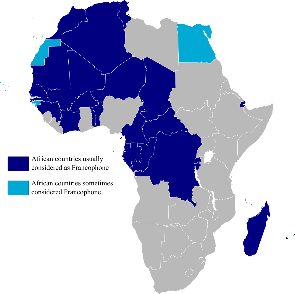
Map highlighting Francophone Africa, made by myself.
| I, the copyright holder of this work, release this work into the public domain. This applies worldwide. In some countries this may not be legally possible; if so: I grant anyone the right to use this work for any purpose, without any conditions, unless such conditions are required by law. |
File history
Click on a date/time to view the file as it appeared at that time.
| Date/Time | Thumbnail | Dimensions | User | Comment | |
|---|---|---|---|---|---|
| current | 15:29, 11 February 2023 | | 997 × 996 (158 KB) | +JMJ+ (talk | contribs) | rephrased the text |
| 15:21, 11 February 2023 |  | 997 × 996 (157 KB) | +JMJ+ (talk | contribs) | Better base map - File:BlankMap-Africa.svg | |
| 21:57, 19 July 2011 |  | 360 × 388 (14 KB) | Rosss (talk | contribs) | Added South Sudan | |
| 01:09, 15 August 2007 |  | 360 × 392 (14 KB) | Rosss (talk | contribs) | Added Réunion, Mauritius, Seychelles, Comoros, Mayotte, Scattered Islands, Cape Verde, Guinea Bisau, Sao Tome e Principe, and the insular part of Equatorial Guinea. | |
| 17:37, 20 November 2006 |  | 360 × 392 (13 KB) | Aaker (talk | contribs) | Map highlighting Francophone Africa. Made by myself. | |
| 17:36, 20 November 2006 |  | 360 × 392 (13 KB) | Aaker (talk | contribs) | Map highlighting Francophone Africa, made by myself. | |
| 17:33, 20 November 2006 |  | 360 × 392 (13 KB) | Aaker (talk | contribs) | Map highlighting Francophone Africa, made by myself, 2006. Carte marquant l'Afrique francophone. | |
| 17:32, 20 November 2006 |  | 360 × 392 (13 KB) | Aaker (talk | contribs) | Map highlighting Francophone Africa, made by myself, 2006. Carte marquant l'Afrique francophone. | |
| 15:46, 11 November 2006 |  | 360 × 392 (13 KB) | Aaker (talk | contribs) | Map highlighting Francophone Africa, made by myself. |
You cannot overwrite this file.
File usage on Commons
The following page uses this file:
File usage on other wikis
The following other wikis use this file:
- Usage on ar.wikipedia.org
- Usage on ast.wikipedia.org
- Usage on de.wikipedia.org
- Usage on en.wikipedia.org
- Usage on es.wikipedia.org
- Usage on fa.wikipedia.org
- Usage on he.wikipedia.org
- Usage on hy.wikipedia.org
- Usage on hyw.wikipedia.org
- Usage on it.wikipedia.org
- Usage on ja.wikipedia.org
- Usage on mr.wikipedia.org
- Usage on pt.wikipedia.org
- Usage on tl.wikipedia.org
- Usage on tr.wiktionary.org
- Usage on ur.wikipedia.org
- Usage on zh.wikipedia.org