File:Karte Landschaftswiesen.JPG
Jump to navigation
Jump to search
No higher resolution available.
Karte_Landschaftswiesen.JPG (556 × 571 pixels, file size: 48 KB, MIME type: image/jpeg)
Captions
Captions
Add a one-line explanation of what this file represents
Summary[edit]
| Description |
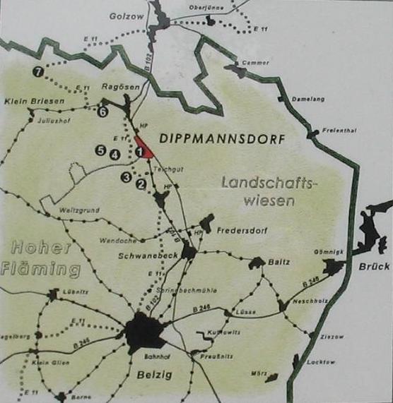
Deutsch: Dörfer im Umkreis der Belziger Landschaftswiesen, Brandenburg. Hinweise: Das Dorf Trebitz ist nicht als Name eingezeichnet, es ist auf der Karte der nördliche Teil von Gömnigk (die Dörfer liegen unmittelbar nebeneinander). Für das Dorf zwischen Fredersdorf und Dippmannsdorf fehlt die Namensangabe "Lütte". Die Hervorhebung von „Dippmannsdorf“ (Nr 1) hat hier keinen Stellenwert und ist der Position der Informationstafel vor Ort geschuldet. Die Nummern bezeichnen örtliche Wanderwege. Die fette Linie stellt die nordöstliche Grenze des Naturparks Hoher Fläming dar.
|
| Date | 15 May 2006 (Date of the picture) |
| Source | Foto (Ausschnitt) einer offiziellen Informationstafel der Naturparkverwaltung Hoher Fläming am Dippmansdorfer Paradies. |
| Author |
map: Naturparkverwaltung Hoher Fläming |
Licensing[edit]
| I, the copyright holder of this work, release this work into the public domain. This applies worldwide. In some countries this may not be legally possible; if so: I grant anyone the right to use this work for any purpose, without any conditions, unless such conditions are required by law. |
|
The photographical reproduction of this work is covered under the article § 59 of the German copyright law, which states that "It shall be permissible to reproduce, by painting, drawing, photography or cinematography, works which are permanently located on public ways, streets or places and to distribute and publicly communicate such copies. For works of architecture, this provision shall be applicable only to the external appearance."
As with all other “limits of copyright by legally permitted uses”, no changes to the actual work are permitted under § 62 of the German copyright law (UrhG). See Commons:Copyright rules by territory/Germany#Freedom of panorama for more information.
|
File history
Click on a date/time to view the file as it appeared at that time.
| Date/Time | Thumbnail | Dimensions | User | Comment | |
|---|---|---|---|---|---|
| current | 12:49, 9 July 2006 | | 556 × 571 (48 KB) | Lienhard Schulz (talk | contribs) | {{Information| |Description= {{de|Dörfer im Umkreis der Belziger Landschaftswiesen, Brandenburg. Hinweise: Das Dorf Trebitz ist nicht als Name eingezeichnet, es ist auf der Karte der nördliche Teil von Gömnik (die Dörfer liegen unmittelbar neb |
You cannot overwrite this file.
File usage on Commons
The following 3 pages use this file:
File usage on other wikis
The following other wikis use this file:
- Usage on azb.wikipedia.org
- Usage on da.wikipedia.org