File:OrteliusWorldMap.jpeg
Ir a la navegación
Ir a la búsqueda
Tamaño de esta previsualización: 800 × 545 píxeles. Otras resoluciones: 320 × 218 píxeles | 640 × 436 píxeles | 1024 × 697 píxeles | 1280 × 872 píxeles | 2560 × 1744 píxeles | 5788 × 3942 píxeles.
Archivo original (5788 × 3942 píxeles; tamaño de archivo: 26,95 MB; tipo MIME: image/jpeg)
Leyendas
Leyendas
Añade una explicación corta acerca de lo que representa este archivo
Resumen
[editar]| Descripción |
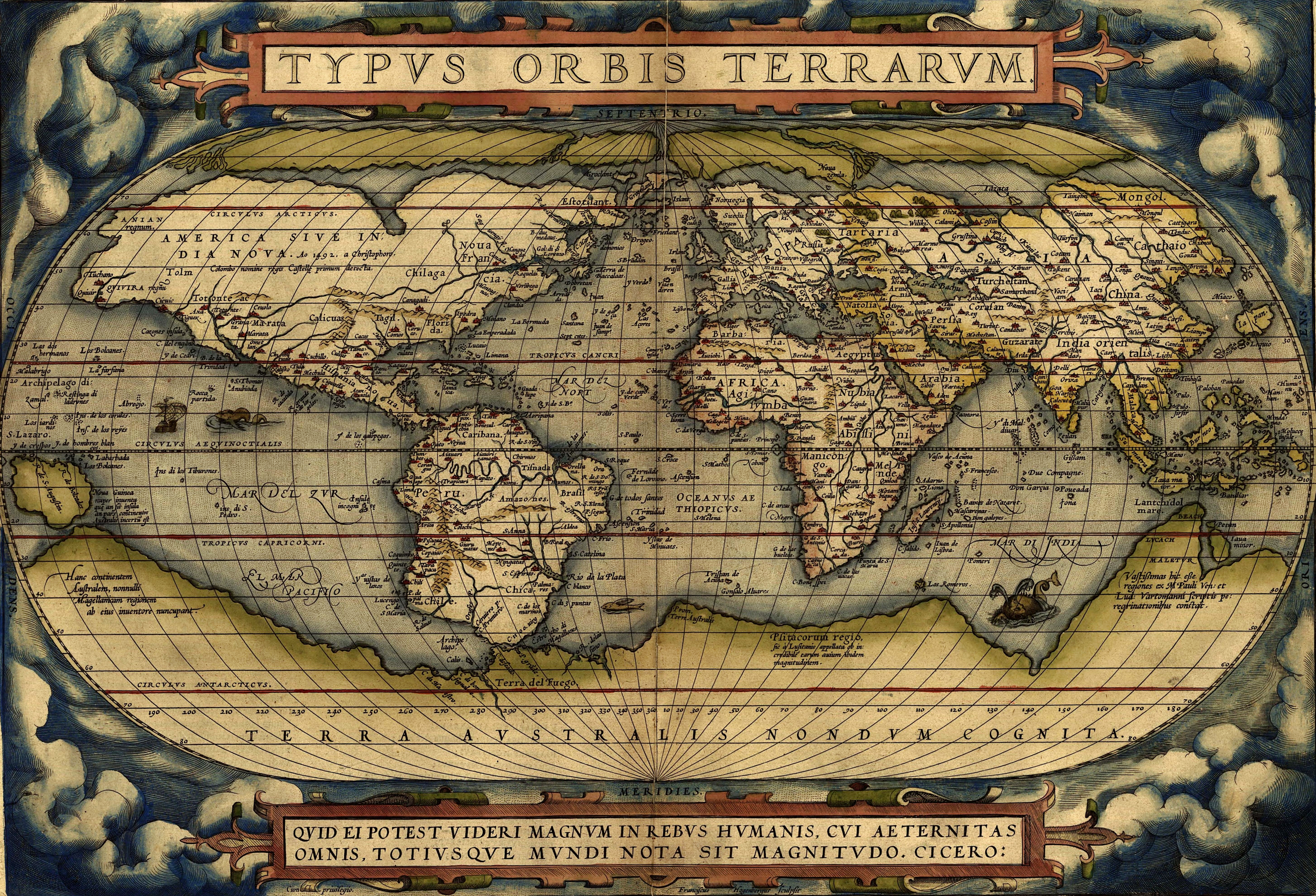
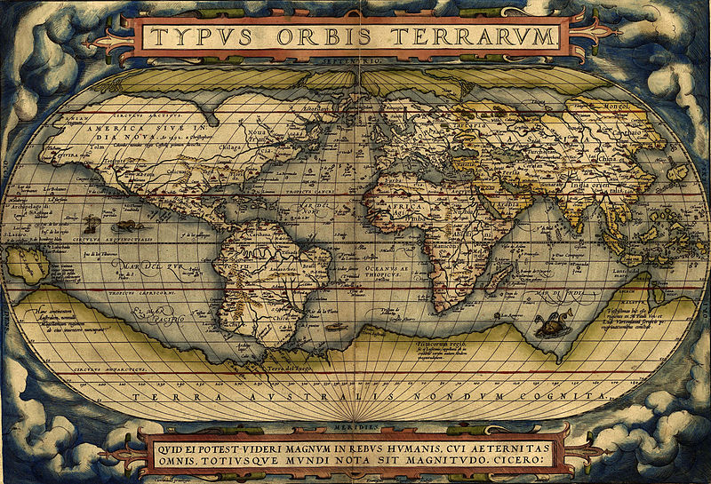
English: Ortelius world map 1570
Español: Mapa Mundial de Ortelius, 1570
Türkçe: Ortelius'un dünya haritası, 1570
עברית: מפת העולם מתוך אטלס אורטליוס |
|||||||||||||||||||||||
| Fecha | ||||||||||||||||||||||||
| Fuente | http://www.britishempire.co.uk/images4/ortelius1570maplarge.jpg | |||||||||||||||||||||||
| Autor |
|
|||||||||||||||||||||||

Licencia
[editar]
|
Esta es una reproducción fotográfica fiel de una obra de arte bidimensional de dominio público. La obra de arte misma se halla en el dominio público por el motivo siguiente:
La postura oficial de la Fundación Wikimedia considera que «las reproducciones fieles de obras de arte bidimensionales de dominio público forman parte del dominio público».
Esta reproducción fotográfica, por ende, también se considera de dominio público dentro de los Estados Unidos. Es posible que otras jurisdicciones restrinjan la reutilización de este contenido; consúltese Reutilización de fotografías PD-Art (en inglés) para más detalles. | ||||
Historial del archivo
Haz clic sobre una fecha y hora para ver el archivo tal como apareció en ese momento.
| Fecha y hora | Miniatura | Dimensiones | Usuario | Comentario | |
|---|---|---|---|---|---|
| actual | 08:37 1 feb 2015 | | 5788 × 3942 (26,95 MB) | Hello world (discusión | contribs.) | new |
| 08:30 1 feb 2015 |  | 2198 × 1532 (6,79 MB) | Hello world (discusión | contribs.) | new | |
| 08:23 1 feb 2015 |  | 2198 × 1532 (6,79 MB) | Hello world (discusión | contribs.) | new | |
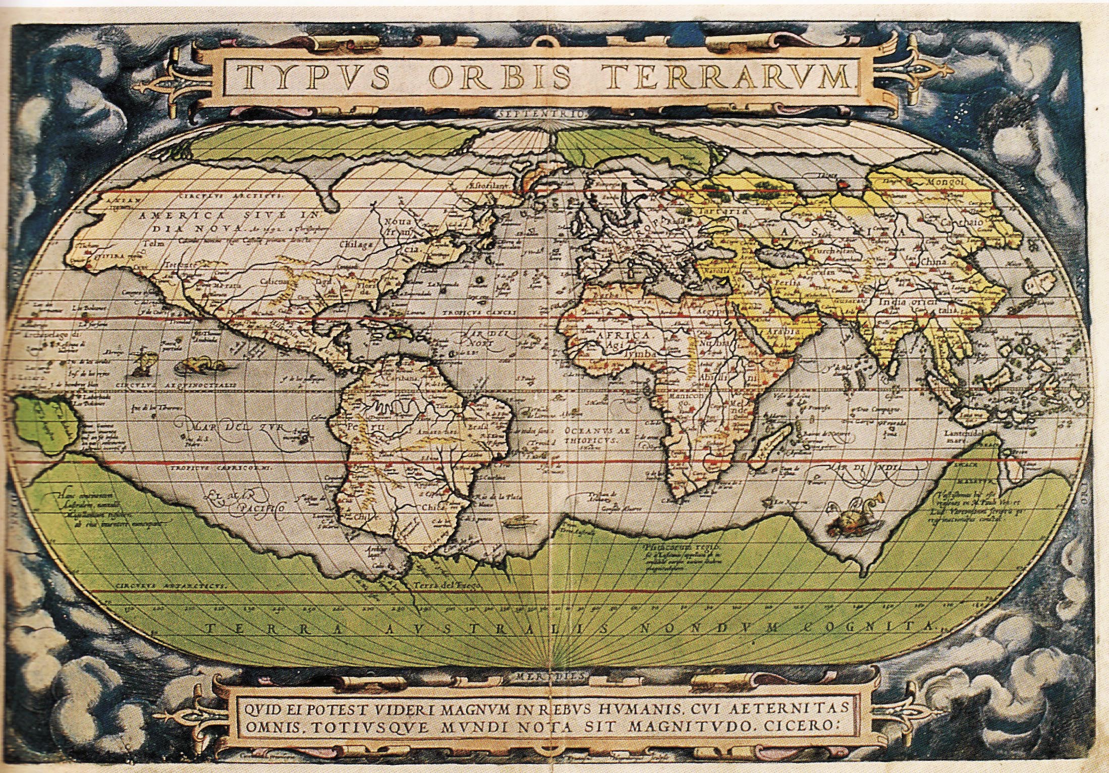
| 11:46 13 jun 2005 |  | 616 × 424 (100 kB) | ¡0-8-15! (discusión | contribs.) | Ortelius world map 1570 {{PD-Old}} |
No puedes sobrescribir este archivo.
Usos del archivo
Hay más de 100 páginas que usan este archivo. La lista siguiente sólo muestra las primeras 100 páginas que usan este archivo. También puedes consultar la lista completa.
- Facsimile atlas
- Maps of the world
- Old maps
- User:Kanchelskis/Atlante
- File:1570 Typus Ortelius mr.jpg
- File:1572 Typus Orbis Terrarum Ortelius.jpg
- Category:Geography
- Category:Geography by continent
- Category:Geography by country
- Category:Geography of Achaea
- Category:Geography of Anhui
- Category:Geography of Bavaria
- Category:Geography of Cantabria
- Category:Geography of Carinthia
- Category:Geography of Central Europe
- Category:Geography of Chukotka
- Category:Geography of Crimea
- Category:Geography of Dagestan
- Category:Geography of Eastern Europe
- Category:Geography of Friesland
- Category:Geography of Friuli-Venezia Giulia
- Category:Geography of Fujian
- Category:Geography of Gansu
- Category:Geography of Guangxi
- Category:Geography of Guizhou
- Category:Geography of Hainan
- Category:Geography of Hebei
- Category:Geography of Heilongjiang
- Category:Geography of Henan
- Category:Geography of Hubei
- Category:Geography of Indre-et-Loire
- Category:Geography of Inner Mongolia
- Category:Geography of Jiangxi
- Category:Geography of Kabardino-Balkaria
- Category:Geography of Kaliningrad Oblast
- Category:Geography of Karachay-Cherkessia
- Category:Geography of Karelia
- Category:Geography of Khakassia
- Category:Geography of Kirov Oblast
- Category:Geography of Komi
- Category:Geography of Krasnodar Krai
- Category:Geography of La Palma
- Category:Geography of Lower Saxony
- Category:Geography of Mecklenburg-Vorpommern
- Category:Geography of Mordovia
- Category:Geography of Moscow Oblast
- Category:Geography of Munich
- Category:Geography of Murmansk Oblast
- Category:Geography of Neuquén Province
- Category:Geography of Ningxia
- Category:Geography of Nordland
- Category:Geography of Northern Africa
- Category:Geography of Olsztyn
- Category:Geography of Oryol Oblast
- Category:Geography of Perm Krai
- Category:Geography of Philadelphia
- Category:Geography of Rajasthan
- Category:Geography of Rhineland-Palatinate
- Category:Geography of Rome
- Category:Geography of Rondônia
- Category:Geography of Rostov Oblast
- Category:Geography of Ryazan Oblast
- Category:Geography of Río Negro Province
- Category:Geography of Saarland
- Category:Geography of Sabah
- Category:Geography of Saint-Martin
- Category:Geography of Saint-Martin (France)
- Category:Geography of Salzburg (state)
- Category:Geography of Samara Oblast
- Category:Geography of San Francisco
- Category:Geography of Santa Cruz de La Palma
- Category:Geography of Sardinia
- Category:Geography of Saxony
- Category:Geography of Schleswig-Holstein
- Category:Geography of Seoul
- Category:Geography of Sergipe
- Category:Geography of Shaanxi
- Category:Geography of Shanxi
- Category:Geography of Sichuan
- Category:Geography of Soest, Germany
- Category:Geography of South Georgia and the South Sandwich Islands
- Category:Geography of Southeastern Europe
- Category:Geography of Spain by autonomous community
- Category:Geography of Styria
- Category:Geography of Switzerland by canton
- Category:Geography of Tenerife
- Category:Geography of Thun
- Category:Geography of Tocantins
- Category:Geography of Trentino
- Category:Geography of Trentino-South Tyrol
- Category:Geography of Ulyanovsk Oblast
- Category:Geography of Upper Austria
- Category:Geography of Vienna
- Category:Geography of Vorarlberg
- Category:Geography of Xinjiang
- Category:Geography of Yunnan
- Category:Geography of the British Overseas Territories
- Category:Geography of the Caribbean
- Category:Geography of the Region of Murcia
- Category:Geography of the canton of Lucerne
Mira más enlaces a este archivo.
Uso global del archivo
Las wikis siguientes utilizan este archivo:
- Uso en af.wikipedia.org
- Uso en ang.wikipedia.org
- Uso en ar.wikipedia.org
- جغرافيا
- عصر الاستكشاف
- تاريخ أوروبا
- التاريخ البشري
- تاريخ القارة القطبية الجنوبية
- قالب:شريط جانبي تاريخ الجغرافيا
- الجغرافيا في عصر الحضارة الإسلامية
- قائمة البلدان من حيث عدد السكان لعام 1900م
- بوابة:المحيط الأطلسي/مقالة مختارة/أرشيف
- بوابة:المحيط الأطلسي/مقالة مختارة/2
- الجغرافيا اليونانية الرومانية
- تاريخ الأرجنتين
- جغرافيا تاريخية
- تيرا أستراليس
- ويكيبيديا:ويكيبيديا للمدارس/مرحبا/جغرافيا
- Uso en arz.wikipedia.org
- Uso en ast.wikipedia.org
- Uso en az.wikipedia.org
- Uso en ba.wikipedia.org
- Uso en be-tarask.wikipedia.org
- Uso en bg.wikipedia.org
- Uso en bh.wikipedia.org
- Uso en bn.wikipedia.org
- Uso en br.wikipedia.org
- Uso en ca.wikipedia.org
Ver más uso global de este archivo.