File:BlankMap-USA-states-Canada-provinces, HI closer.svg
Aller à la navigation
Aller à la recherche

Taille de cet aperçu PNG pour ce fichier SVG : 512 × 512 pixels. Autres résolutions : 240 × 240 pixels | 480 × 480 pixels | 768 × 768 pixels | 1 024 × 1 024 pixels | 2 048 × 2 048 pixels.
Fichier d’origine (Fichier SVG, nominalement de 512 × 512 pixels, taille : 104 kio)
Légendes
Légendes
Ajoutez en une ligne la description de ce que représente ce fichier
| Description |
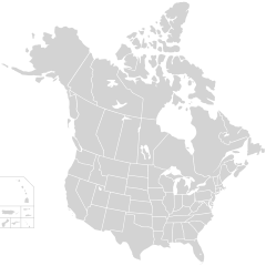
English: Blank SVG map of USA and Canada with state and province borders. Hawaii has been moved closer to the mainland USA to reduce width of image.
Non-contiguous parts of a states/provinces are "grouped" together with the main area of the state/provinces, so any state/provinces can be coloured in completion with one click anywhere on the state/provinces's area. Also, all states/provinces have a "id" attached to them, making them easy to find. Select "find" and then enter in the state/provinces's ISO 3166-2 code in the "id" field to find it. The codes can be found here (Canada) and here (USA). |
| Date | |
| Source |
Cette image vectorielle a été créée avec Inkscape, puis modifiée à la main . |
| Auteur | Lokal_Profil |
| Autorisation (Réutilisation de ce fichier) |
Ce fichier est disponible selon les termes de la licence Creative Commons Attribution – Partage dans les Mêmes Conditions 2.5 Générique Attribution: Lokal_Profil
|
| Autres versions |
Cette image vectorielle contient des éléments, éventuellement modifiés, qui ont été extraits de :
The same as this map with the two-letter state or province name label for each one |
Historique du fichier
Cliquer sur une date et heure pour voir le fichier tel qu'il était à ce moment-là.
| Date et heure | Vignette | Dimensions | Utilisateur | Commentaire | |
|---|---|---|---|---|---|
| actuel | 23 novembre 2020 à 01:48 | | 512 × 512 (104 kio) | Ponderosapine210 (d | contributions) | Accidentally uploaded wrong version. Here is the correct one. |
| 23 novembre 2020 à 01:38 |  | 512 × 596 (132 kio) | Ponderosapine210 (d | contributions) | Added the prominent islands of Manitoulin (Ontario) and Isle Royale (Michigan) to the Great Lakes. | |
| 1 juin 2019 à 22:59 |  | 512 × 512 (99 kio) | Fluffy89502 (d | contributions) | added territories | |
| 8 décembre 2007 à 21:18 |  | 1 730 × 1 730 (212 kio) | Lokal Profil (d | contributions) | Code trimming | |
| 3 juillet 2007 à 04:21 |  | 1 730 × 1 730 (213 kio) | Lokal Profil (d | contributions) | {{Information |Description={{en|Blank SVG map of USA and Canada with state and province borders. Hawaii has been moved closer to the mainland USA to reduce width of image.}} Non-contiguous parts of a states/provinces are "grouped" together with the main a |
Vous ne pouvez pas remplacer ce fichier.
Utilisations locales du fichier
Les 20 pages suivantes utilisent ce fichier :
- User:Lokal Profil/Gallery/Map
- File:BOSdomestic&canada.png
- File:Big6 teams by state province.svg
- File:Blank USA, w territories.svg
- File:Blank US Map (states only).svg
- File:Blank US Map (white on gray and black).svg
- File:Cascadia map.svg
- File:DCA flight map.svg
- File:Keystone-pipeline-route.svg
- File:NA Five Big Sports Franchises Names.svg
- File:NA Five Big Sports Franchises no names.svg
- File:Polygonia comma range map.JPG
- File:Regional Ambassadors Map-2.svg
- File:Spoke Hub Distribution.svg
- File:TPA destinations north america.png
- File:TransMountainPipeline.svg
- File:USA-Canada-silhouette-transbg.png
- File:Western Climate Initiative members.svg
- File:Wood turtle distribution-2-2.TIF
- File:Wood turtle distribution.JPG
.svg)
.svg)
Utilisations du fichier sur d’autres wikis
Les autres wikis suivants utilisent ce fichier :
- Utilisation sur en.wikipedia.org
- Utilisation sur fr.wikipedia.org