Category:Ōpāwaho / Heathcote River
Jump to navigation
Jump to search
river in Christchurch, New Zealand  | |||||
| Upload media | |||||
| Instance of | |||||
|---|---|---|---|---|---|
| Location | Christchurch City, Canterbury Region, New Zealand | ||||
| Length |
| ||||
| Elevation above sea level |
| ||||
| Mouth of the watercourse |
| ||||
 | |||||
The Ōpāwaho / Heathcote River lies within the city boundaries of Christchurch, New Zealand, and is fed from springs near Templeton Road and also receives wet weather flows from as far west as Pound Road. It meanders around the base of the Port Hills from west to south-east.
Subcategories
This category has the following 4 subcategories, out of 4 total.
Media in category "Ōpāwaho / Heathcote River"
The following 58 files are in this category, out of 58 total.
-
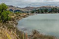
 Avon Heathcote Estuary in Christchurch New Zealand.jpg 1,786 × 2,500; 2.99 MB
-
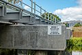 Bridge 7 (Main South Line), Christchurch, New Zealand 09.jpg 5,215 × 3,477; 2.86 MB
-
 Bridge 7 (Main South Line), Christchurch, New Zealand 10.jpg 5,316 × 3,297; 3.32 MB
-
 Bridge 7 (Main South Line), Christchurch, New Zealand 11.jpg 5,070 × 3,313; 3.03 MB
-
 Bridge 7 (Main South Line), Christchurch, New Zealand 12.jpg 5,306 × 3,537; 3.27 MB
-
 Bridge 7 (Main South Line), Christchurch, New Zealand 14.jpg 5,241 × 3,494; 3.18 MB
-
 Centennial Park Christchurch 5.JPG 640 × 480; 152 KB
-
 Christchurch 360 Trail 010.jpg 5,472 × 3,648; 8.63 MB
-
 Christchurch 360 Trail 011.jpg 5,472 × 3,648; 6.21 MB
-
 Christchurch 360 Trail 012.jpg 5,472 × 3,648; 6.36 MB
-
 Earthquake damage near Heathcote River .jpg 964 × 1,294; 678 KB
-
 Evening at the Ōpāwaho River in Christchurch, New Zealand.jpg 2,500 × 1,667; 1.04 MB
-
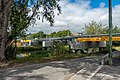
 Ferry Road bridge across Heathcote River, Christchurch, New Zealand 27.jpg 5,293 × 3,529; 3.74 MB
-
 Heathcote - spot the kids.jpg 3,680 × 2,760; 2.49 MB
-
 Heathcote Rive from Sheldon Street footbridge, Christchurch, New Zealand 05.jpg 5,472 × 3,648; 2.86 MB
-
 Heathcote River (14201815879).jpg 1,000 × 669; 255 KB
-
 Heathcote River - Settlers Reserve, Christchurch, New Zealand 19.jpg 5,472 × 3,648; 2.93 MB
-
 Heathcote River - Settlers Reserve, Christchurch, New Zealand 20.jpg 5,472 × 3,648; 3.23 MB
-
 Heathcote River - Settlers Reserve, Christchurch, New Zealand 21.jpg 5,472 × 3,648; 3.61 MB
-
 Heathcote River - Settlers Reserve, Christchurch, New Zealand 22.jpg 4,801 × 3,504; 3.34 MB
-
 Heathcote River - Settlers Reserve, Christchurch, New Zealand 23.jpg 5,444 × 3,629; 3.89 MB
-
 Heathcote River - Settlers Reserve, Christchurch, New Zealand 24.jpg 5,472 × 3,648; 2.94 MB
-
 Heathcote River - Settlers Reserve, Christchurch, New Zealand 25.jpg 5,472 × 3,648; 2.9 MB
-
 Heathcote River - Settlers Reserve, Christchurch, New Zealand 26.jpg 5,472 × 3,648; 2.97 MB
-
 Heathcote River 1.JPG 640 × 480; 147 KB
-
 Heathcote River bank lateral spreading.jpg 3,680 × 2,760; 2.47 MB
-
 Heathcote River Flood, Christchurch.jpg 1,024 × 687; 886 KB
-
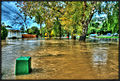
 Heathcote River in flood, 2014.jpg 2,176 × 3,264; 4.92 MB
-
 Heathcote River in flood.jpg 3,648 × 2,432; 4.59 MB
-
 Heathcote River in Woolston, Christchurch, New Zealand 13.jpg 5,005 × 3,424; 3.3 MB
-
 Heathcote river, as seen from Clarendon Terrace, Woolston, Christchurch.jpg 3,264 × 1,836; 1,020 KB
-
 Heathcote River, Christchurch, New Zealand 01.jpg 5,472 × 3,648; 3.75 MB
-
 Heathcote River, Christchurch, New Zealand 02.jpg 5,472 × 3,648; 3.42 MB
-
 Heathcote River, Christchurch, New Zealand 12.jpg 5,472 × 3,648; 2.88 MB
-
 Heathcote River, Christchurch, New Zealand 15.jpg 5,472 × 3,648; 3.56 MB
-
 Heathcote River, Christchurch, New Zealand 16.jpg 5,472 × 3,648; 3.73 MB
-
 Heathcote River, Christchurch, New Zealand 17.jpg 5,166 × 3,345; 2.82 MB
-
 Heathcote River.JPG 640 × 480; 146 KB
-
 HeathcoteRiver01 gobeirne.jpg 6,332 × 1,614; 5.99 MB
-
 HeathcoteRiver02 gobeirne.jpg 6,779 × 1,796; 7.42 MB
-
 Man in the Blue Hat (14207273047).jpg 669 × 1,000; 302 KB
-
 On a Sunny day in June (14390363331).jpg 1,000 × 669; 238 KB
-
 Opawa Road bridge across Heathcote River, Christchurch, New Zealand 07.jpg 5,472 × 3,648; 3.17 MB
-
 Opawa Road bridge across Heathcote River, Christchurch, New Zealand 08.jpg 5,347 × 3,565; 3.09 MB
-
 Pier at Heathcote River, Christchurch, New Zealand 18.jpg 5,472 × 3,648; 3.77 MB
-
 Sunset on the Ōpāwaho River in Christchurch, New Zealand.jpg 1,786 × 2,500; 1.15 MB
-
 Surprise Meeting (14392656664).jpg 1,000 × 731; 236 KB
-
 The Ōpāwaho, Christchurch in Springtime.jpg 2,500 × 1,667; 1.42 MB
-
 Too Early or Too Late (14392337582).jpg 1,000 × 669; 191 KB
-
 Tunnel Road Bridge across Heathcote River, Christchurch, New Zealand 05.jpg 5,472 × 3,648; 3.72 MB
-
 Tunnel Road Bridge across Heathcote River, Christchurch, New Zealand 06.jpg 5,472 × 3,648; 2.9 MB
-
 View of Heathcote River from Sheldon Street footbridge, Christchurch, New Zealand 06.jpg 3,648 × 5,472; 3.28 MB
-
 Walking Beside the Heathcote River (14207139490) (2).jpg 669 × 1,000; 287 KB
-
 Walking the Dog (14393715415).jpg 1,000 × 669; 246 KB
-
 Waltham Road bridge across Heathcote River, Christchurch, New Zealand 03.jpg 5,472 × 3,648; 3.16 MB
-
 Woolston Cut from Connal Street bridge, Christchurch, New Zealand 18.jpg 5,472 × 3,648; 3.66 MB
-
 Woolston flood control gates.jpg 1,280 × 960; 578 KB
-
 Ōpāwaho, Christchurch in Winter.jpg 2,500 × 1,666; 4.16 MB

,_Christchurch,_New_Zealand_09.jpg)
,_Christchurch,_New_Zealand_10.jpg)
,_Christchurch,_New_Zealand_11.jpg)
,_Christchurch,_New_Zealand_12.jpg)
,_Christchurch,_New_Zealand_14.jpg)


.jpg)


.jpg)
.jpg)


.jpg)

.jpg)


_(2).jpg)
.jpg)


