Category:1560s maps of Europe
Jump to navigation
Jump to search
Temperate regions: North America · South America · Africa · Europe · Asia · – Polar regions: – Other regions:
Subcategories
This category has the following 41 subcategories, out of 41 total.
.
B
C
- 1560s maps of the Caucasus (3 F)
- 1560s maps of Croatia (1 F)
D
E
- 1560s maps of Eastern Europe (6 F)
F
G
H
I
L
- 1560s maps of Latvia (empty)
N
P
R
S
- 1560s maps of Slovenia (2 F)
- 1560s maps of Sweden (1 F)
T
- 1560s maps of Turkey (4 F)
U
Media in category "1560s maps of Europe"
This category contains only the following file.
-
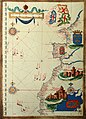 Sebastião Lopes 1575.jpg 2,232 × 3,100; 4.32 MB
