Category:1630s maps of North America
Jump to navigation
Jump to search
Temperate regions: North America · South America · Africa · Europe · Asia · – Polar regions: – Other regions:
Subcategories
This category has the following 11 subcategories, out of 11 total.
Media in category "1630s maps of North America"
The following 5 files are in this category, out of 5 total.
-
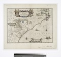
 Blaeu - Nova Belgica et Anglia Nova (Detail Hudson Area).png 798 × 465; 685 KB
-
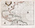 Insvlæ Americanæ in Oceano Septentrionali cum terris adjacentibus. LOC 2003630536.jpg 7,011 × 5,780; 5.89 MB
-
 Insvlæ Americanæ in Oceano Septentrionali cum terris adjacentibus. LOC 2003630536.tif 7,011 × 5,780; 115.94 MB
-

-
.png)
