Category:1630s maps of the United States
Jump to navigation
Jump to search
Countries of the Americas: Brazil · Canada · Cuba · Mexico · United States of America
Other areas: Puerto Rico
Other areas: Puerto Rico
Partly: Indonesia

States of the United States: Delaware · Florida · Massachusetts · New Jersey · New York · Pennsylvania · Virginia
Puerto Rico
Puerto Rico
| NO WIKIDATA ID FOUND! Search for 1630s maps of the United States on Wikidata | |
| Upload media |
Subcategories
This category has the following 12 subcategories, out of 12 total.
- 1635 maps of the United States (empty)
- 1638 maps of the United States (empty)
D
- 1630s maps of Delaware (2 F)
F
- 1630s maps of Florida (2 F)
M
N
P
- 1630s maps of Pennsylvania (2 F)
- 1630s maps of Puerto Rico (3 F)
V
- 1630s maps of Virginia (9 F)
Media in category "1630s maps of the United States"
The following 7 files are in this category, out of 7 total.
-
 Noua Terrae-Mariae tabula. NYPL434431.tiff 5,643 × 4,808; 77.65 MB
-
 Delaware Bay Vinckeboons.jpg 8,423 × 5,971; 28 MB
-
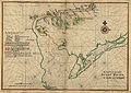
 Map of New Netherland, Virginia, and New England WDL10083.png 1,461 × 1,024; 3.16 MB
-
 Nova Virginiae tabvla. NYPL434464.tiff 4,147 × 3,228; 38.3 MB
-
 Noua Terrae-Mariae tabula (NYPL b15317671-434431).jpg 3,701 × 2,913; 3.17 MB
-
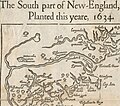 Wood New England Map 1634 Detail.jpg 1,756 × 1,544; 517 KB
-
 Wpdms early grants 1621 1639.png 426 × 491; 87 KB


.jpg)

