Category:1650s maps of Lower Saxony
Jump to navigation
Jump to search
 Federal states of Germany: |

Media in category "1650s maps of Lower Saxony"
The following 10 files are in this category, out of 10 total.
-
 Joh Mejer Stormarn 1650.jpg 5,216 × 3,762; 19.05 MB
-
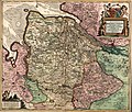 Bremen-Verden1655.jpg 1,644 × 1,398; 3.14 MB
-
 "Comitatus Bentheim et Steinefurt - Auctore Ioanne Westenberg... " (21635064104).jpg 3,805 × 3,096; 2.25 MB
-
 "Comitatus Pinnen Berg - Iohannes Mejer...; Andres Lorensen sculps." (22070021140).jpg 3,689 × 2,947; 2.38 MB
-

-
 "Inferioris Saxoniae Circulus" (21637260073).jpg 3,627 × 2,988; 2.57 MB
-
 "Oldenburg comitatus - E. Sigmonsz sculp." (21636801553).jpg 3,876 × 3,126; 2.48 MB
-
 "Osnabrugensis episcopatus - Auctore Ioanne Gigante " (22070968989).jpg 3,829 × 3,060; 2.45 MB
-
 Landkarte Ducatus Brunsvicensis fereq(ue) Lunaeburgensis.jpg 3,617 × 2,989; 2.48 MB
-
 "Typus Frisiae orientalis - Auctore Ubbone Emmio" (22268275031).jpg 3,616 × 2,875; 2.27 MB


.jpg)
.jpg)
.jpg)
.jpg)
.jpg)
.jpg)
_Lunaeburgensis.jpg)
.jpg)