Category:1650s maps of Germany
Jump to navigation
Jump to search
Countries of Europe: Armenia‡ · Belgium · Bosnia and Herzegovina · Bulgaria · Croatia · Cyprus‡ · Denmark · France‡ · Germany · Greece · Hungary · Republic of Ireland · Italy · Latvia · Lithuania · Netherlands‡ · Norway · Poland · Portugal‡ · Romania · Russia‡ · Slovenia · Spain‡ · Sweden · Switzerland · Turkey‡ · Ukraine
‡: partly located in Europe
‡: partly located in Europe
Federal states of Germany:
Baden-Württemberg · Bavaria · Berlin · Brandenburg · Bremen · Hamburg · Hesse · Lower Saxony · Mecklenburg-Vorpommern · Saxony · Schleswig-Holstein · Thuringia
Subcategories
This category has the following 21 subcategories, out of 21 total.
- 1653 maps of Germany (1 F)
- 1654 maps of Germany (empty)
- 1655 maps of Germany (1 F)
- 1657 maps of Germany (1 F)
- 1658 maps of Germany (5 F)
B
- 1650s maps of Bavaria (4 F)
- 1650s maps of Brandenburg (2 F)
- 1650s maps of Bremen (state) (2 F)
H
- 1650s maps of Hesse (9 F)
L
- 1650s maps of Lower Saxony (2 F)
M
S
T
- 1650s maps of Thuringia (2 F)
Media in category "1650s maps of Germany"
The following 3 files are in this category, out of 3 total.
-
 "Germania, vulgo Deutschlandt " (22269382401).jpg 3,437 × 2,971; 2.75 MB
-
-
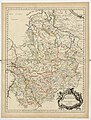
 Karte des Amtes Schwarzenfels.jpg 3,000 × 2,740; 954 KB
.jpg)
.jpg)
