Category:16th-century maps of the Western Mediterranean
Jump to navigation
Jump to search
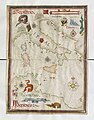
English: This category collects 16th-century maps that show only the Western part of the Mediterranean Sea (between Italy and Spain). This includes (from west to east) the Alboran Sea, the Balearic Sea, the Gulf of Lion, the Ligurian Sea, the Tyrrhenian Sea and the Strait of Sicily
Incomplete maps (like cut-off double pages) should be categorized according to the full content of the original map, unless it is a deliberate crop.
Incomplete maps (like cut-off double pages) should be categorized according to the full content of the original map, unless it is a deliberate crop.
Subcategories
This category has the following 4 subcategories, out of 4 total.
C
M
S
Media in category "16th-century maps of the Western Mediterranean"
The following 17 files are in this category, out of 17 total.
-
 Maggiolo North Africa, Europe, and part of Asia.jpg 1,536 × 1,092; 1.74 MB
-
 Maggiolo western Mediterranean.jpg 1,536 × 1,090; 1.79 MB
-

-

-

-
 Western Mediterranean RMG F1412.tiff 5,412 × 6,495; 100.57 MB
-
 Sardinia und Corsica RMG F1731.tiff 7,403 × 4,855; 102.83 MB
-
 1554 map of France and the Iberian Peninsula.jpg 11,818 × 9,452; 27.01 MB
-

-
-
 Europa Levante RMG F1523.tiff 5,052 × 6,940; 100.31 MB
-

-
 Universae Europae maritimae eiusque navigationis descriptio - btv1b532114735 (2 of 3).jpg 8,718 × 6,466; 10.23 MB
-
 Millo Geographicae tabulae.jpg 800 × 516; 95 KB
-

-
 Bodleian Library MS. Marsh 294 f 7b.jpg 796 × 1,000; 723 KB
-
 Stevenson 1911 atlasofportolanc00magg 0021 IX Western Mediterranean.jpg 2,932 × 3,790; 1.23 MB


.jpg)
_-_bpt6k9116854h_(14_of_51).jpg)
_-_bpt6k9116854h_(17_of_51).jpg)

.jpg)
.jpg)
.jpg)
.jpg)


