Category:16th-century maps of Sardinia
Jump to navigation
Jump to search
Subcategories
This category has the following 2 subcategories, out of 2 total.
M
Media in category "16th-century maps of Sardinia"
The following 13 files are in this category, out of 13 total.
-
 0 Sardaigne - Galleria delle carte geografiche.JPG 2,518 × 3,888; 5.59 MB
-
 Tabula Europae VII.jpg 556 × 450; 65 KB
-
 Print, book-illustration, map (BM 1982,U.2460).jpg 1,535 × 2,500; 1.11 MB
-
 Map of Sardinia - Bordone Benedetto - 1547.jpg 800 × 483; 208 KB
-
 Corsica to Corfu and Tripoli RMG F1411.tiff 6,473 × 5,433; 100.62 MB
-

-
-
 Atlas Ortelius KB PPN369376781-071av-071br.jpg 3,000 × 2,194; 4.46 MB
-
 Isola di Sardigna-da Italia-di Stefano Bonsignori-1578-Palazzo Vecchio-Firenze.jpg 2,219 × 1,646; 1.5 MB
-
 Kingdom of Sardinia 16th century map.jpg 1,050 × 1,676; 1.98 MB
-
 Stefano Bonsignori Italia Sardegna.jpg 451 × 321; 99 KB
-
 Tabula Europae VII. Basilea, Sebastian Münster, 1550 circa.jpg 2,103 × 1,636; 1.25 MB
-
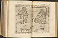
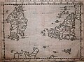 Tavola nuova di Sardigna et di Sicilia. Venezia, Girolamo Ruscelli, 1561.jpg 1,986 × 1,481; 1.25 MB


.jpg)


_44.jpg)


