Category:1710s maps of Portugal
Jump to navigation
Jump to search
Countries of Europe: Armenia‡ · Belgium · Bosnia and Herzegovina · Bulgaria · Croatia · Denmark · France‡ · Georgia‡ · Germany · Greece · Hungary · Republic of Ireland · Italy · Lithuania · Moldova · Netherlands‡ · Norway · Poland · Portugal‡ · Romania · Russia‡ · Serbia · Slovenia · Spain‡ · Sweden · Switzerland · Turkey‡ · Ukraine · United Kingdom
Limited recognition: Abkhazia‡
‡: partly located in Europe
Limited recognition: Abkhazia‡
‡: partly located in Europe
Media in category "1710s maps of Portugal"
The following 9 files are in this category, out of 9 total.
-
 A chart of the sea coasts of England...and part of Barbary - btv1b53009614s.jpg 21,352 × 8,979; 27.58 MB
-

-
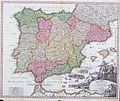
 Carte nouvelle et curieuse du Royaume d'Espagne... - C. Inselin - btv1b53119707p.jpg 11,302 × 7,550; 14.53 MB
-
 Hispania Regnum.jpg 4,832 × 3,889; 6.77 MB
-

-

-
 Portugalliae et Algarbiae cum finitimis Hispaniae regnis 1710 Johann Baptist Homann.jpg 1,313 × 1,138; 762 KB
-

-
 SpainandPortugal1710.jpg 900 × 761; 233 KB


.jpg)

.jpg)
