Category:1710s maps of Ukraine
Jump to navigation
Jump to search
Subcategories
This category has the following 2 subcategories, out of 2 total.
- 1714 maps of Ukraine (1 F)
- 1716 maps of Ukraine (1 F)
Media in category "1710s maps of Ukraine"
The following 5 files are in this category, out of 5 total.
-
 Красне на мапі 1711.png 841 × 496; 733 KB
-
 Piccola Crimea.jpg 4,239 × 2,929; 3.18 MB
-
 Banduri and Lisle. Imperii Orientalis et Circumjacentium Regionum.E.jpg 5,933 × 3,069; 3.37 MB
-
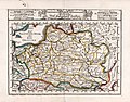 Compendiosa Poloniae Repraesentatio Polen.jpg 5,661 × 4,413; 6.29 MB
-
 Ca. 1710 map of Russia in Europe and Ukraine by Joseph-Nicolas Delisle.jpg 16,190 × 23,869; 93.65 MB


