Category:1730s maps of Asia
Jump to navigation
Jump to search
Temperate regions: North America · South America · Africa · Europe · Asia · Oceania – Polar regions: – Other regions:
Subcategories
This category has the following 29 subcategories, out of 29 total.
- 1739 maps of Asia (1 F)
.
A
C
- 1730s maps of Central Asia (13 F)
- 1730s maps of Cyprus (2 F)
E
- 1730s maps of Egypt (10 F)
G
I
- 1730s maps of India (9 F)
- 1730s maps of Indonesia (7 F)
- 1730s maps of Iraq (2 F)
P
- 1730s maps of Palestine (4 F)
R
T
- 1730s maps of Taiwan (3 F)
Media in category "1730s maps of Asia"
The following 9 files are in this category, out of 9 total.
-
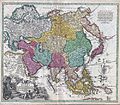 1730 C. Homann Map of Asia - Geographicus - Asiae-homann-1730.jpg 4,000 × 3,492; 5.26 MB
-
 1730 map of Asia by Guillaume de L'Isle.tif 7,091 × 5,971; 242.3 MB
-
 Asiae nova delineatio.png 6,200 × 5,042; 57.69 MB
-
 CEM-44-La-Chine-la-Tartarie-Chinoise-et-le-Thibet-1734-Central-Asia-2574.jpg 2,560 × 1,920; 2.07 MB
-
 CEM-44-La-Chine-la-Tartarie-Chinoise-et-le-Thibet-1734-East-2570.jpg 1,920 × 2,560; 2.08 MB
-
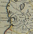 Kelifer Usboi.jpg 548 × 568; 81 KB
-
 Map - Special Collections University of Amsterdam - OTM- HB-KZL 33.12.16.tif 7,765 × 6,554; 145.6 MB
-
 Map of Asia ... NYPL1630432.tiff 6,906 × 4,812; 95.08 MB
-
 Map of Asia by Herman Moll.jpg 23,367 × 14,299; 68.82 MB


