Category:1730s maps of the Philippines
Jump to navigation
Jump to search
- Provinces of the Philippines
- Province-level divisions (independent cities, Metro Manila)
Subcategories
This category has only the following subcategory.
Media in category "1730s maps of the Philippines"
The following 5 files are in this category, out of 5 total.
-
 A Hydrographical and Chorographical Chart of the Philippine Islands WDL10089.png 1,096 × 1,024; 2.42 MB
-
 Carta Hydrographica y Chorographica de la Yslas Filipinas MANILA, 1734.jpg 2,000 × 1,870; 2.09 MB
-

-
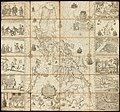
 Carta hydrographica y chorographica delas yslas Filipinas - P. Pedro Murillo Velarde - btv1b5963240f.jpg 14,780 × 13,786; 34.42 MB
-
 PH Museum of Natural History Map.jpg 3,060 × 4,080; 3.01 MB


.jpg)

