Category:1760 maps of South America
Jump to navigation
Jump to search
Temperate regions: North America · South America · Africa · Europe · Asia · – Polar regions: – Other regions:
| 1760 1761 1762 1763 1764 1765 1768 1769 → |
Media in category "1760 maps of South America"
The following 16 files are in this category, out of 16 total.
-
-

-

-

-
-

-

-

-
-

-

-

-
-
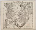
 Le Paraguay, tiré de la carte de l'Amérique méridionale de M. d'Anville - btv1b8468988n.jpg 7,020 × 6,452; 8.32 MB
-

-

,_costa_LOC_90682952.jpg)


