Category:1760s maps of Ukraine
Jump to navigation
Jump to search
Countries of Europe: Albania · Armenia‡ · Austria · Azerbaijan‡ · Belgium · Bosnia and Herzegovina · Bulgaria · Cyprus‡ · Denmark · France‡ · Georgia‡ · Germany · Greece · Hungary · Republic of Ireland · Italy · Lithuania · Moldova · Montenegro · Netherlands‡ · Norway · Poland · Portugal‡ · Romania · Russia‡ · Slovenia · Spain‡ · Sweden · Switzerland · Turkey‡ · Ukraine · United Kingdom
Limited recognition: Abkhazia‡
‡: partly located in Europe
Limited recognition: Abkhazia‡
‡: partly located in Europe
Media in category "1760s maps of Ukraine"
The following 12 files are in this category, out of 12 total.
-
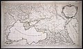
 Carte de la Mer Noire; Carte du canal de la Mer Noire. 1764.jpg 2,960 × 3,448; 1.9 MB
-
 Jeu des cartes géographiques - S. L. Hegrad (16) - La Petite Tartarie.jpg 1,588 × 2,770; 517 KB
-
 Rigelman 1768 map of Rostov fortress.jpg 1,502 × 1,051; 239 KB
-
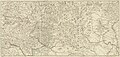
 1769 map of Poland and Russia in Europe (Facius) 1.jpg 3,184 × 1,737; 1.57 MB
-
 1769 map of Poland and Russia in Europe by Johann Gottlieb Facius.jpg 11,596 × 7,738; 15.89 MB
-
-
-
 F.St. Alexandre.jpg 1,121 × 817; 793 KB
-

-
 Partie Du Cours du Dneper Chez le Rouge (Paris, 1769).jpg 2,500 × 1,740; 1.32 MB
-
-
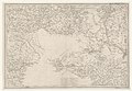
 Ukrainskaya liniya.1769.jpg 961 × 511; 146 KB

_-_La_Petite_Tartarie.jpg)

_1.jpg)

.jpg)


.jpg)
.jpg)
