Category:1763 maps of North America
Jump to navigation
Jump to search
Temperate regions: North America · South America · Africa · Europe · Asia · – Polar regions: – Other regions:
English: 1763 maps of North America
Subcategories
This category has the following 3 subcategories, out of 3 total.
C
U
Media in category "1763 maps of North America"
The following 39 files are in this category, out of 39 total.
-
(Colonial America) LOC 2015591097.jpg 3,032 × 2,381; 977 KB
-
(Colonial America) LOC 2015591097.tif 3,032 × 2,381; 20.65 MB
-
A new map of North America from the latest discoveries, 1763 NYPL483714.tiff 4,640 × 5,683; 75.45 MB
-
A new map of North America from the latest discoveries, 1763. NYPL434121.tiff 5,017 × 4,065; 58.36 MB
-
A new map of North America from the latest discoveries. LOC 74695015.jpg 4,544 × 3,311; 2.44 MB
-
A new map of North America from the latest discoveries. LOC 74695015.tif 4,544 × 3,311; 43.04 MB
-
A New map of North America from the latest discoveries. LOC 75693984.jpg 5,065 × 3,847; 2.76 MB
-
A New map of North America from the latest discoveries. LOC 75693984.tif 5,065 × 3,847; 55.75 MB
-
Dury Atlas Map 8 North America.jpg 3,047 × 2,612; 1.71 MB
-
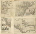
Map of Spanish Louisiana and the American colonies) - J. Gibson, sculp. NYPL434043.tiff 3,040 × 3,494; 30.4 MB
-
Map of Spanish Louisiana and the American colonies.) NYPL483702.tiff 3,424 × 3,638; 35.65 MB
-
New Map of North America (1763).JPG 4,843 × 2,979; 9.88 MB
-
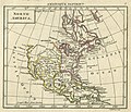
North America. LOC 75693503.jpg 11,840 × 11,296; 19.76 MB
-
North America. LOC 75693503.tif 11,840 × 11,296; 382.65 MB
-
Pontiac's war region.png 765 × 510; 79 KB
-
St. Augustine Map 1763.jpg 464 × 213; 80 KB


