Category:1770 maps of the United States
Jump to navigation
Jump to search
Subcategories
This category has the following 4 subcategories, out of 4 total.
Media in category "1770 maps of the United States"
The following 26 files are in this category, out of 26 total.
-

-
 (New York Island and East Jersey. Unfinished. LOC gm71002311.jpg 13,586 × 11,000; 16.83 MB
-
 (New York Island and East Jersey. Unfinished. LOC gm71002311.tif 13,586 × 11,000; 427.57 MB
-
 (Old map of Brooklyn and greater part of King's County, Long Island. LOC 73691650.jpg 3,652 × 2,261; 1.12 MB
-
 (Old map of Brooklyn and greater part of King's County, Long Island. LOC 73691650.tif 3,652 × 2,261; 23.62 MB
-

-

-
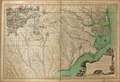
 A compleat map of North-Carolina from an actual survey LOC 83693769.jpg 13,949 × 9,524; 23.05 MB
-
 A compleat map of North-Carolina from an actual survey LOC 83693769.tif 13,949 × 9,524; 380.09 MB
-
 A draught of Delaware Bay. LOC gm72003568.tif 13,657 × 6,637; 259.33 MB
-

-
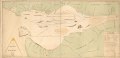
 Le Missisipi ou la Louisiane dans l'Amérique septentrionale. LOC 75693015.jpg 3,639 × 2,330; 1.37 MB
-
 Le Missisipi ou la Louisiane dans l'Amérique septentrionale. LOC 75693015.tif 3,639 × 2,330; 24.26 MB
-
 Le Mississipi ou la Louisiane dans l'Amérique septentrionale. LOC 74694262.jpg 5,788 × 3,828; 2.64 MB
-
 Le Mississipi ou la Louisiane dans l'Amérique septentrionale. LOC 74694262.tif 5,788 × 3,828; 63.39 MB
-
 Map of the roads from New Rochelle to Kingstreet, Westchester County. LOC 73691648.jpg 2,730 × 3,458; 1.27 MB
-
 Map of the roads from New Rochelle to Kingstreet, Westchester County. LOC 73691648.tif 2,730 × 3,458; 27.01 MB
-
 New orleans 1770 Pittman map.jpg 1,878 × 1,420; 735 KB
-
 Plan of Charles Town, Maryland. LOC 2010588342.jpg 4,584 × 6,768; 3.16 MB
-
 Plan of Charles Town, Maryland. LOC 2010588342.tif 4,584 × 6,768; 88.76 MB
-
 Plan of Fort George and adjacent works at Pensacola in West Florida. LOC 74692221.jpg 5,591 × 8,514; 5.94 MB
-
 Plan of Fort George and adjacent works at Pensacola in West Florida. LOC 74692221.tif 5,591 × 8,514; 136.19 MB
-
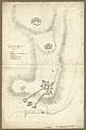
 Plan of New Orleans. LOC 2003627090.jpg 3,314 × 2,261; 1.55 MB
-
 Plan of New Orleans. LOC 2003627090.tif 3,314 × 2,261; 21.44 MB
-
 Slavery in the 13 colonies.jpg 550 × 611; 109 KB
-
 Stuyvesant Farm from The Plan of the City of New York in North America by Ratzer 1770.jpg 1,956 × 2,360; 2.63 MB


.jpg)


,_Mohawk_River,_Niagara_region,_and_Lake_Ontario_in_New_York_Province)._LOC_2006625857.jpg)