Category:1780 maps of the United States
Jump to navigation
Jump to search
States of the United States: Alabama · Florida · Georgia · Illinois · Massachusetts · Michigan · Montana · New Jersey · New York · North Dakota · Pennsylvania · Wisconsin
Puerto Rico
Puerto Rico
Subcategories
This category has the following 15 subcategories, out of 15 total.
A
- 1780 maps of Alabama (4 F)
F
- 1780 maps of Florida (6 F)
G
I
- 1780 maps of Illinois (1 F)
M
- 1780 maps of Massachusetts (15 F)
- 1780 maps of Michigan (1 F)
- 1780 maps of Montana (1 F)
N
- 1780 maps of New Jersey (15 F)
- 1780 maps of New York (state) (14 F)
- 1780 maps of North Dakota (1 F)
P
- 1780 maps of Puerto Rico (7 F)
W
- 1780 maps of Wisconsin (1 F)
Media in category "1780 maps of the United States"
The following 24 files are in this category, out of 24 total.
-
 1780 map of Charleston, South Carolina.jpeg 1,985 × 2,673; 1.07 MB
-
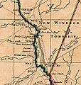
 1780 map of the Hubbardton Military Road.jpg 808 × 714; 442 KB
-
-
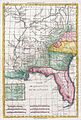
 1780 Raynal and Bonne Map of Mexico and Texas - Geographicus - NouveauMexique-bonne-1780.jpg 2,500 × 1,685; 1.27 MB
-

-

-

-

-
 A chart of the bay and harbour of Pensacola in the Province of West Florida. LOC 77693968.tif 9,076 × 6,739; 174.99 MB
-

-
 BattleOfRidgefield1.png 1,351 × 1,777; 4.8 MB
-

-

-
 Carte de la partie nord, des Etats Unis, de l'Amérique septentrionale. NYPL484238.tiff 4,855 × 3,812; 52.96 MB
-

-

-

-
 CentralSavannahRiver1780.jpg 768 × 811; 125 KB
-
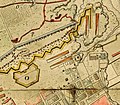
 Charles Town, South Carolina, with a chart of the bars & harbour, LOC gm71005466.jpg 3,002 × 2,479; 1.26 MB
-

-

-
 Carte nouvelle des posséssions angloises en Amérique (NYPL b13875025-484228).jpg 6,300 × 4,704; 7.07 MB
-
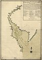 Plano de la Bahia de la Ware y entrada de Filadelfie ... LOC 73691796.jpg 6,098 × 8,672; 6.05 MB
-
 Siege of Charleston 1780.jpg 643 × 565; 245 KB


.jpg)
.jpg)

