Category:1780s maps of Poland
Jump to navigation
Jump to search
Countries of Europe: Albania · Armenia‡ · Austria · Azerbaijan‡ · Belgium · Bosnia and Herzegovina · Bulgaria · Croatia · Cyprus‡ · Czech Republic · Finland · France‡ · Georgia‡ · Germany · Greece · Hungary · Republic of Ireland · Italy · Lithuania · Moldova · Netherlands‡ · Norway · Poland · Portugal‡ · Romania · Russia‡ · Serbia · Slovenia · Spain‡ · Sweden · Switzerland · Turkey‡ · Ukraine · United Kingdom
Limited recognition: Abkhazia‡
‡: partly located in Europe
Limited recognition: Abkhazia‡
‡: partly located in Europe
Media in category "1780s maps of Poland"
The following 9 files are in this category, out of 9 total.
-

-
 1780s map of Warsaw by P.F. Tardieu.tif 17,181 × 13,438; 660.57 MB
-
 Eastern Europe - Antonio Zatta (1781).jpg 1,024 × 742; 211 KB
-
 Eastern Europe by Antonio Zatta.jpg 1,500 × 1,171; 1.57 MB
-
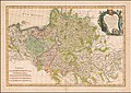
 La Polonia, divisa ne' suoi Palatinati, tratta dall' Atlante Polacco del Sig.r Rizzi Zannoni.jpg 11,381 × 8,320; 15.86 MB
-

-
 1783 map of Poland by Giovanni Antonio Rizzi Zannoni.jpg 11,810 × 8,323; 21.34 MB
-
 Plan von der Krim und der Nogdyschen Tatarey.jpg 619 × 969; 268 KB
-
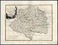
 A new map of the Kingdom of Poland with its dismembered provinces (1787).jpg 10,266 × 6,848; 14.09 MB

.jpg)


.jpg)