Category:1780s maps of Russia
Jump to navigation
Jump to search
Countries of Asia: Afghanistan · Armenia‡ · Azerbaijan‡ · People's Republic of China · Cyprus‡ · Egypt‡ · Georgia‡ · India · Indonesia‡ · Iran · Iraq · Japan · Lebanon · Pakistan · Philippines · Russia‡ · Syria · Turkey‡ · Yemen
Limited recognition: Abkhazia‡ · Taiwan · State of Palestine
‡: partly located in Asia
Limited recognition: Abkhazia‡ · Taiwan · State of Palestine
‡: partly located in Asia
Countries of Europe: Albania · Armenia‡ · Austria · Azerbaijan‡ · Belgium · Bosnia and Herzegovina · Bulgaria · Croatia · Cyprus‡ · Czech Republic · Finland · France‡ · Georgia‡ · Germany · Greece · Hungary · Republic of Ireland · Italy · Lithuania · Moldova · Netherlands‡ · Norway · Poland · Portugal‡ · Romania · Russia‡ · Serbia · Slovenia · Spain‡ · Sweden · Switzerland · Turkey‡ · Ukraine · United Kingdom
Limited recognition: Abkhazia‡
‡: partly located in Europe
Limited recognition: Abkhazia‡
‡: partly located in Europe
Subcategories
This category has the following 2 subcategories, out of 2 total.
- 1783 maps of Russia (1 F)
- 1784 maps of Russia (1 F)
Media in category "1780s maps of Russia"
The following 11 files are in this category, out of 11 total.
-
 Rigobert-Bonne-Atlas-de-toutes-les-parties-connues-du-globe-terrestre MG 0003.tif 5,148 × 3,510; 51.73 MB
-
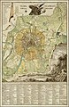
 A plan of the city of Moscow. The Kitchin Senr sculpt - btv1b84401186.jpg 5,973 × 5,566; 5.39 MB
-
 Map of the Caucasus 1784.jpg 8,895 × 6,213; 25.07 MB
-
 Siebiež. Себеж (1785).jpg 10,636 × 6,400; 11.71 MB
-
 Деревня Урывки.jpg 494 × 471; 118 KB
-
 Generalkarta .png 6,300 × 5,027; 50.84 MB
-
 1789 map of Moscow by Ivan Marchenkov.jpg 4,069 × 6,242; 5.03 MB
-
 Serpukhov 1784.jpeg 6,316 × 5,117; 10.18 MB
-
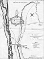 The plan of the fortress Vladikavkaz and the Ingush village of Zaur (1784).jpg 2,086 × 2,771; 3.36 MB
-
 Карта Пограничной Линии Российской Империи 1782 Л. Штедер.jpg 5,565 × 8,219; 50.89 MB
-
 Сл. Богдановка и сл. Лашиновка, 1780-1790 гг..jpg 2,460 × 2,421; 635 KB


.jpg)


.jpg)

