Category:17th-century maps of Emilia-Romagna
Jump to navigation
Jump to search
Media in category "17th-century maps of Emilia-Romagna"
The following 10 files are in this category, out of 10 total.
-
 Middle Italy map 1618.jpg 940 × 697; 260 KB
-
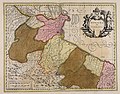
 "Ducato di Ferrara" (22264837241).jpg 4,038 × 3,078; 2.36 MB
-
 "Romagna olim Flaminia" (22066515258).jpg 3,978 × 3,120; 2.3 MB
-
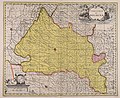
 "Territorio di Bologna" (21631578834).jpg 3,726 × 3,102; 2.66 MB
-
 Romagna olim Flaminia - CBT 5882071.jpg 5,450 × 4,255; 7.37 MB
-
 Atlante Veneto Volume 2 039.jpg 10,380 × 7,215; 9.04 MB
-

-
 Ducato di Ferrara - CBT 5882035.jpg 5,497 × 4,302; 6.44 MB
-

-
 Territorio di Bologna - CBT 5882036.jpg 5,682 × 4,657; 8.74 MB

.jpg)
.jpg)
.jpg)


.jpg)
