Category:17th-century maps of Sicily
Jump to navigation
Jump to search
Media in category "17th-century maps of Sicily"
The following 19 files are in this category, out of 19 total.
-
 Map of Italy 1600 South East.jpg 800 × 600; 124 KB
-

-

-

-
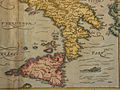
 Sicilia - Porcacchi Tomaso - 1620.jpg 1,500 × 1,114; 1.4 MB
-

-

-

-
 Fotothek df tg 0008445 Geographie ^ Insel.jpg 800 × 561; 209 KB
-

-
 Atlante Veneto Volume 2 029.jpg 7,329 × 10,344; 8.49 MB
-
 Atlante Veneto Volume 2 034.jpg 10,320 × 7,135; 8.24 MB
-
 Regnum Siciliae cum circumjacentibus regnis et insulis - CBT 5882643.jpg 5,761 × 4,680; 7.21 MB
-
-
 Atlas de la Méditerranée (Reproduction numérique) - s.n. - btv1b53028102v (02 of 11).jpg 7,664 × 6,128; 8.26 MB
-
 G (4=Om. 074 ; 1 - 635 000 env). Nicolaus Geilkerk coelavit - btv1b8493515n.jpg 6,534 × 5,165; 5.52 MB
-
 Lipari-Vulcano-1699.jpg 3,810 × 5,151; 7.32 MB
-
 Siciliae veteris typus - (d'après Ab. Ortelius) ; Abraham Goos sculpsit - btv1b5963919f.jpg 6,184 × 4,800; 4.59 MB
-
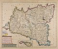
 Val di Mazara nel 1688.png 957 × 747; 1.2 MB


.jpg)

.jpg)
_Cluverio_;_Henry_le_Roy_fecit_-_btv1b53170426p_(1_of_2).jpg)
.jpg)

.jpg)


_-_s.n._-_btv1b53028102v_(02_of_11).jpg)
._Nicolaus_Geilkerk_coelavit_-_btv1b8493515n.jpg)

_;_Abraham_Goos_sculpsit_-_btv1b5963919f.jpg)
