Category:17th-century maps of Ireland
Jump to navigation
Jump to search
Countries of Europe: Albania · Armenia‡ · Austria · Azerbaijan‡ · Belarus · Belgium · Bosnia and Herzegovina · Bulgaria · Croatia · Cyprus‡ · Czech Republic · Denmark · Estonia · Finland · France‡ · Georgia‡ · Germany · Greece · Hungary · Iceland · Republic of Ireland · Italy · Latvia · Lithuania · Luxembourg · Malta · Montenegro · Netherlands‡ · Norway · Poland · Portugal‡ · Romania · Russia‡ · Serbia · Slovakia · Slovenia · Spain‡ · Sweden · Switzerland · Turkey‡ · Ukraine · United Kingdom
Specific status: Gibraltar · Isle of Man – Limited recognition: Abkhazia‡
‡: partly located in Europe
Specific status: Gibraltar · Isle of Man – Limited recognition: Abkhazia‡
‡: partly located in Europe
Subcategories
This category has the following 15 subcategories, out of 15 total.
#
- 1600s maps of Ireland (25 F)
- 1610s maps of Ireland (2 F)
- 1620s maps of Ireland (5 F)
- 1630s maps of Ireland (empty)
- 1640s maps of Ireland (9 F)
- 1650s maps of Ireland (11 F)
- 1660s maps of Ireland (6 F)
- 1670s maps of Ireland (2 F)
- 1680s maps of Ireland (13 F)
- 1690s maps of Ireland (7 F)
D
M
S
Media in category "17th-century maps of Ireland"
The following 10 files are in this category, out of 10 total.
-
 1622 Thomas Raven Map of Bellaghy.jpg 2,468 × 1,976; 894 KB
-
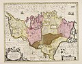 Provincia Connachtiae = The province of Connaugt - CBT 6595916.jpg 5,704 × 4,416; 6.81 MB
-
 Provincia Momoniae = The province of Mounster - CBT 6595959.jpg 5,612 × 4,427; 6.9 MB
-
 16th Century Map of Cork - Extracted and replicated from Pacata Hibernia page 137.png 2,296 × 1,290; 6.03 MB
-

-
-

-
 Hibernia seu Britannia minor cum aliq. insulis - btv1b5963766d.jpg 1,944 × 2,808; 781 KB
-

-
 UBBasel Map Irland 1677-1702 Kartenslg Mappe 238-56.tif 8,115 × 10,464, 2 pages; 242.97 MB


.jpg)

