Category:1800s maps of Baden-Württemberg
Jump to navigation
Jump to search

Federal states of Germany:


Subcategories
This category has the following 2 subcategories, out of 2 total.
+
Media in category "1800s maps of Baden-Württemberg"
The following 22 files are in this category, out of 22 total.
-
 Konstanz Vermessung 1807 retouched.jpg 1,921 × 2,601; 4.6 MB
-
 Konstanz Vermessung 1807.jpg 1,950 × 2,616; 3.36 MB
-
 Amt Blumberg 1800.jpg 1,046 × 671; 170 KB
-
 Amt Bohlingen 1800.jpg 1,175 × 839; 255 KB
-
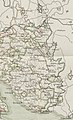 Amt Heiligenberg 1800.jpg 1,426 × 2,339; 779 KB
-
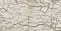 Amt Löffingen 1800.jpg 1,651 × 857; 341 KB
-
 Amt Messkirch 1800.jpg 1,573 × 1,842; 577 KB
-
 Amt Möhringen 1800.jpg 1,558 × 1,124; 391 KB
-
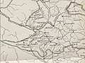 Amt Neustadt Baden 1800.jpg 1,543 × 1,149; 371 KB
-
 Amt Stühlingen 1800.jpg 1,222 × 1,373; 371 KB
-
 Amt Villingen.jpg 1,891 × 1,789; 753 KB
-
 Bezirksamt Hüfingen 1800.jpg 1,914 × 1,617; 700 KB
-
 Bezirksamt Neustadt 1830.JPG 2,062 × 1,850; 775 KB
-
 Ferdinandsdorf.jpg 2,643 × 1,522; 4.02 MB
-
 Großer Stadtplan 1803.jpg 2,601 × 2,037; 906 KB
-

-
 Obervogteiamt Villingen.jpg 1,453 × 1,484; 500 KB
-
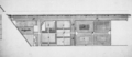 Schwetzingen-Schloss-1807.png 993 × 434; 242 KB
-
 Schwäbischer Reichskreis 1805.jpg 1,920 × 1,712; 3.87 MB
-
 Seekreis Baden 1800 Baumann.jpg 7,483 × 4,326; 6.01 MB
-
 Stabsamt Bräunlingen 1800.jpg 1,202 × 642; 185 KB
-


_Bl%C3%A4ttern_von_den_L%C3%A4ndern_zwischen_dem_Rhein_Main_und_Neckar_nebst_den_angr%C3%A4nzenden_Gegenden_-_HK1154.jpg)


