Category:1800s maps of Berlin
Jump to navigation
Jump to search
|
Federal states of Germany: |
Subcategories
This category has the following 2 subcategories, out of 2 total.
- 1802 maps of Berlin (1 F)
- 1809 maps of Berlin (1 F)
Media in category "1800s maps of Berlin"
The following 7 files are in this category, out of 7 total.
-
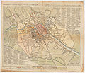
 Schneider, Plan von Berlin, 1802 (cropped 1).jpg 1,384 × 1,028; 627 KB
-
 Schneider, Plan von Berlin, 1802.jpg 7,008 × 5,204; 11.82 MB
-
 Sotzmann Grundriss der Königlichen Haupt und Residenzstadt Berlin 1803.jpg 5,485 × 4,693; 12.16 MB
-
 Berlin. - A plan of the city of Berlin. Published by J. Stockdale - btv1b84449208.jpg 4,893 × 3,579; 3.16 MB
-

-
 Map de berlin 1800.png 968 × 971; 2.1 MB
-
 Selter Grundriss von Berlin 1804.jpg 15,606 × 13,493; 71.41 MB
.jpg)


