Category:1800s maps of Boston
Jump to navigation
Jump to search
Subcategories
This category has only the following subcategory.
B
Media in category "1800s maps of Boston"
The following 23 files are in this category, out of 23 total.
-

-
 1800-1807 Plan of Boston, from the Digital Commonwealth - commonwealth cj82m7403.jpg 7,606 × 6,091; 6.02 MB
-
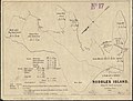 1801 Survey of Noddles Island.jpg 800 × 610; 208 KB
-
 1803 Cornhill Boston byCarleton BPL10934 detail.png 806 × 712; 868 KB
-
 1803 NorthEnd Boston byCarleton BPL10934 detail.png 810 × 671; 885 KB
-
 1806 Boston map byRPhillips.png 807 × 714; 1.11 MB
-
 1806 Boston map Wayne BPL10640.png 680 × 659; 996 KB
-
 1806 Cornhill Boston byNorman detail BPL10103.png 806 × 715; 974 KB
-
 1806 NorthEnd Boston byNorman detail BPL10103.png 814 × 715; 995 KB
-
 1806 PearlSt Boston map byWilliamNorman.png 808 × 715; 1.08 MB
-
 1807 (circa) Plan of Boston, from the Digital Commonwealth - commonwealth 9s161d616.jpg 2,356 × 4,006; 1.33 MB
-
 1807 Buache Map of Boston, Massachusetts - Geographicus - Boston-buache-1807.jpg 3,000 × 1,970; 2.16 MB
-
 A new plan of Boston from actual surveys (NYPL Hades-118337-54283).tif 4,504 × 5,739; 73.96 MB
-
 A plan of Boston - from actual survey LOC 2011589290.jpg 3,889 × 5,936; 2.78 MB
-
 A plan of Boston, from actual survey (2674408541).jpg 1,252 × 2,000; 2 MB
-
 Boston area colonial map.jpg 1,286 × 827; 274 KB
-
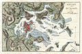
 Carte de la Baye de Baston (2674881289).jpg 1,525 × 2,000; 2.27 MB
-
 Detail of historical map of Boston (23448048456).jpg 4,760 × 4,696; 2.88 MB
-
 Eastie1806.jpg 1,179 × 845; 1.24 MB
-
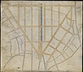 Manuscript plan of the Bulfinch Triangle, Boston, MA (2674588524).jpg 2,000 × 1,737; 2.26 MB
-
 Manuscript plan of the Bulfinch Triangle, Boston, MA (2674590754).jpg 2,000 × 1,670; 2.25 MB
-
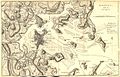
 Plano de la bahia y puerto de Boston (6093629469).jpg 2,000 × 1,566; 2.82 MB
-
 The Boston directory Fleuron W002802-3.png 1,010 × 816; 31 KB
.jpg)


_Plan_of_Boston,_from_the_Digital_Commonwealth_-_commonwealth_9s161d616.jpg)


.jpg)

.jpg)
.jpg)

.jpg)
.jpg)
.jpg)
