Category:1850s maps of Boston
Jump to navigation
Jump to search
Subcategories
This category has the following 2 subcategories, out of 2 total.
Media in category "1850s maps of Boston"
The following 68 files are in this category, out of 68 total.
-

-

-
 1850 BeaconHill BirdsEyeView Boston byJohnBachmann.png 814 × 671; 969 KB
-
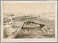
 1850 bird's-eye view map of Boston (color).jpg 8,983 × 6,709; 7.3 MB
-
 1850 bird's-eye view map of Boston.jpg 9,880 × 7,280; 13.31 MB
-
-
 1850 FederalStChurch BirdsEyeView Boston byJohnBachmann.png 717 × 706; 1.14 MB
-
 1850 NathDearborn Boynton map Boston2674451953.jpg 1,794 × 2,000; 3.81 MB
-
 1850 SouthEnd area Boston Boynton Dearborn.png 810 × 713; 1.02 MB
-
 1852 shipyard Briggs Boston McIntyre map detail.png 863 × 562; 531 KB
-

-

-
 1855 Colton Plan or Map of Boston - Geographicus - Boston-colton-1855.jpg 3,290 × 4,000; 3.9 MB
-

-
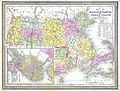
 Atlas Of The USA 1857 (Boston).jpg 2,363 × 2,685; 1.1 MB
-
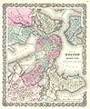
 1857 Colton Map of Boston, Massachusetts - Geographicus - Boston-colton-1857.jpg 3,021 × 3,500; 3.25 MB
-

-
 1859 NorthSt Boston map.jpg 2,000 × 782; 1.17 MB
-
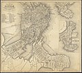
 1859 Plan of Boston comprising a part of Charlestown and Cambridge (2674457079).jpg 1,627 × 2,000; 3.33 MB
-

-
 Boston (2675948260).jpg 2,000 × 1,406; 1.63 MB
-
 Boston Street Map, 1853.jpg 977 × 1,674; 1.42 MB
-
 Colton's map of Boston and adjacent cities. LOC 2012593352.jpg 5,133 × 4,929; 4.67 MB
-
 Colton's map of Boston and adjacent cities. LOC 2012593352.tif 5,133 × 4,929; 72.39 MB
-
 Copy of a plan of South Bay (3856245794).jpg 2,000 × 1,560; 2.4 MB
-
 Copy of part of plan of inner harbor of Boston, showing commissioners lines (3856245928).jpg 2,000 × 1,551; 2.29 MB
-

-
 Map of Boston and its vicinity (2675636316).jpg 2,000 × 1,781; 2.95 MB
-
 Map of Boston and its vicinity (2675741606).jpg 2,000 × 1,801; 3.04 MB
-
 Map of Boston and vicinity (2674453931).jpg 2,000 × 1,574; 2.84 MB
-
 Map of Brighton 1856.jpg 1,122 × 1,428; 348 KB
-
 Map of Dorchester Mass. (2674669589).jpg 2,000 × 1,577; 2.52 MB
-
 Map of parts of Boston Harbor and its tributaries (2675742374).jpg 1,542 × 2,000; 1.55 MB
-
 Map of the cemetery of Mount Auburn, Boston (3719856163).jpg 1,024 × 724; 631 KB
-
 Map of the city and vicinity of Boston Massachusetts (2673913619).jpg 1,985 × 2,000; 4.02 MB
-
 Minots Ledge off Boston Harbor, showing the proposed site of a light house (7537856380).jpg 1,966 × 2,000; 2.75 MB
-

-
-

-

-

-

-

-

-
 Plan of (Boston) Public Library lot (9138718272).jpg 799 × 576; 53 KB
-
 Plan of Boston comprising a part of Charlestown and Cambridge (2674446357).jpg 1,815 × 2,000; 3.29 MB
-
 Plan of Boston comprising a part of Charlestown and Cambridge (2674455465).jpg 1,635 × 2,000; 3.49 MB
-
 Plan of building lots on Washington... (2675375520).jpg 1,321 × 2,000; 1.82 MB
-
 Plan of Charles River and Warren bridges, with the vicinity (2674635813).jpg 2,000 × 1,296; 1.9 MB
-
 Plan of dwelling houses & house lots, in West Roxbury (2675566546).jpg 2,000 × 1,420; 2.07 MB
-
 Plan of extension of Devonshire Street connecting Otis & Winthrop Places (2674493711).jpg 2,000 × 1,434; 2.05 MB
-

-

-

-

-
 Plan of land in Roxbury belonging to the heirs of Alfred Evans (2675079106).jpg 2,000 × 1,518; 2.14 MB
-
 Plan of lands belonging to the Boston Water Power Company (3120132377).jpg 2,000 × 1,584; 2.71 MB
-
 Plan of lands in West-Roxbury, belonging to the estate of Chas. M. Taft (2675517890).jpg 2,000 × 1,566; 2.38 MB
-
 Plan of lands in West-Roxbury, belonging to the estate of Chas. M. Taft (2675518734).jpg 2,000 × 1,436; 2.12 MB
-

-

-
-
 Plan of the Coffin Estate, corner of Summer and Chauncy Streets (2675376942).jpg 1,318 × 2,000; 1.82 MB
-

-
 Plan of the proposed docks at South Boston (9472521741).jpg 800 × 557; 69 KB
-

-
 Sketch of Boston Harbor and Bay (3120960458).jpg 2,000 × 1,702; 2.99 MB
-
 The history and antiquities of Boston (1856) (14590671468).jpg 3,040 × 1,828; 804 KB
.jpg)

.jpg)


_(14738218266).jpg)


.jpg)
.jpg)


.jpg)
.jpg)
.jpg)


.jpg)
.jpg)
.jpg)
.jpg)
.jpg)
.jpg)

.jpg)
.jpg)
.jpg)
.jpg)
.jpg)
.jpg)
.jpg)
.jpg)
.jpg)
.jpg)
.jpg)
.jpg)
.jpg)
_Public_Library_lot_(9138718272).jpg)
.jpg)
.jpg)
.jpg)
.jpg)
.jpg)
.jpg)
.jpg)
.jpg)
.jpg)
_June_19_1851_at_4_o_clk_pm_on_the_premises_(9472266227).jpg)
.jpg)
.jpg)
.jpg)
.jpg)
.jpg)

.jpg)
.jpg)
.jpg)
.jpg)
.jpg)
_(14590671468).jpg)