Category:1810s maps of North Rhine-Westphalia
Jump to navigation
Jump to search
Federal states of Germany:
Subcategories
This category has the following 2 subcategories, out of 2 total.
Media in category "1810s maps of North Rhine-Westphalia"
This category contains only the following file.
-
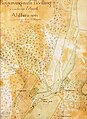 Landkarte Ahlhausen, 1812.jpg 2,552 × 3,504; 8.19 MB
