Category:1810s maps of Berlin
Jump to navigation
Jump to search
|
Federal states of Germany: |
Subcategories
This category has the following 2 subcategories, out of 2 total.
- 1812 maps of Berlin (1 F)
Media in category "1810s maps of Berlin"
The following 6 files are in this category, out of 6 total.
-
 Reymann Neuester Grundriss von Berlin 1810.jpg 6,344 × 4,558; 13.45 MB
-
 Kartenausschnitt Leipziger Str. 3, Selter 1811.png 1,037 × 797; 2.1 MB
-
 Reymann Topographischer Plan der Gegend um Berlin ca1816.jpg 8,759 × 7,998; 25.57 MB
-
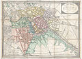
 Sachs Grundriss von Berlin 1816.jpg 7,378 × 6,148; 15.74 MB
-

-
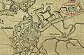 Spandau um 1812.jpg 1,288 × 842; 656 KB


.jpg)
