Category:1828 maps of Canada
Jump to navigation
Jump to search
Countries of North America: Canada · Mexico · United States of America‡
‡: partly located in North America
‡: partly located in North America
| ← 1821 1823 1825 1827 1828 1829 → |
English: Maps of Canada from 1828 or related to Canada in 1828
Français : Les cartes du Canada de 1828 ou se rapportant au Canada en 1828
Media in category "1828 maps of Canada"
This category contains only the following file.
-
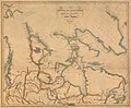 1828 British Arctic exploration map.jpg 1,862 × 1,532; 2.45 MB
