Category:1829 maps of Canada
Jump to navigation
Jump to search
Countries of North America: Canada · Mexico · United States of America‡
‡: partly located in North America
‡: partly located in North America
| ← 1821 1823 1825 1827 1828 1829 → |
English: Maps of Canada from 1829 or related to Canada in 1829
Français : Les cartes du Canada de 1829 ou se rapportant au Canada en 1829
Media in category "1829 maps of Canada"
The following 6 files are in this category, out of 6 total.
-
 Gulf of Boothia, map drawn by Inuit 1829 (cropped).jpg 883 × 743; 127 KB
-
 Gulf of Boothia, map drawn by Inuit 1829.jpg 1,052 × 860; 138 KB
-
 Laurie Fredonia or the United States of North America 1829 UTA.jpg 5,708 × 3,832; 6.5 MB
-

-
 Plan of the town of Goderich Upper Canada founded by the Canada Company 1829.jpg 1,920 × 1,756; 569 KB
-
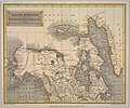 Polar regions including British Nth. America, &c. (14353387295).jpg 2,397 × 2,000; 2.25 MB
.jpg)


.jpg)

.jpg)