Category:1830s maps of Virginia
Jump to navigation
Jump to search
States of the United States: Alabama · Alaska · Arkansas · California · Connecticut · Delaware · Florida · Georgia · Hawaii · Idaho · Illinois · Indiana · Iowa · Kentucky · Louisiana · Maine · Maryland · Massachusetts · Michigan · Minnesota · Mississippi · Missouri · Montana · Nebraska · New Hampshire · New Mexico · New York · North Dakota · Ohio · Oklahoma · Oregon · Pennsylvania · Rhode Island · South Carolina · South Dakota · Tennessee · Texas · Utah · Vermont · Virginia · Washington · Wisconsin · Wyoming – Washington, D.C.
Puerto Rico
Puerto Rico
Media in category "1830s maps of Virginia"
The following 2 files are in this category, out of 2 total.
-
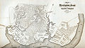 A Map of Washington's Farms at Mt. Vernon (1830 engraving).jpg 4,408 × 2,489; 10.93 MB
-
 Map of the Petersburg Railroad in 1838.jpg 418 × 714; 78 KB
.jpg)
