Category:1840s maps of Turkey
Jump to navigation
Jump to search
Subcategories
This category has the following 3 subcategories, out of 3 total.
- 1840 maps of Turkey (1 F)
- 1842 maps of Turkey (2 F)
*
- 1840s maps of Istanbul (8 F)
Media in category "1840s maps of Turkey"
The following 9 files are in this category, out of 9 total.
-
 1843 map of İstanbul.jpg 3,071 × 2,561; 2.03 MB
-
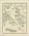 Grecian Archipelago (ancient) by William Smith.jpg 4,431 × 5,420; 2.56 MB
-

-

-

-

-
 John Rapkin, Asia minor (FL35868138 2714767).jpg 8,241 × 6,275; 76.11 MB
-

-
 Barclay's Dictionary Turkey in Asia.jpg 5,931 × 4,800; 19.45 MB

_by_William_Smith.jpg)


,_Published_1844.jpg)
.jpg)
.jpg)
